There are/or were sort of a flood walls, in that all the lower level door and other openings have/had 4ft high slots in them where could insert thick plywood panels to keep water out. I have not been there for a number of years so not sure if still in place. Maybe someone can drop by and check to see if they still have them.
1 Like
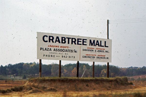
and they built all those damns upstream - at least 2 if I am remembering right. One of my first memories of Raleigh is Crabtree flooding not long after it opened. I remember because our apartment flooded. As a second grader it left an impression. They actually let the 5th graders go home early to help their parents. That building grouping is now a gravel lot -the old Palms grouping on the right as you head up Horton off Lake Boone.
Rather than flood walls, the effort focused on controlling the flow in the mall basin: damns, greenways, run off rules.
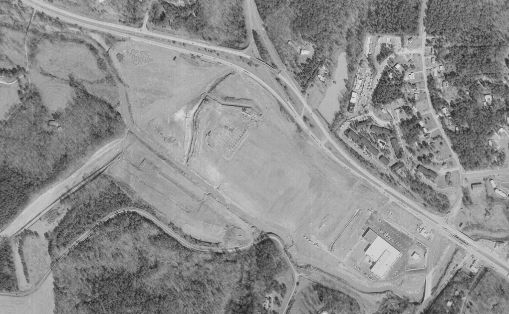
Looking North: (1950s?, possibly earlier)
Floodplain that became Crabtree on left…Glenwood ave (under construction)…Creedmoor interchange in top left corner (under construction)… Leesville rd on the right (current day Lead Mine; was the main road to Durham at the time)…Ridge rd at the bottom (Followed the alignment of Arrow drive before the beltline was built)
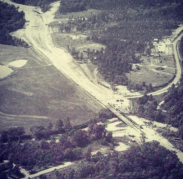
1971 Aerial:
mall under construction…“Big Star” grocery store on the right…notice the ramps at the old interchange with Creedmoor (top of pic)
20 Likes
Converting the quarry just upstream to stormwater retention would have a sizeable impact on flooding. Quarries have enormous capacity because they are so deep. It could reduce the peak levels of Crabtree Creek to less damaging levels during major floods. Not big enough to eliminate flooding entirely though.
Its proximity to the mall.helps a lot, since only one major tributary, Hare Snipe Creek, joins Crabtree downstream of the quarry and upstream of the mall. If anyone has the appetite for a heavy engineering project, a bored tunnel from there to the quarry could divert excess flood waters from Hare Snipe Creek. Probably not worth it, but if potentially billions of dollars in development could be headed that way in the long run, then maybe?
6 Likes
Crabtree Quarry and Whitewater Center. A new water feature and tourist mecca for Raleigh. (only when it storms). Nice!
9 Likes

I believe that there were supposed to be 10 or 12 lakes up stream to control the flooding. They did not build the last one which was supposed to make the valley nearly flood proof. The county did not want to spend the money. Some examples of the lakes are Lynn, Shelly, Crabtree, the one by the airport, etc.
9 Likes
Would be interested to see that plan, and learn where that 12th missing lake would have gone. (Wonder if the quarry could take its place?) Also would be interesting to see if their calculations (likely 1960s era?) were correct, and if it really would have prevented flooding during some of the monster storms since then (like Fran).
3 Likes
Think would be really hard to prevent flooding from a storm that drops 3ft of water.
2 Likes
I lived in Richmond (which has floodwalls downtown) during TROPICAL STORM (not hurricane) Gaston. The floodwalls actually kept the water in the city to a point where Shockoe Bottom bore the brunt of the flooding. I think we got like 13 inches of rain in 11 hours (this number may be off…). The walls were designed to keep the James River out of the city, however the one time I saw them in use, they kept the urban flooding IN the city.
Edit: The video below is from Bottom’s Up Pizza (I highly recommend this place!!) located directly across the street from the Floodwall. There is now a “high water mark” on the wall as you come in the front door.
TLDR… Nature (water) is ALWAYS going to win over what humans try to control. We need to live in harmony with the occasional flooding, or else we will just make the problem worse.

2 Likes
Yep the Chinese have been trying to control the Yangtze River for 2000 years and still has major flooding ever few years.
2 Likes

6 Likes
Did Devereux meadows or Peace st flood during Gaston?
Agreed @orulz the maps would be cool to see.
Thanks @Alan for the names, I remembered Crabtree and the one by the airport, but forgot Lynn and Shelly.
They seem to have the flooding in Crabtree valley pretty well under control, save 500 yr rain falls. How about the flooding along 6 Forks & Wake Forest? That area use to flood regularly.
Six Forks and WF Road still a problem but better than in the past. I haven’t seen Peace Flood (beyond standing rain right after a gully washer) in quite a while.
1 Like
That is Crabtree creek as well. Just further downstream.
For anyone who thinks that that investing in malls will make them survive, here is an architect professor’s take on that:
I think Crabtree is working to move away from being just a mall and more like a downtown with lot’s of activities other than shopping, more like main street with a roof. Would not be surprised to see things like skate rink, Escape rooms and >lol< even pony rids as this one on 5th floor of a HUGE mall in Suzhou China.

Oh and almost forgot a multiplex movie theater and water fountains.
5 Likes
Per the most recent FEMA maps the 100year flood elevation near Wake Forest and Hodges has gone down by about 6’ over the previous version. That doesn’t mean it won’t flood. I have seen it flooding in that area after the maps were revised. It hasn’t been that long since Crabtree was evacuated due to flooding.
I’m more concerned that many projections are showing our annual rainfall increasing by 14% with an increasing intensity of rain events. Maybe the quarries can indeed be used as stormwater reservoirs. When you look at the maps, parts of the Crabtree building are in the Floodway, and the rest is in the Floodplain. Typically no development at all is allowed in the Floodway. I just hope they don’t build to the existing maps with this expansion, or they address it with a solution that provides adequate storage for future runoff levels.
2 Likes
Hard to really tell but if zoom in looks like the old sears footprint and new tower have at least 2 levels of parking under them. Guess that’s 2 fold, create more parking and get indoor spaces above any flooding. Does not do much for current building but did say “focus on improving stormwater management” in renovations. Sounds like a lot is going to be done with $290m, guessing tower is only a small fraction of that cost.
3 Likes
$290 million is a lot for even a 30-story tower. A similar-sized building in Charlotte, the 29-story FNB Tower, is only running about $129 million. The developers at Crabtree must be including some other major work in their estimates.
2 Likes