I-40 didn’t exist?20
I-40 followed Wade avenue until the beltline, where it ended… extended to Wilmington in the 80’s.
If you go to iMaps and switch to the 1981 aerials you can see the construction.
3 Likes
A few pictures of Raleigh Municipal Airport
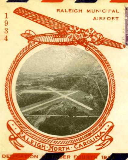
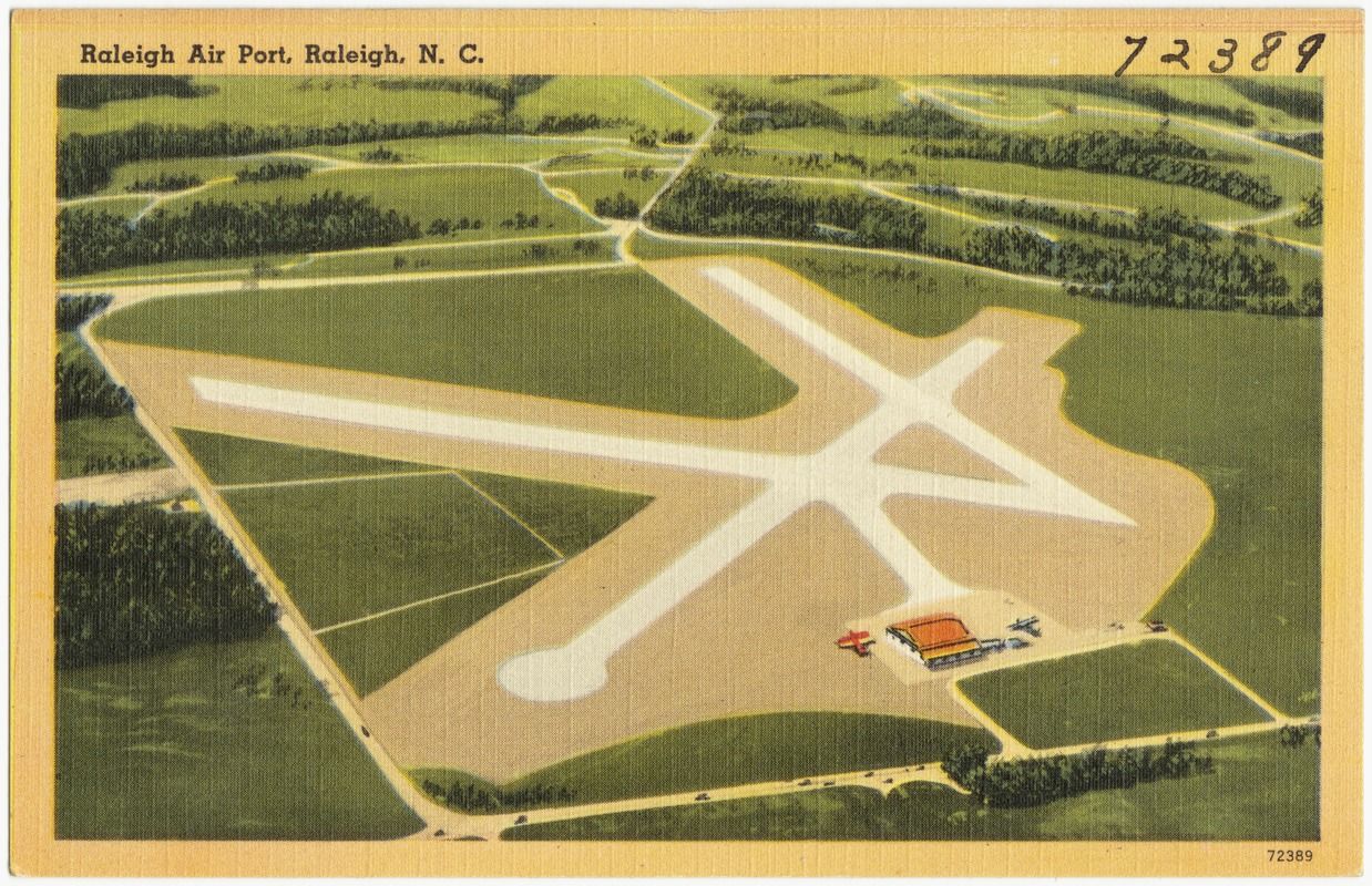
a lot more information can be found here:
http://www.airfields-freeman.com/NC/Airfields_NC_Raleigh.htm#raleigh
7 Likes
I-40 didn’t exist at all. The stretch that is now the Wade Ave. Extension, all the way to RTP was built for IBM later in the decade.
4 Likes
I’m going out to do some drone shots. Any requests?
1 Like
Just ones you’re probably going to get already. Fairweather, Bloc 83, maybe the South Street Condos Pit if you’ve never got that yet for a good before and after if this mythical project ever happens.
3 Likes
Please don’t melt. We like having you around.
11 Likes
Check the respective threads for updated shots a little bit later.
5 Likes
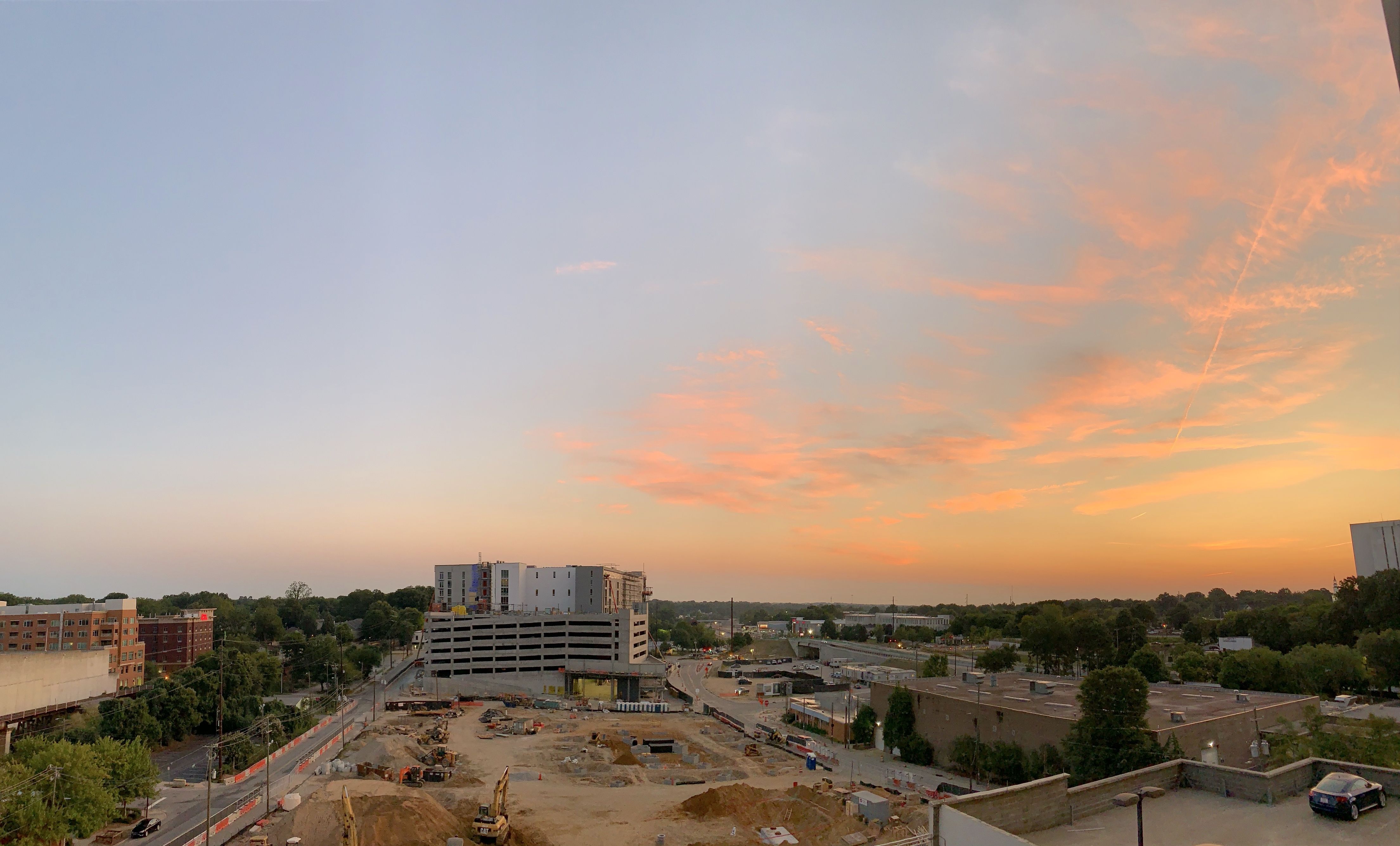
Downtown has a fiery glow at sunset when viewed from the west. An additional cool thing is how FNB (from a certain angle) catches the light in such a way to make it look like it’s a bifurcated building. I zoomed in to capture the effect, so pardon the pixelation.
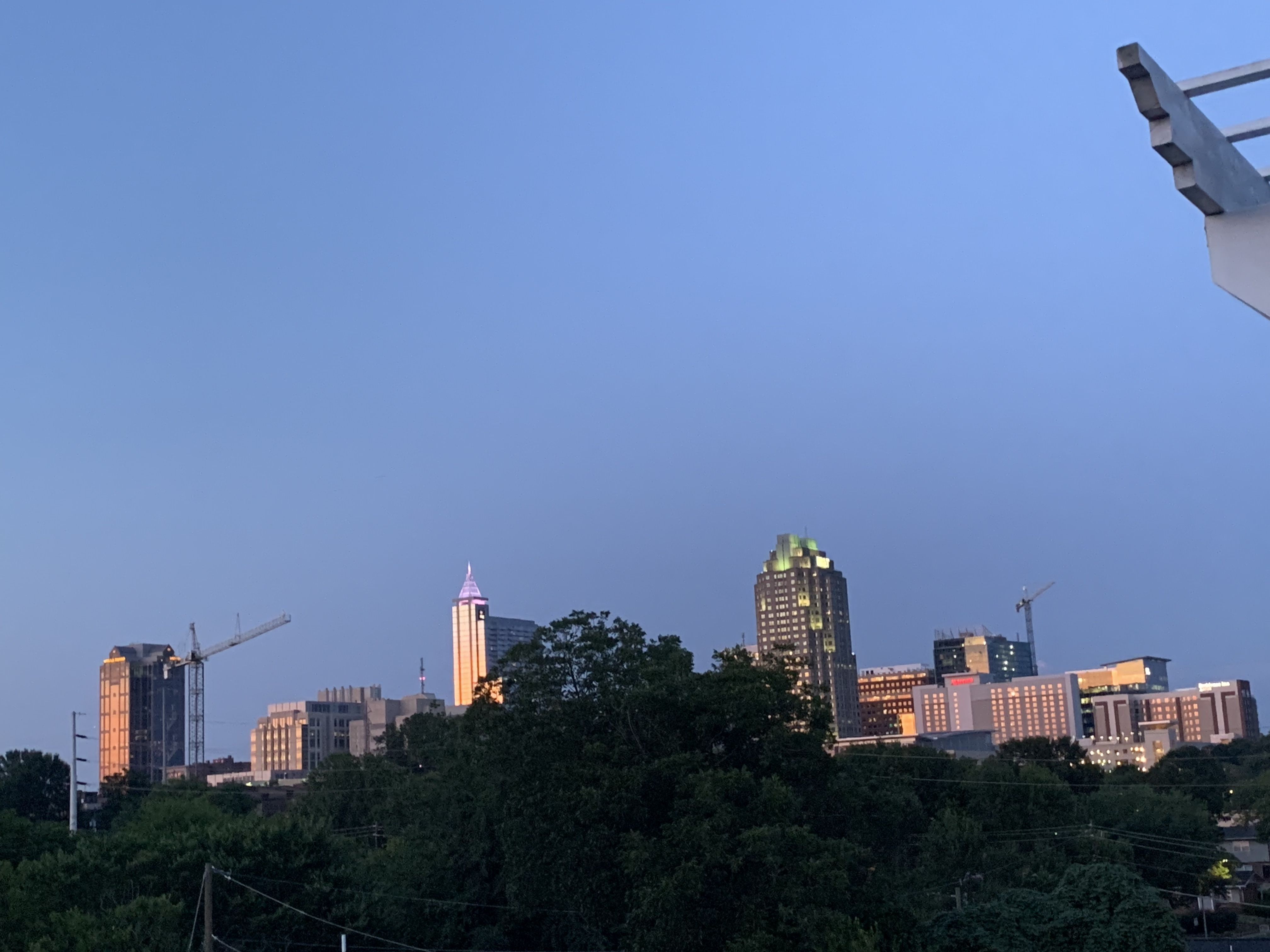
14 Likes
Great pic! Love that FNB Tower is showing up so nicely too.
4 Likes
Awesome and thank you 
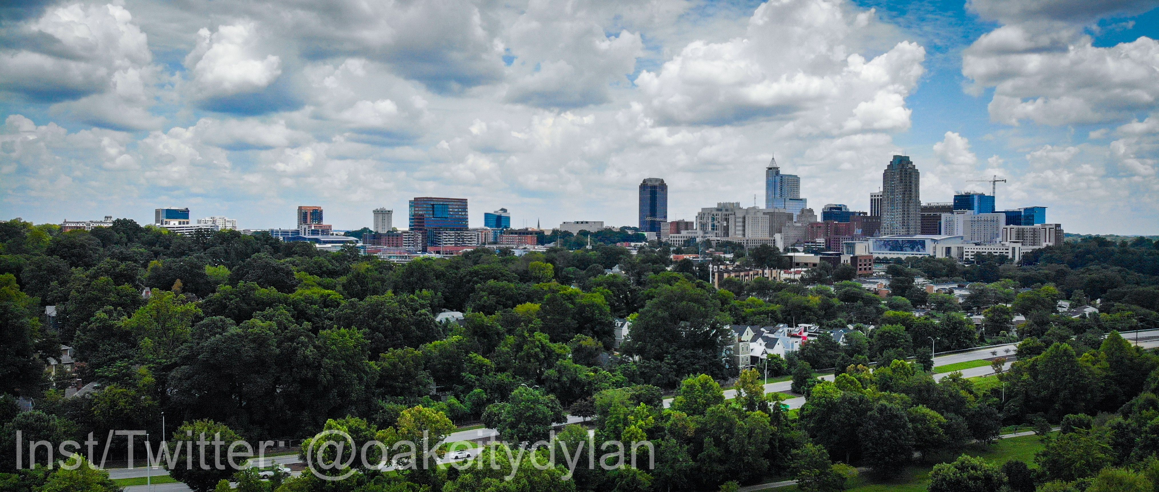
Imagine the impact that 121 Fayetteville st would have on this “money” shot…
3 Likes
16 Likes
Nice watermark too: 
1 Like
By the way, how’s this rendering coming along? (If you need more hands to try to finish this, I can try to help in my free time!)
2 Likes
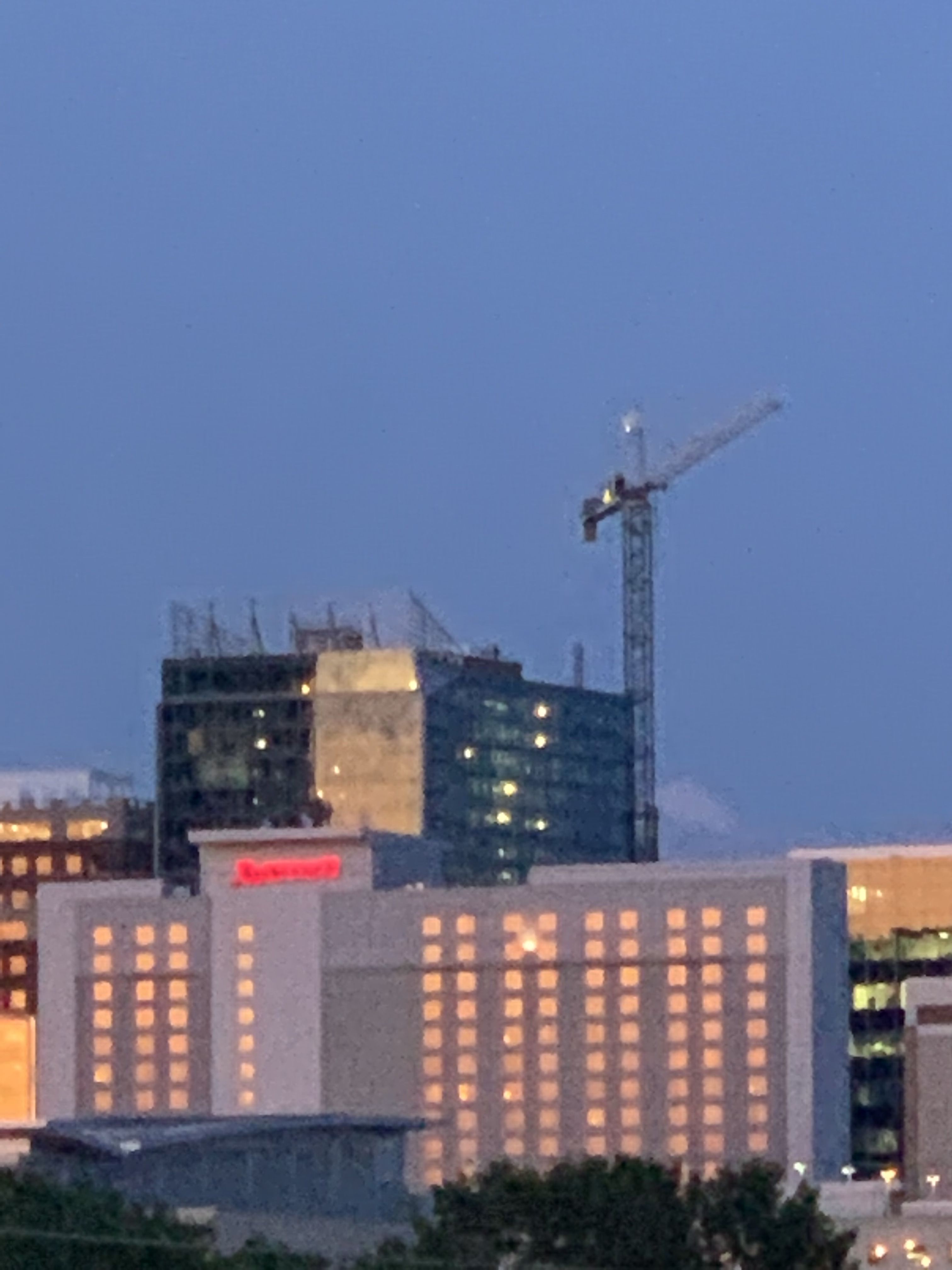
That’s a great angle. I’d guess the Fairweather will show up in this view next year. Not so much from the ground but definitely from a 100’ up aerial vantage.
1 Like
Looks like a good spot for an observation tower!
4 Likes
If you zoom in you can see the crane now but it will pop up just under the court house (from this angle) once topped out. 
1 Like