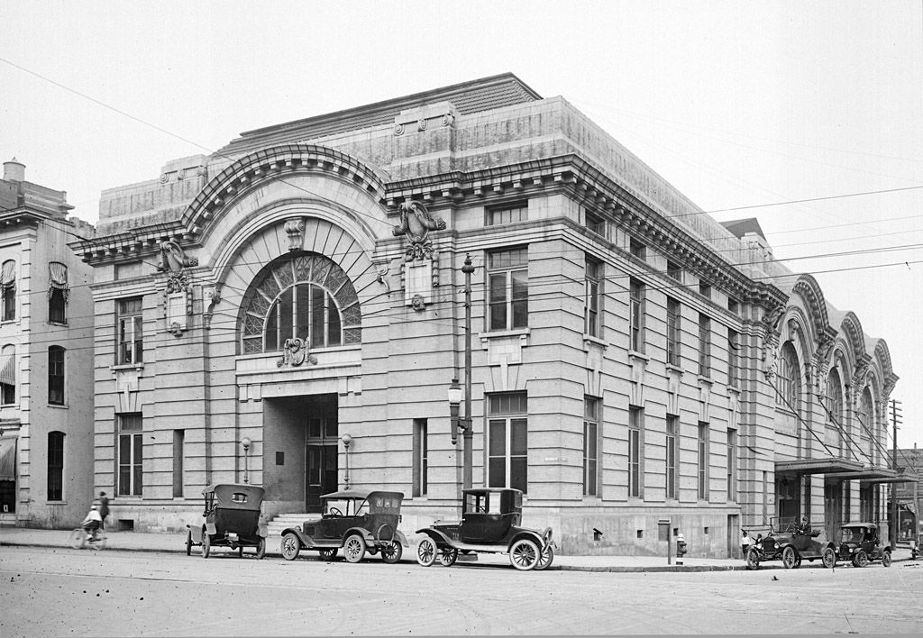
Those are some big losses, as much as I appreciate the size of PNC. It’s a shame the older office buildings weren’t saved. Going from Citizens National Bank to the current First Citizens Building is pretty sad.
3 Likes
I thought the Metropolitan Hall burned down, but I’m not sure about that.
The 1913 one did burn down. Interestingly it is also in the photo…also designed by Thorton Marye, the visible Wake Courthouse and Commercial Bank. What is a surprise to me is that both buildings co-existed…I had assumed Metropolitan Hall was lost somehow and the 1913 City Hall replaced it afterwards. Shortly after this picture, I think a neoclassical office building was built between Market and Exchange, and then that was torn down for the Wachovia Building (now YMCA, etc.). During these years Raleigh should have been busy expanding it’s grid instead of mowing down stuff everytime fashions changed or an extra floors of space was needed…we’d have a much much larger urban grid, and commercial core…and have an actual commercial historic district perhaps. Or current arguments about what to keep and what to replace would be almost moot.
5 Likes
So is that the Yarbough House (I may have misspelled it) there across from the courthouse? That would make sense. I was heartbroken when they tore down the Commerce, what was then First Citizen’s. I recall the issue of adding to it was the orginnial’s floors were a strange, non-standard height and a new building wouldn’t line up. They tore it down, and then built in North Hills. We are lucky that the Ol’ Citizen’s is still standing.
Lets see if I can add this from the Library of Congress collection. Raleigh in 1872.
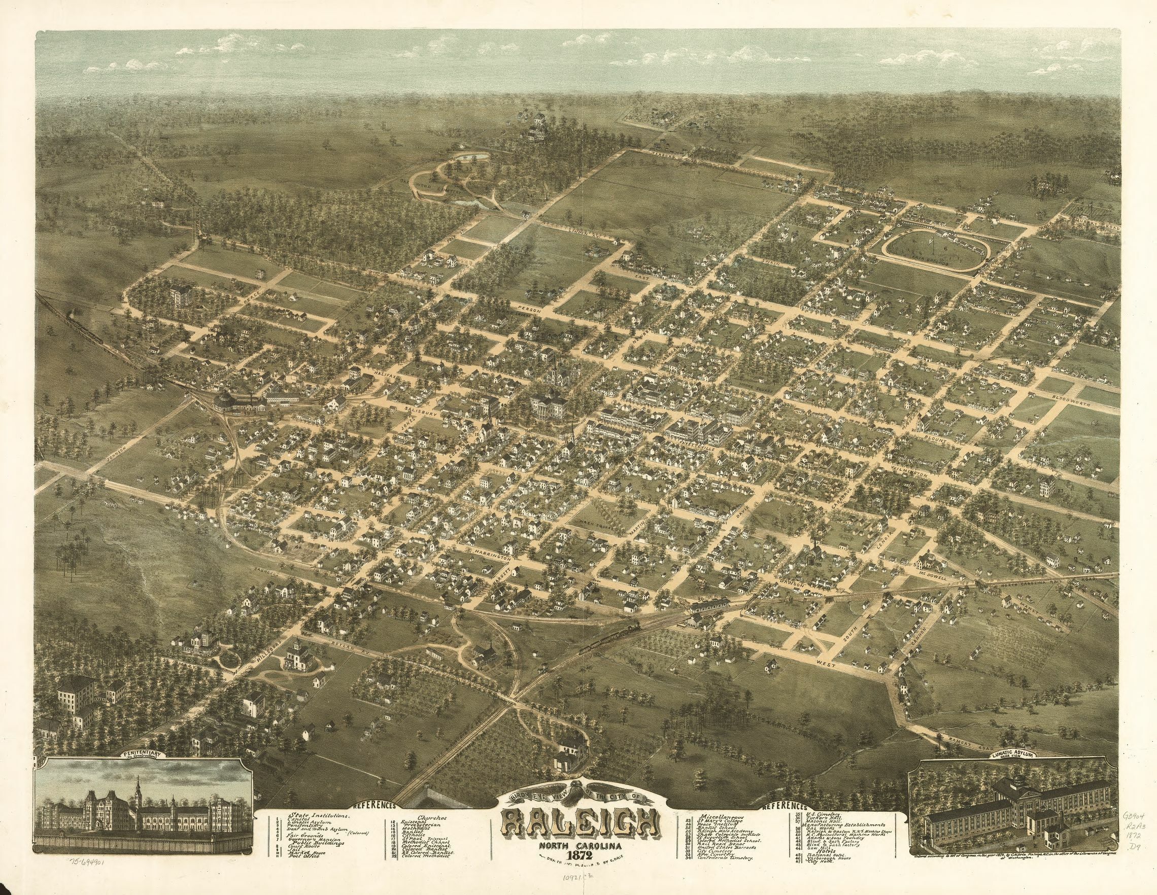
Here is the link for the maps and other bird’s eye views for NC
4 Likes
Awesome. I found an even better zoom link but it doesn’t google…I’ll try and remember to post it. Anyway, 47 is what i think is the 1795 court house, relocated. 8 is the court house in use in 1871, without the Italianate upgrade and wings it’ll receive soon after this painting was made. Grad a copy of of Elizabeth Reid Murray volume 1 and look up courthouses in the index. Keep reading passages until you find the one that says the old courthouse was moved to the SE corner of Davie and Wilmington and used as a hotel…
1 Like
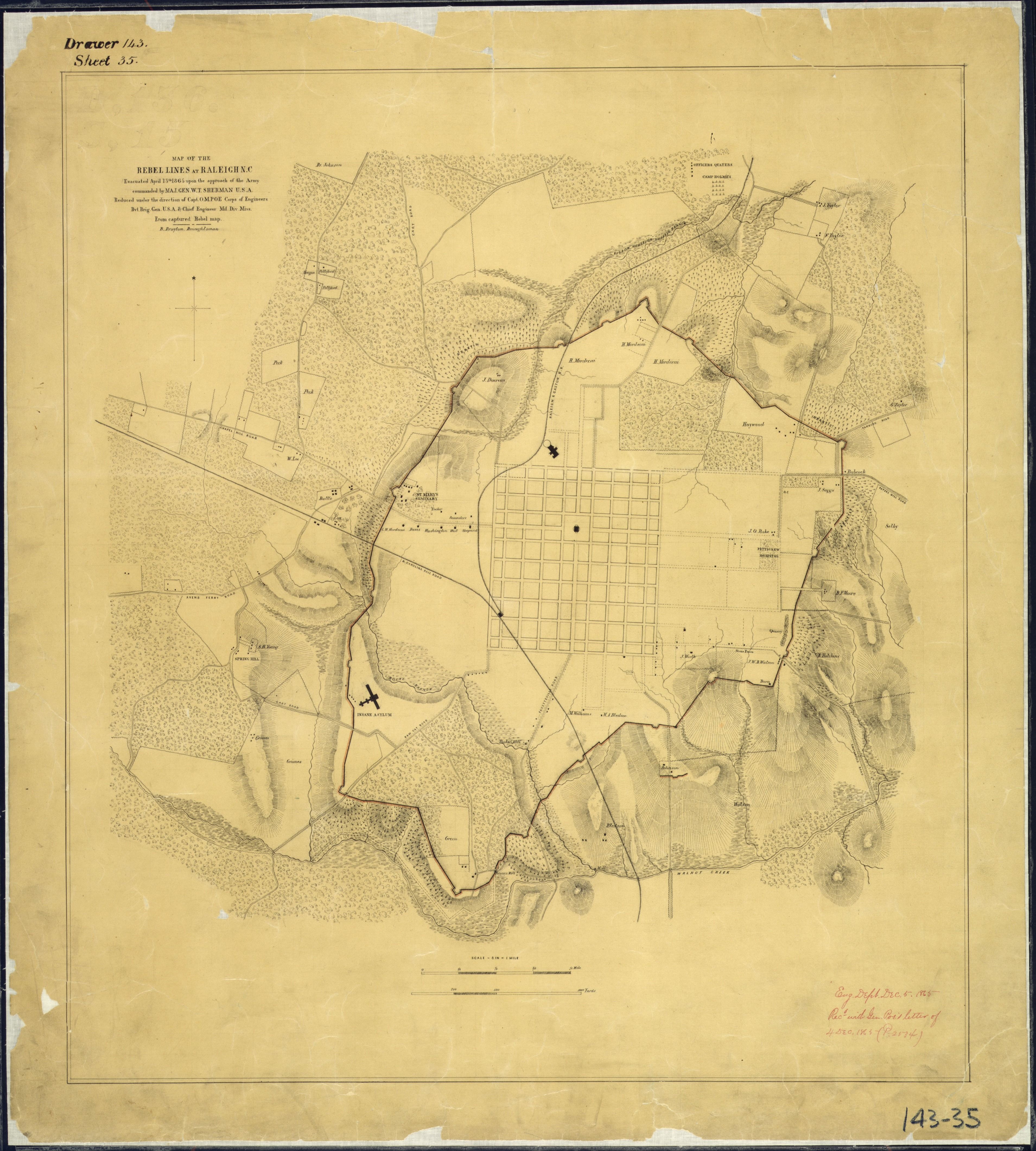
It zoomed for me, but was huge. Very cool. I always new the defenses went across Dix Hill, or I guess more properly its Spring Hill? But it was really interesting the exact routes, particularly on the west side where I grew up. Also interesting to see the houses/plantations that are marked.
2 Likes
Tracing this stuff out is super fun. I even used this map to nail down some of the old mill locations I never knew existed. Anyway, I live just inside one redoubt at the northern tip of Bart…Battery Heights being named for that one. I also think the SW east-west line was just above Maywood Ave. Crossed Glenwood at Cleveland St. Etc Etc. Officers Quarters would have been up along Georgetown. Old Avent Ferry Roa’s alignment is seen very clearly.
Here is the super high res,zoomable link to Drie.
1 Like
Mark, that’s really cool. Are there any remnants of the fortifications near you?
Nothing identifiable or that I am aware of. There *are a lot of trolley track parts over here though…dig them up all the time in my yard.
2 Likes
It kills me that this is some of the fine architecture we lost. Some of these make me really sad
http://goodnightraleigh.com/2017/04/you-are-invited-to-explore-lost-raleigh-this-sunday-april-23-at-mordecai-historic-park/#
12 Likes
The greatest generation may have toughed out the depression, and fought in WWII, but they sure knew how to destroy architecture.
Be glad that it didn’t go even further. There were proposals to essentially wipe clean a lot of DT for a modern government campus that was in alignment with the times.
6 Likes
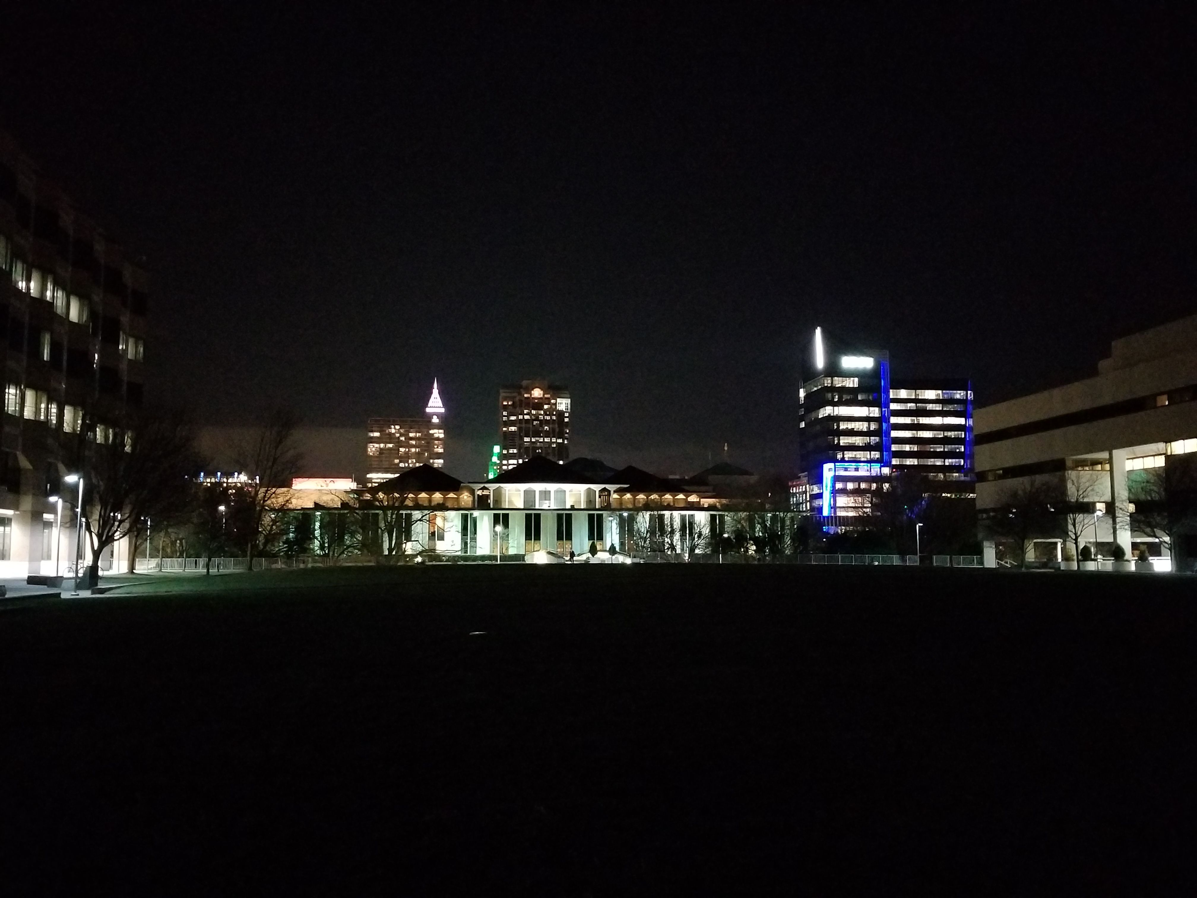
This is one of my favorite spots/views downtown, especially on a warm summer or autumn evening! I love how panoramic the views are in cozy this nook. While I enjoy the peace of usually having Halifax Mall to myself and the occasional jogger, I often think about how underutilized the plaza (and the whole government complex) feels. Maybe after the recently announced development over at Seaboard Station starts shaping up the plaza will get more of the activation it deserves and could* support.
8 Likes
Ah my office building. Blech.
These are terrific. Thanks for sharing them!
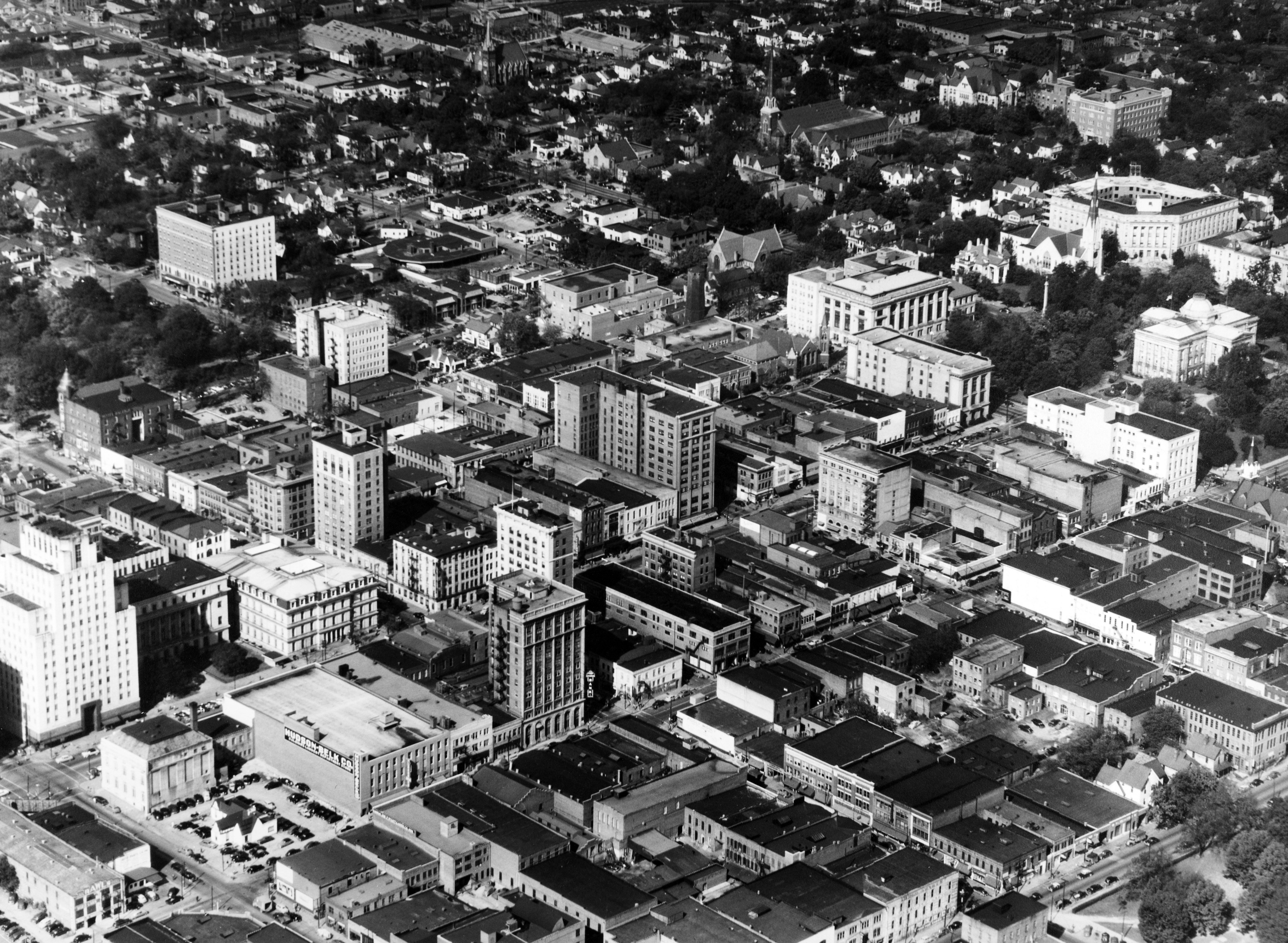
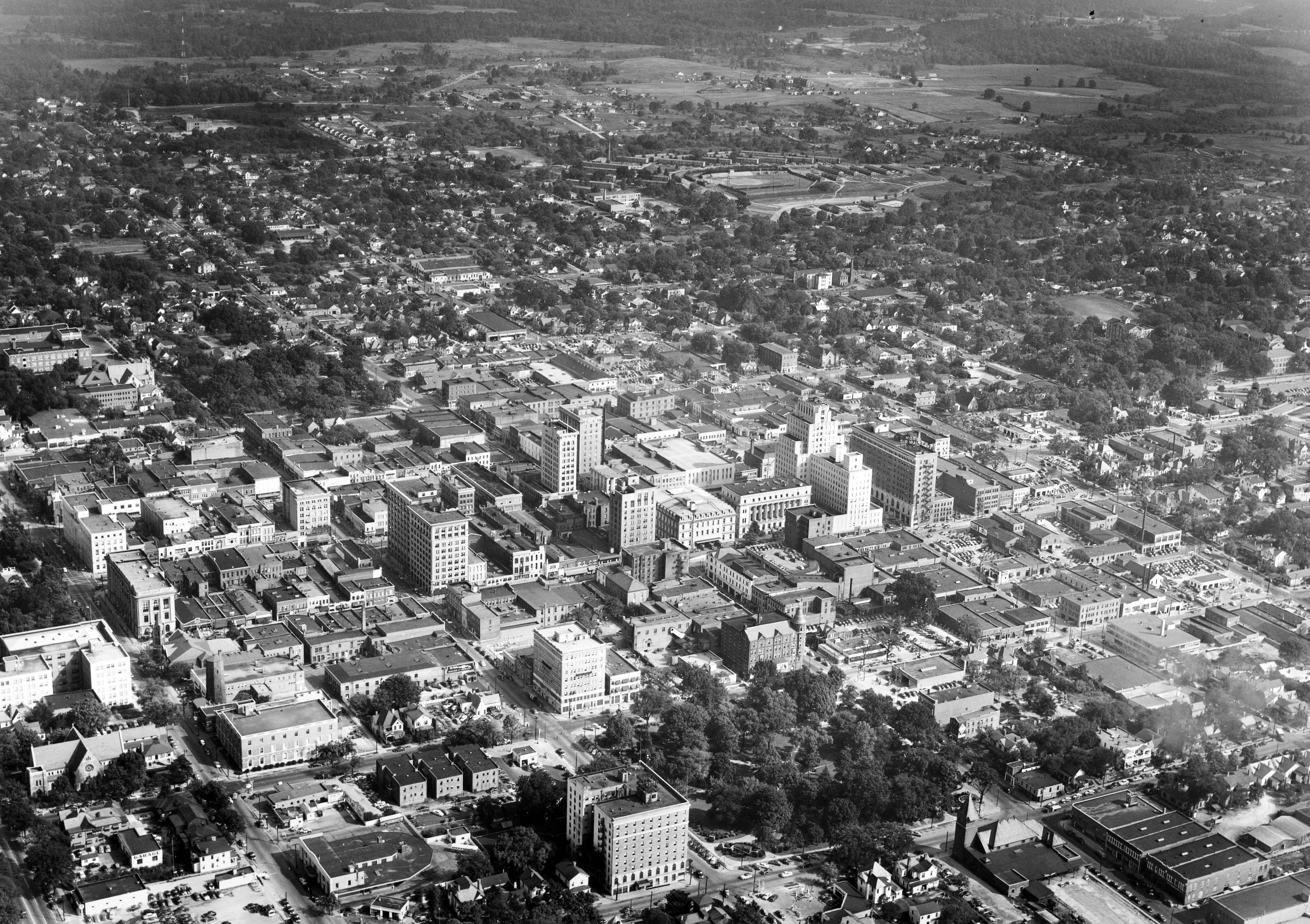
Raleigh looked more dense back then? I guess that we lost a lot of those small buildings to fires, parking decks and empty parking lots?
5 Likes
I was just thinking “there ain’t too many parking lots in that picture”
2 Likes
What was the building that was replaced by the current City Hall? (Across from Nash Square to the Northwest…)