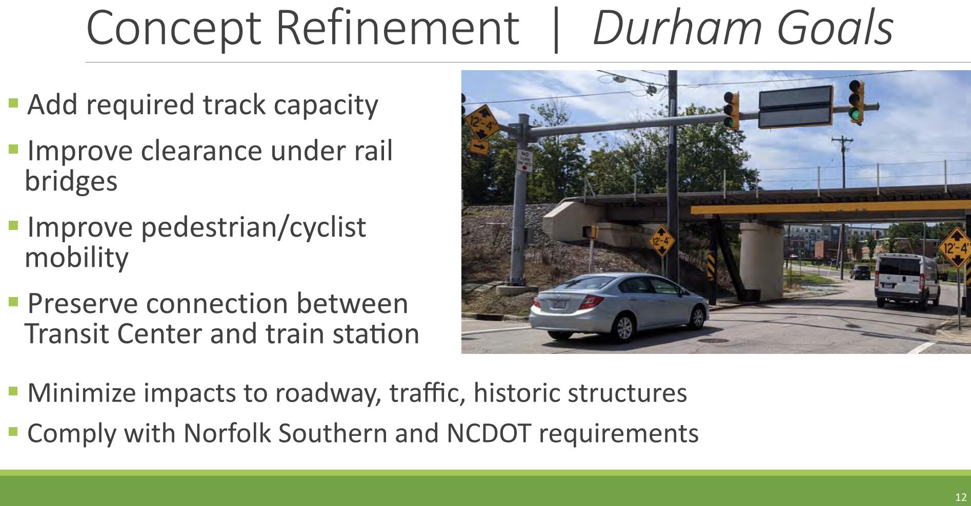
You’re right, the knee-jerk reaction to anything elevated is always “Elevated?! zZOMG Berlin Wall! Blight!” Any proposal to build something elevated in Durham (or Raleigh) will have to get out in front of that. The best way I can think of would be to start with a feasibility study of the concept that anticipates and counters these concerns, particularly by including realistic renderings of what this would look like, as well as reference images of places like:
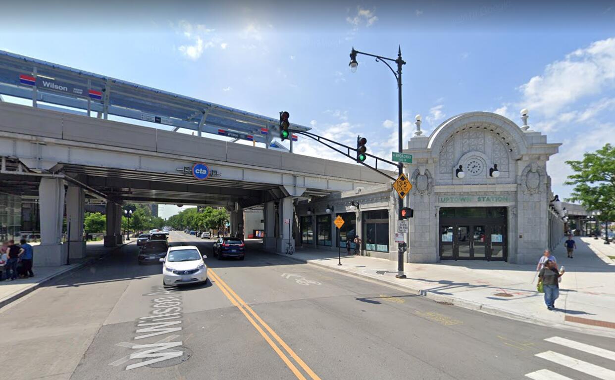
this (Chicago)
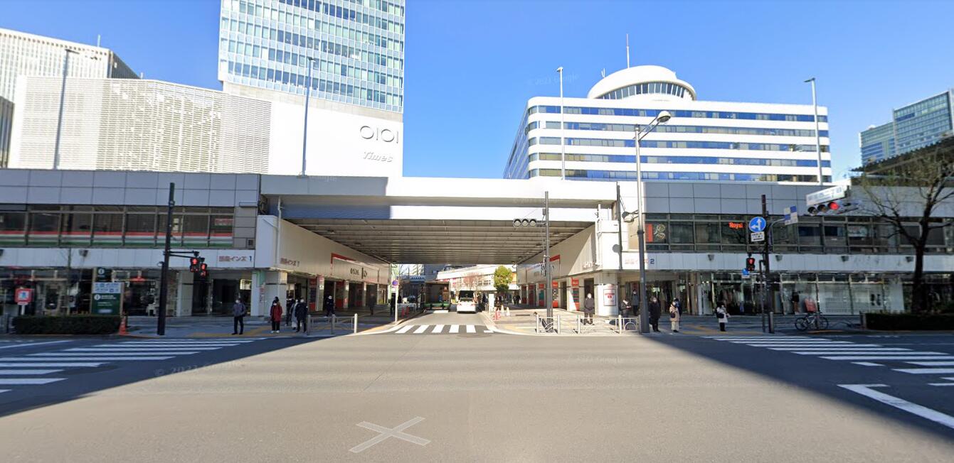
or this (Tokyo)
In these cases, well-done elevated infrastructure has been built with overpasses high and wide enough to let natural light in beneath, and active uses have been placed beneath the viaduct. This combines to make it feel like an amenity, rather than a blight.
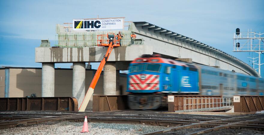
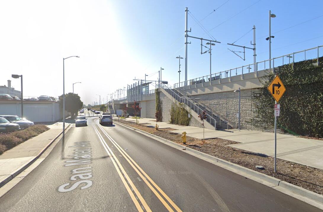
The typical American way of building elevated infrastructure through engagement in a traditional NEPA process almost always winds up adopting the premise that the elevated infrastructure should be as low as possible, to reduce impacts, which is dumb because it doesn’t reduce impacts, and also increases costs because it involves lowering streets to pass under a partially raised overpass. The best case scenario for this is something like:
this (San Bruno, CA)
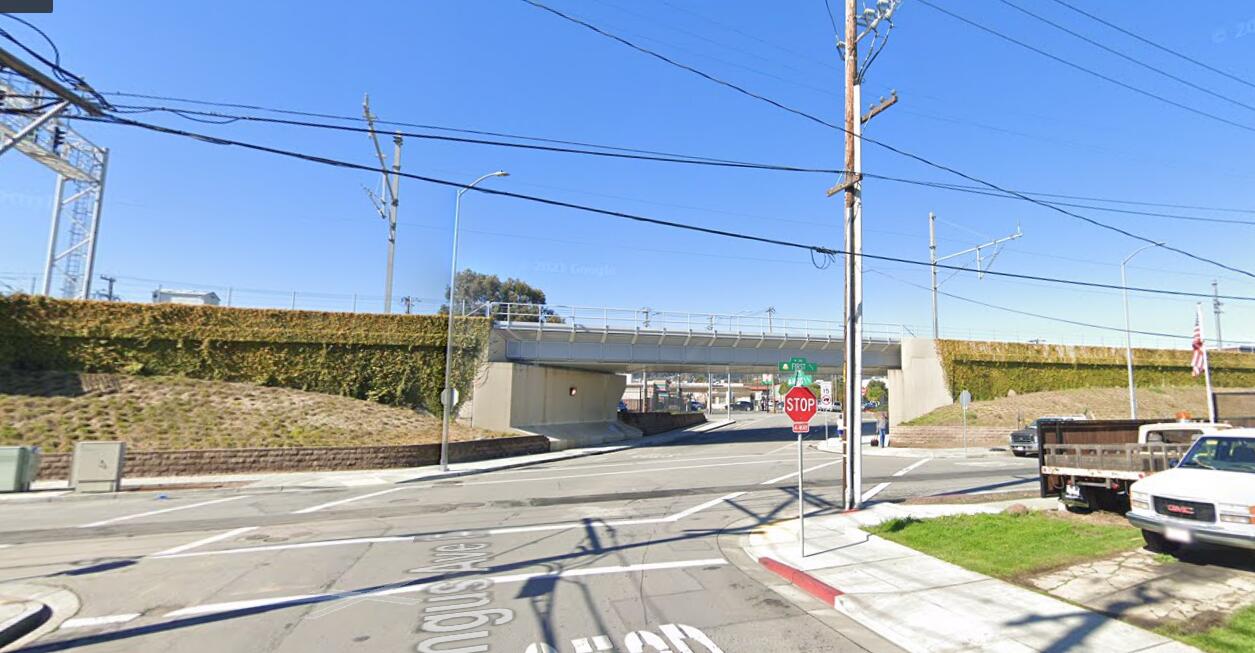
But more typically you wind up with something like
this
…where, ok, yeah the Berlin Wall comparison is actually kind of apt. When DOLRT looked at doing something like this before, what they proposed was something along these lines. So, yeah. Not so great.
It’s going to require a PR campaign, to be sure, but the nice thing about doing a feasibility study first is that you don’t have to follow the glacial NEPA process where you have to avoid showing bias for any particular alternative. This feasibility study could also demonstrate the extreme cost and infeasibility of the trenches, tunnels, and “Do Nothing” plans that people will no doubt suggest as alternatives.
When the NEPA process begins and you start talking about elevated viaducts as one among several alternatives, you have the attractive renderings in hand (and in peoples’ minds) to counter the “Berlin Wall” reaction.
@keita: As far as dealing with impacts to historical resources, NEPA’s EIS process is horrendously broken, so is always a minefield. Its dependence on lawsuits (or the threat of them) to address concerns means that there are too many opportunities for disingenuous interloping NIMBYs with tenuous (at best) standing, to make specious claims on literally any grounds, that the planning agency must then expend considerable resources responding to.
Furthermore, my impression is that, as a result of its highly reactionary nature, the NEPA has come to look at history as fragile, static, and complete, rather than the robust, constantly evolving, living, breathing thing that it is. If somebody says that “Building a railroad bridge in front of this building is a major impact,” then it’s taken at face value.
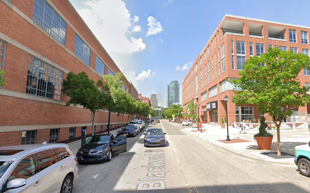
A more rational approach, in my opinion, would be to note that we are not proposing to demolish or alter any historical structures, nor to do anything that would amount to a greater impact than building a new building across the street from, or next door to, a historical structure. After all, if doing…
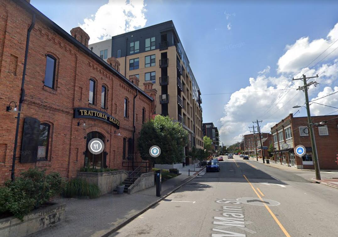
this
…across from American Tobacco or Brightleaf is not just allowed, but welcomed, lauded even, then why should building a viaduct with retail underneath be viewed much differently? It’s essentially just building a new building across Pettigrew from the Old Bull Building.
There should also be a reckoning with the fact that this is a 200’ wide railroad right-of-way, that has been in place since about 1850 - and that if the Southern Railway had the need and money to do this back in 1870, or 1925, or 1962, they wouldn’t have hesitated, for even a second.
Having acknowledged the above points, we should treat this infrastructure as adding another layer onto the rich and varied history of Downtown Durham. We should work to make sure that this new layer is as nice and contextual as reasonably possible - but if you reference the Chicago example above, I think it would be quite possible to build something that could blend in well in the historical context.