Dam was completed in 1981. I remember seeing all the trees cleared from I-85 coming down from my home at the time in DC area.
3 Likes
Millbrook was a defined area of town. In the early 1980s several small houses were rehabbed into shops - Located at current WF road and the original Millbrook Rd. Cool little area until Millbrook was widened into what it is now.
4 Likes
Nor Jordan lake, nor Benson lake, nor Crabtree lake!
7 Likes
Millbrook was once its own village that was lost to the growth of north Raleigh.
8 Likes
“Scott wanted, in particular, to pave rural roads. In a little over one year, thousands of miles (4,658, over one-third of Scott’s goal) of North Carolina’s country roads were paved. Scott also urged utility companies to provide electrical and telephone services to rural areas.” accomplishment or not for the era. William Kerr Scott (1896-1958) - North Carolina History.
2 Likes
Tell me more about this!?? Can we bring this back?!
The building at 2526 Hillsborough once had a small interior mall with neon decor. It only had a few shops inside; the door was where the Starbucks Pickup is now. The skylights are still visible in aerial views.
3 Likes
I loved the idea when it opened, heck I remember it being the industrial space. The interior was cool, but small, and very late 70s, (or early 80s as John piints out,), lol. It never seem to catch fire, I dont remember going to the bar there, even tho it was 4 blocks from my house.
2 Likes
I thought it was more 80s than late 70s.
1 Like
It was an industrial space in the early 80s
2 Likes
Oh wow that’s pretty crazy. Planning for their invasion I suppose. God bless Ronald Reagan
![]()
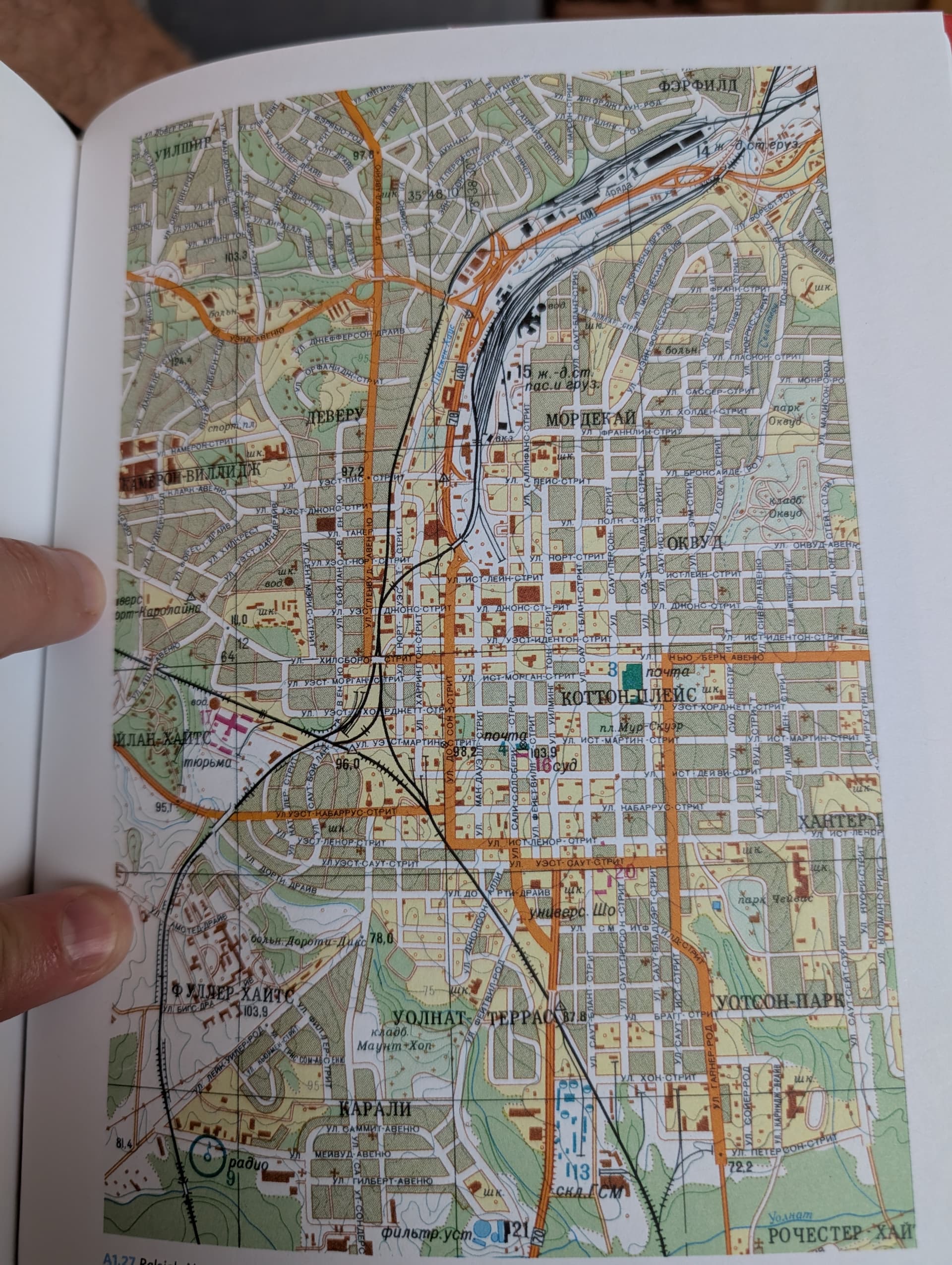
I never thought about how you’d transliterate some English sounds into Cyrillic. Walnut creek is Oo-o-l-n-a-t, Watson is Oo-o-t-s-o-n. But in Oakwood, they just switched the W into a V, O-k-v-oo-d.
Also, there’s a road drawn in from Rochester Heights (lower right) up to Peterson St. I’ve seen evidence of a previous road (I guess an extension of Waller Pl) and a bridge across the creek, but this is the first time I’ve actually seen it on a map.
2 Likes
It kinda shows up on the 1981 & 1988 image overlays for imaps, but looks like it was just a dirt road. Those ruskies were thorough
1 Like
Ps this set me off on a tangent, and you can really see the way parking lots just gutted downtown comparing this 1950 broad aerial:
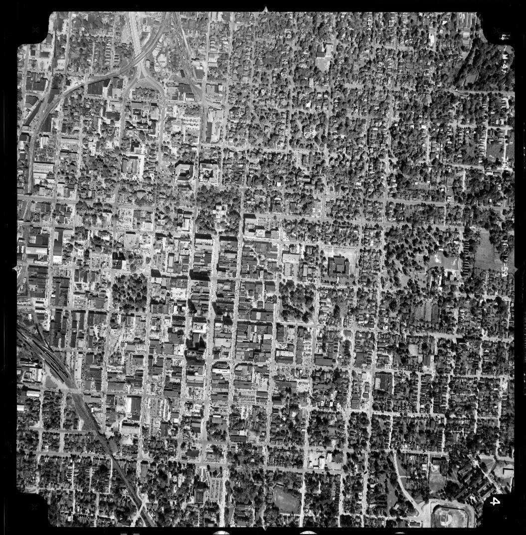
With this 1960 shot of the area bounded by Blount, Martin, McDowell, and South:
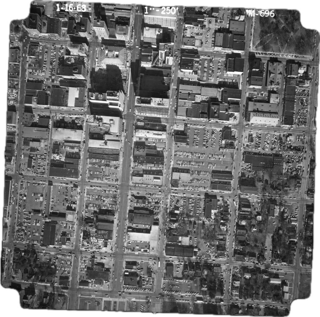
12 Likes
Really interesting Civil War era anecdote about Raleigh/Dix Park.
“During the Civil War, Union forces were camped on the Dix Hospital grounds in Raleigh when they learned of President Abraham Lincoln’s assassination.
About 2,000 enraged soldiers, torches in hand, marched toward town. But at a bridge over a creek at what is now Lake Wheeler Road, Union Maj. Gen. John Logan waited with cannons and ordered the troops to a halt — likely saving the city from destruction.”
9 Likes
What a cool story! Thanks for bringing it to our attention.
3 Likes
And then in the 1970s, the City decided to tear down all of these buildings to turn into parking lots.
3 Likes
I think we should do an annual reenactment!
1 Like
It’ll be us trying to hold off the Livable Raleigh folks from destroying all the tall buildings.
1 Like