Wow, if its anything like that it will be awesome. I particularly like the small chapeau you drew on top. What a dapper building!
5 Likes
I thought it was a couch, but it is art so open to interpretation I suppose.
3 Likes
Those are some great pics, Nick! I’m using the one without the prison as the wallpaper on my ultra widescreen monitor now.
2 Likes
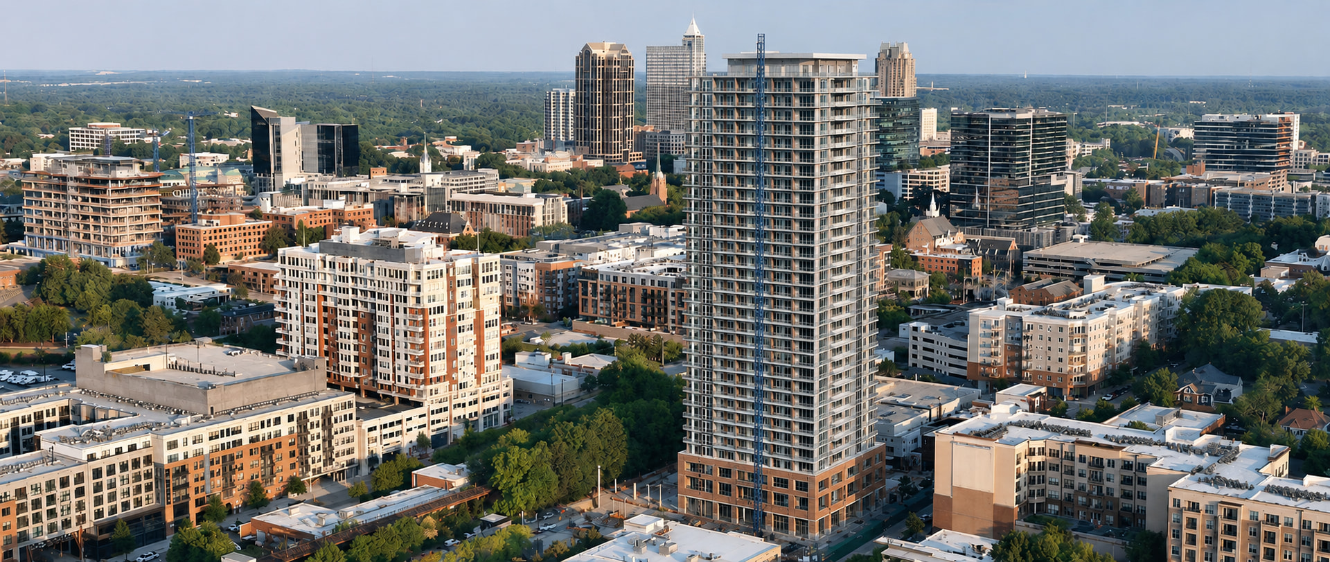
I took the original image (thanks Vatnos!) and did a little ChatGPTing to it. It’s not exact, but this thing will be huge.
20 Likes
DANG. It almost looks like it belongs in another city. Man, that place called Raleigh needs to up its game if they want to keep up. Just sayin’.
3 Likes
Sigh, another job (Jake’s) lost to AI. Sad.
10 Likes
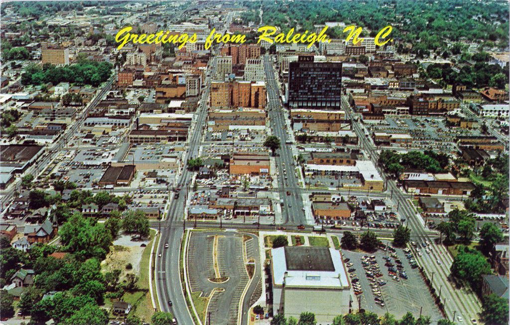
That top one is a great picture. Well done dude.
2 Likes
I can’t even tell what the point of reference is for this picture. When was this?
1 Like
AI says it was taken in 1976.
Her we go with AI lies again 
3 Likes
I’m more impressed they had drones with 35mm film back then. 
4 Likes
That’s WAY before 1976. If it was 1976, we would see both the old Civic Center and the Fayetteville Street Mall under construction. Both were completed in 1977.
My guess is that it’s in the 60s.
3 Likes
Wait. Is that an AI picture? I give up.
The dark building is 333 Fayetteville and was the tallest building in Raleigh when built in 1964 with BB&T as the anchor tenant.
I briefly had an office there pre-COVID. Very cool building.
So probably the 60’s. One Progress Plaza was 1977.
1 Like
The “R” in Raleigh obstructs the Capitol, but it looks like the copper roofs of the Legislative Building (1963} are visible behind the Capitol. Raleigh was a sleepy Capital town with several colleges, when
In 1965 IBM announced a major expansion coming to RTP and in scattered office buildings through North Raleigh. North Raleigh boomed.
This was the beginning of the awakening; followed by the opening of Beltline (from Cary to New Bern Ave.). North Hills Mall, Crabtree.Valley Mall, and putting Raleigh on the Interstate Highway map by extending I 40 from its temporary terminus in Greensboro, through Raleigh to Wilmington. Good state leadership in the '60s was key to making these forward thinking changes to NC economy..
4 Likes
I kinda thought the same thing. My mission for the day is to find the OP and get it sorted.
From what I can tell, the picture itself was taken sometime between 1969 and 1973. The postcard at the link below is dated 1973, but the S. Salisbury St. extension to the West of the auditorium was made in 1969.
2 Likes
When we moved to Raleigh in 1974, I-40 was double dead-ended. On the west, it ended in RTP at the Durham Freeway, and on the east it died into Wade Ave. The reason the Wade Ave. extension is a freeway is that it used to be the route of Interstate 40. This section was basically built for IBM as they had existing offices in Raleigh prior to their gigantic site in RTP.
There’s something to be said for the old moniker that Raleigh is the town that IBM built.
It wasn’t until the early 80s that I-40 was routed to the south as the southern half of the beltline, and it wasn’t until the late 80s that it extended to Chapel Hill in time for the 1987 US Olympic Festival.
5 Likes
I wish they had just sent it through to Capital so it’d be a quick highway drive for me now. Why didn’t they consider my future needs when I was just being born up in New York?
3 Likes