If you could, that would be fantastic! Something similar to the image Ken posted above, that includes Downtown as well as Glenwood South and potentially Seaboard Station as well. If you can’t, no big deal — I’ll snag a screenshot from Google Maps.
It’ll be after the first of the year before I’d be able to. Even if you do use something more readily available I’d like to capture that view anyway for historical reference.
I believe the hotel with the turret is the Hotel Raleigh:
http://goodnightraleigh.com/2012/07/hotel-raleigh-raleigh-n-c-2
Right you are, though it was later named the Park and the Park Central. Thanks for interesting link. Goodnightraleigh was, is and always be a great read and source.
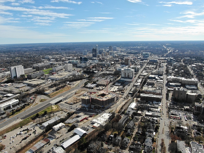
Here’s some excellent photos of One Glenwood and all of Downtown Raleigh from the sky.
WOW 
Beautiful! Thank you very much for sharing! 
I’m out and about today grabbing some aerial shots. Here’s one from the northwest side of downtown. I can’t get a better/higher angle without going over FAA max heights but I’m planning to get similar shots from the southwest and southeast corners of downtown later today. Below is a link to the album I’m putting the shots in if you want to peruse.
I added the rest of my DTR shots from today to the album link above. I love that Google Photos auto stitched my panoramas. 
From this one you can see Boylan Bridge to the far left and the southern gateway area to the far right. Middle bottom is lot of the Fairweather and the new proposed Kane construction. I’m sure somebody in this group will do a better job of highlighting those. Please feel free to use these photos. I would ask if any are used in a publication that I get credit.
Here is a shot from the southeast side of downtown with the southern gateway into the city to the far left and if you look carefully you can see the new Transfer Co. building nearly to the far right.
Thank you for posting all of these fantastic photos (including the ones in other threads)! It’s really great to see downtown from different perspectives.
Also, if you don’t mind, I’ll probably use one of your pictures for another “Future downtown” drawing.
Please do and thanks!
Also, if you (or anybody else) has any specific angles or requests, please let me know.
Thanks for all the awesome pics. Your work is amazing.
Dude you are the man these are great pictures! Idk if you ever get over that way but I saw WRAL started using a new shot of downtown taken from up on Wake Forest Rd. Probably around the Duke hospital area? Idk. But I think it’s one of the better shots that really shows how far the silhouette of downtown stretches. Would be great to see what you could do with that. Just as a suggestion of course. Thanks again for your hard work on all these different pictures!
Can you shoot me a link or image of the shot? I can certainly give it a shot. lol
Idk how to add the picture itself but here’s the link of the angle I’m talking about.
Edit* Nevermind I keep adding a link and it never works for some reason.
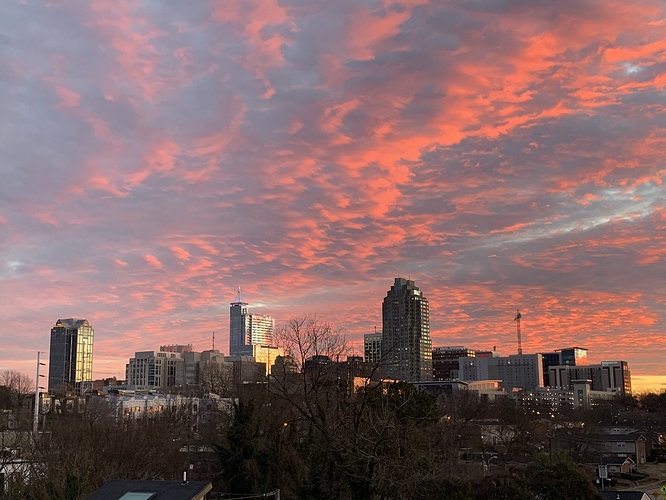
Just an incredible sunrise. I wish I had a better camera than my phone or a drone (but I’d probably wreck it into someone)
Great colors.
I was hoping FNB would start appearing above the Marriott. Just the crane for now.
That last pic shows a good angle where the new Residence Inn helps extend the skyline south.
They still have a ways to go. I’m counting somewhere between 13 or 14th floor depending if that one space is just a utility zone or an actual floor. So 7 to 8 floors to go.
Given DTR’s landscape (hills/valleys) I don’t think it will be that visible. Maybe a partial corner from the “Money Shot”? Maybe from the East-side of DTR?
Really cool drone shot. I will take some drone shots from Dix and post them here soon.
It will be just under the height of the crane when finished. Should be slightly higher than Progress 1, so it will be visible and quite prominent anywhere from the south.
There are still several floors to go.


