This was from last year. Same pic I used for the MeetUp for DTRaleigh. @dtraleigh should be sharing soon if he hasn’t already and I missed it.
11 Likes
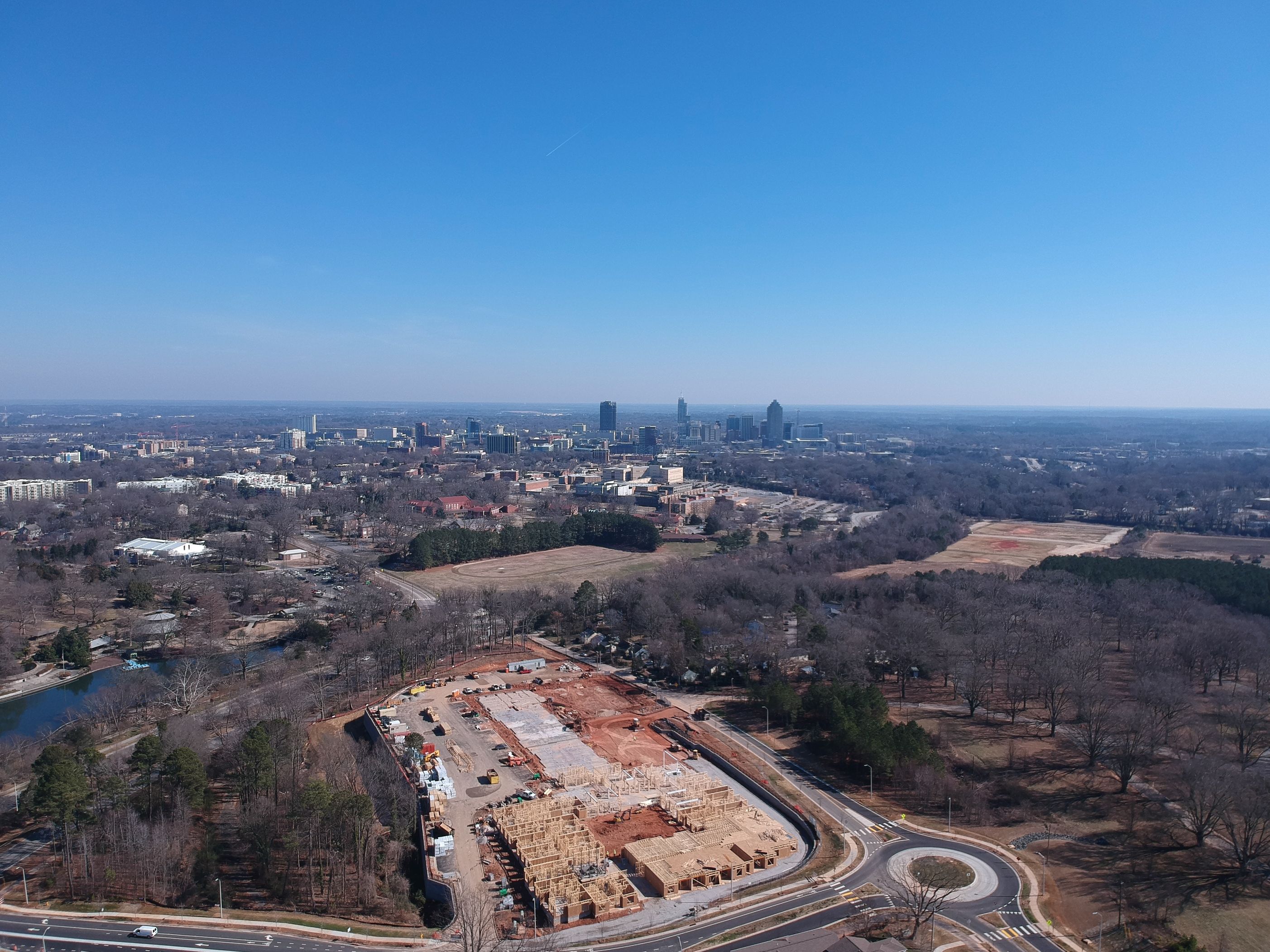
You guys all do awesome with your creative angles and composition. Nicely done everyone.
9 Likes
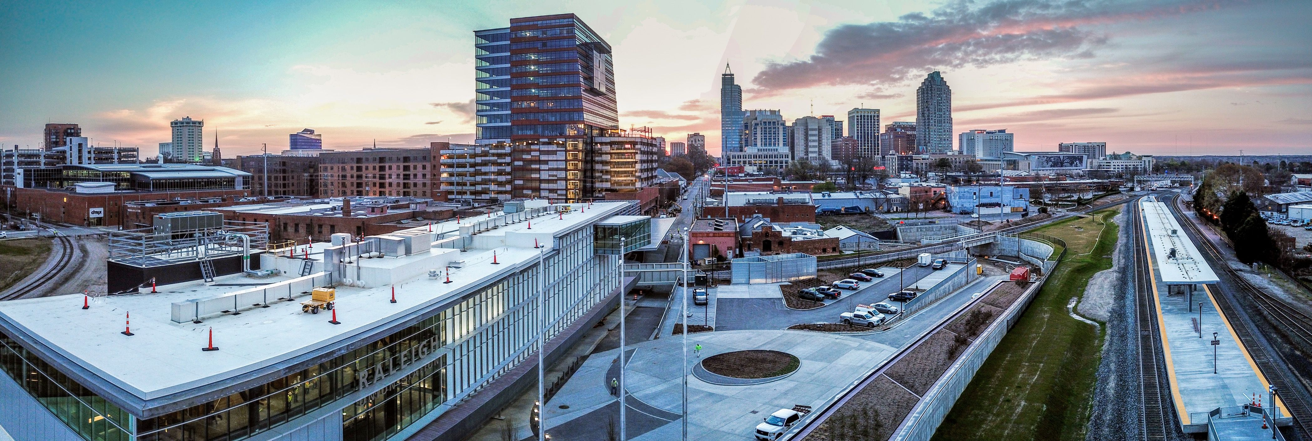
What is the construction right in the foreground?
3 Likes
“Old” folks home
https://www.liveoverture.com/communities/raleigh-centennial/?utm_source=GoogleLocalListing&utm_medium=organic
4 Likes
Oh, I hadn’t realized Overture was 55+. I figured it was another matchstick student apartment complex.
1 Like
Lol. Senior housing with “over” in the name. Game over.
1 Like
Over the hill? 
(It is on a hill, for what it’s worth)
2 Likes
Where’d you get that? They kinda messed up/mixed up the Century Post office color
2 Likes
Did you take that phone yourself?
…sarcasm alert
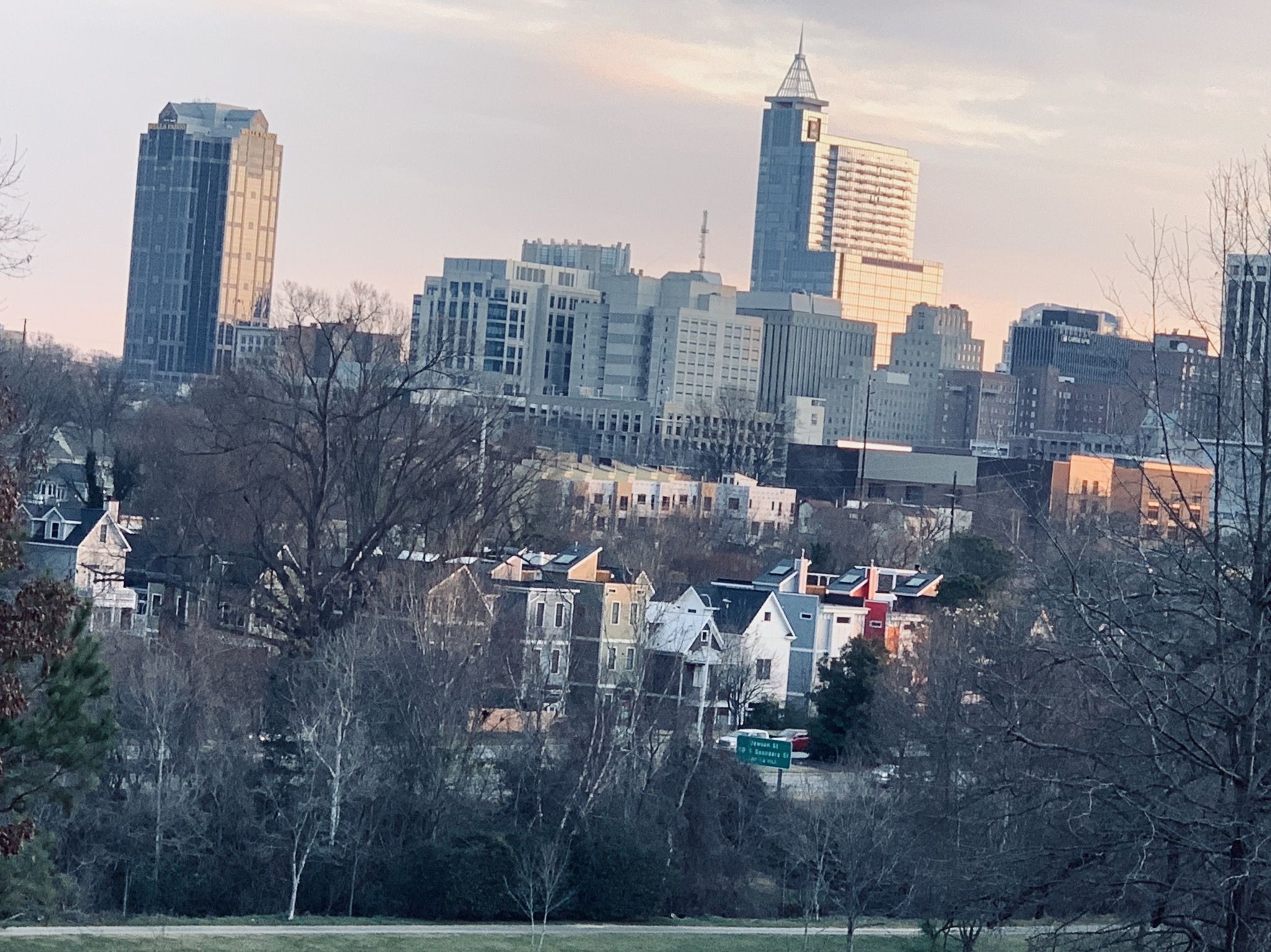
Cool shot! The way you framed it reminds me of the iconic shot of San Francisco. Very nice!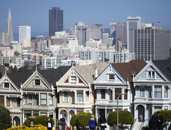
12 Likes
South Street townhomes really adding to the layers here
7 Likes
Yeah the Fairweather and the South Street Condos (should they ever actually start construction) should add even more. And they’ll still be visible ones the trees fill in I believe whereas Dorthea Gardens will get covered up a bit.
1 Like
Monday is the big day for the Fairweather! You guys are going to get sick of my progress photos for that project. Unfortunately I’m not here Monday to get the first dig pics. They’ll be removing a good amount of earth level with the West St. side for the first floor parking deck up to Harrington.
3 Likes
Raleigh’s skyline is growing!
Saw this from @maptastik on Twitter and wanted to share. It is an aerial map from 1981 laid over 2017. You can scroll back and forth. http://maptastikdev.maps.arcgis.com/apps/StorytellingSwipe/index.html?appid=890e378714ad41bdbe8b8ff3fdf3f9e2
I have not explored to much around, but I noticed that Raleigh Blvd, does not go south of New Bern and MLK does not go east of downtown. Really interesting stuff.
5 Likes
22 Likes
Wow that’s nice…