Rail Line to Fuquay-Varina

One additional benefit of re-routing the railroad is that it would unlock the area bounded by Hargett St. to the north, Boylan St./Boylan Bridge Brewpub to the west, and the remaining railroad/Union Station to the south and east. That’s a very substantial chunk of land that’s currently a wasteland when it could instead be put to any number of great uses. You’d also free up a smaller patch of currently underutilized land between the railroads between Hargett and Morgan that could be put to good use.

And since this would be a land swap, the state would now own that land and could sell it to the private sector for a nice sum. It certainly wouldn’t offset the cost of acquiring the other land, but it would definitely defray that cost somewhat, and then you get the benefit of all that space downtown. And of course, this would probably be part of a comprehensive plan to close down Central Prison and sell off that land, and that really would bring in massive amounts of money (and re-routing the railroad would just further expand the range of options for what you could potentially do with that land.)

3 Likes

You got it! The land west of Union Station is another component of the ROI from the public’s perspective.

Now we just need somebody at the city to take this seriously…

2 Likes

All interesting ideas, but how do we get the right people to take notice and actually start exploring possibilities?

The post from Dan in the Dorothea Dix thread indicated that the railroad is being treated as a constraint for the foreseeable future.

Basically I think a city councilor or councilors would need to get interested, and start asking staff to look into it. They’d have to care enough about it so that they don’t give up when the railroad (inevitably) is not very receptive at first.

I don’t have much leverage with council, since I currently live (and vote) in Cary.

Why would the tracks have to climb 50 feet? A bridge over Wilmington street would only need 20 or so feet of clearance. You will need a bridge over 401 anyway. Its a moot point anyway. I imagine any response from the city council to be along the lines of the railroad being treated as a constraint.

The land areas that you are referring aren’t as useful from a development perspective because the SEHSR plan shows a few more tracks than what are presently installed.

You have to remember that Raleigh is deceptively hilly. It can seem pretty flat because we don’t have mountains, but there’s still hundreds of feet of difference between the highest ridges and the lowest valleys. The water tower near the fairgrounds is situated at about 510’ above sea level for example, while three miles north, Crabtree Creek by the mall is just 210’.

At the point where they cross under Hammond, the tracks are at an elevation of 240’ above sea level. On the other hand, Wilmington street near the intersection of Renfrow Road is at an elevation of 270’ above sea level. So to even have an at-grade crossing at Wilmington, the railroad has to climb 30 feet from where it crosses beneath Hammond, to where it would reach Wilmington Street. Already that is an untenable 2% grade.

Furthermore, to cross on a bridge OVER Wilmington Street, it would need to be another 20 feet higher. 30 + 20 = 50.

This is why it makes sense to go under Wilmington, rather than over it.

I unfortunately agree that getting somebody official to take this seriously is a long shot. I think it’s worth a look, but I’m not the one in an elected office.

1 Like

Gotcha. I wasn’t factoring in the change in terrain in my calculations. Is South Saunders higher in elevation than Wilmington St.? You would still have to elevate over S. Saunders.

South Saunders is lower again, in another valley. It’s at 240’. This alignment climbs gradually from 240’ under Hammond Road to 310’ at Carolina Pines Avenue, and would be at about 275 or 280’ by that point, on a relatively high bridge above South Saunders Street. It would be maybe 5 feet higher than the bridge that carries I-40 over South Saunders.

I keep forgetting that SEHSR is a thing that will probably eventually happen one of these days. Yeah, that does cut into the amount of land available for resale, although there’s definitely still some good land left there, and … hey, wait a minute.

So let me get this straight … the rail line running from Union Station to Charlotte is going to be the line for high speed rail, with the speed so high that we can’t have any at-grade rail crossings, and we’re going to have to shut down multiple city streets to all other forms of traffic … and yet there’s a freight line with a crossing just west of Union Station that blocks the commuter rail line for minutes at a time?

Am I understanding this correctly @orulz? That seems, IDK, like kind of a problem.

1 Like

It isn’t that big of a problem. The NS line crossing the HSR corridor isn’t heavily used.

1 Like

Yeah, so this is sort of the point: the railroad line that would potentially be rerouted, and some of the existing track that would be rededicated to other, more socially beneficial, purposes isn’t heavily used in the first place.

I mean, it’s not, it’s definitely not, and I can tell you firsthand that it isn’t heavily used because I live right next to the line. But the fact that it’s not heavily used anyway would seem to suggest that the barriers to rerouting it shouldn’t be insurmountably high, and that there ought to be a way to devise a mutually agreeable solution.

1 Like

Yes, early studies for the SEHSR (starting as early as 1995) did identify this as a problem and did suggest closing this crossing. They actually wanted the platforms for the Raleigh station to be built west of Boylan Avenue, since this would allow trains from both Selma and Wake Forest to serve a set of parallel platforms.

The specific plan, as I recall, was to move NS’s freight trains onto the main leg of the wye and build a crossover and move some other stuff around so they could move onto the branch from there. Honestly this wouldn’t have benefited Norfolk Southern in any way: trains would have to move just as slowly (10mph) through the sharper curve of the Wye and through the crossovers and turnouts required to reach the branch. It’s no wonder they turned it down.

So at the time, the planners gave up, eventually settling on the track configuration with widely separated platforms that we are familiar with today.

But things have changed since then, however. From the public perspective, there’s Dix Park now, where the railroad slices it in two, creating a clear public benefit for removing the railroad and joining the two halves of the park together. There’s Union Station and all the new development happening on the west side of downtown now, increasing the value of the real estate that would be liberated by moving NS out of there. Commuter Rail using the freight tracks is now a thing too, with an increased urgency due to the transit sales tax. This will involve crossing the Diamond, whereas back then it was thought that any local trains would be DMUs using a completely separate, dedicated set of tracks and a trench or bridge through the Wye area to completely avoid interacting with freight trains.

From the railroad’s perspective, Norfolk Southern has moved their focus more heavily towards mainline operations and away from branches. In the interim, they have already leasing the part of this same line north of Glenwood Yard to a shortline operator. With the right offer, they probably would agree to sell this short segment of the line south of downtown, especially if a bypass were built. While it’s not NS, CSX has the following statement in their official policy on passenger rail, and I expect that NS would be no different in this matter:

CSX will consider publicly funded relocations of freight operations if they preserve CSX’s customer service, competitive position, and access to current and future freight customers.

Furthermore, I think that my plan, though more expensive to implement, is probably better than both the current situation and the original plan from a RR operations perspective as well. Trains accessing the branch would have to travel about 1 extra mile (3.5mi instead of 2.5mi) to get to Carolina Pines Avenue, but they’d actually be able to get there faster from a time perspective, since they could access the branch through a crossover and turnout while operating at speed, which would probably be about 35mph (the approximate speed trains can travel around a 5 degree curve), compared with the 10mph speed limit for crossing the diamond today. Not to mention the trains going to this branch would be crossing the mainline east of downtown Raleigh, which is significantly less busy from both a freight and passenger perspective than the tracks to the west that they have to cross today.

The biggest downside from NS’s perspective is that they would be moving off of a line that they own outright, onto one that they operate by lease agreement (NCRR), but I reiterate that for the right price that would probably be OK with them.

2 Likes

The flip side of the coin would be to leave as-is, because the line is lightly used, and the significant expense to reroute a lightly used line would be difficult to justify using taxpayer money.

1 Like

I do see your argument, but (if you couldn’t tell already, LOL) I see it a little diffently.

NCSU has a railroad through the middle of its campus. Although the university does fine, and indeed has grown up around the railroad, I can say as a former student who lived on campus for three years, its presence does have a pretty big impact: it makes the academic part of campus north of the tracks and the residential part to the south feel almost like two separate universes, that you have to warp between by using the “Free Expression Wormhole”, rather than part of an integrated single institution.

The same can be said of Pullen Park. Half of the park is actually north of the tracks, but it feels completely disjoint from the southern half where most of the activities are.

Now, the railroad at NCSU is much busier than the one through Dix, but regardless of whether there are no trains or 200 trains a day, the right-of-way is likely to be fenced off so it’s just as much of a barrier either way.

But even given that, if uniting the halves of Dix Park by removing the freight line is the only thing to be gained, then yeah, maybe it doesn’t pencil out. Adding a few more pedestrian bridges would be cheaper and would achieve some of the same goals.

It’s only when you look at the other things (the rail trail connection to downtown and to the south of I-40, the extra land opened up for development, the potentially better railroad operations) that it starts to seem like it just might pencil out. Might. Not saying it definitely would. If we study it and find that it’s just too expensive, or completely fails to meet some goal or requirement, then I’m totally fine dropping it.

I’d just like somebody to actually look into it. That’s all.

2 Likes

I’ve emailed my city councilor.

3 Likes

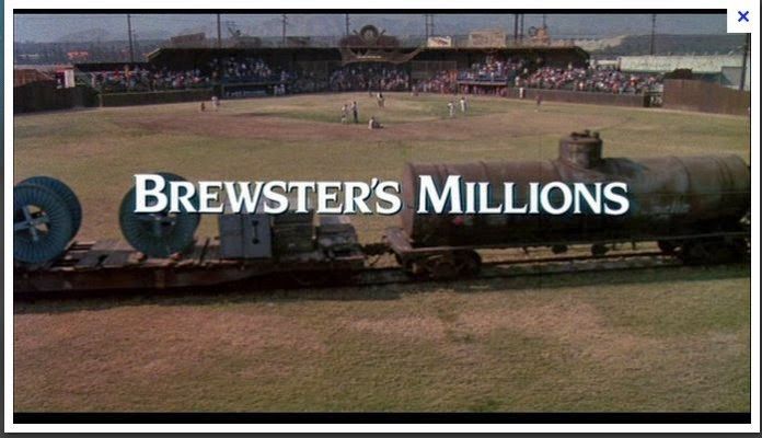
There’s nothing wrong with having a difference of opinion. Civil discourse is a forgotten art these days. I’m a fiscal conservative (as if you couldn’t tell) but I’m certainly not opposed to spending money on projects, either. I think the way the Dix plan is designed with separate areas, the railroad going through the middle isn’t as noticeable. Now, if the plan showed the railroad going through the middle of a ball field like in the movie “Brewster’s Millions” that would be a different story.

3 Likes

With the park starting from nil with the railroad already in place, you can build up around it and to a degree that allows you to downplay its prominence. Like NC State. However, I think the presence of the railroad does hamstring the potential of the park, to an extent. How would the plan for the park look, if that were a broad, level trail carrying pedestrians, bikes, and (yes) scooters on a long, majestic bridge over Western Boulevard, and on into the heart of Downtown Raleigh?

You can’t tell me that nothing would change. Well, you could tell me that, but I wouldn’t believe it. I think that trail would become one of the brightest shining centerpieces of the entire park, rather than something to be minimized, downplayed, hidden, avoided, and worked around.

1 Like

It is certainly something to keep in mind, especially if the NS were to abandon the line. Another thing to remember is that many of the park’s features aren’t yet funded (they are looking for sponsors, etc…) let alone there being funds for buying the portion of the rail line and providing an alternate route. I’m certain that the railroad itself would not want to spend a dime of its own money.

2 Likes

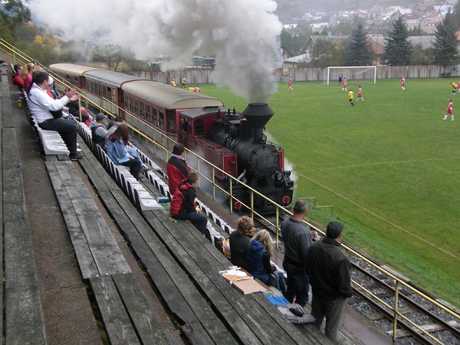
Jánošovka Soccer Field does just that in real life.

5 Likes