The Oakwood Freeway was protested, so the solution was to reroute the road thru the ‘southside’, to connect with DOWNTOWN BLVD north of downtown. Heritage Park was constructed around this time.

6 Likes
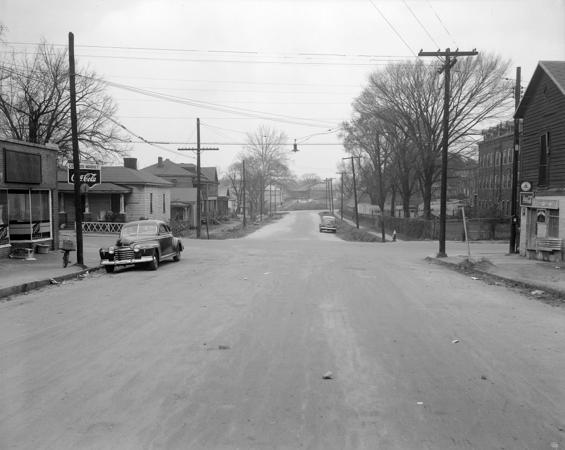
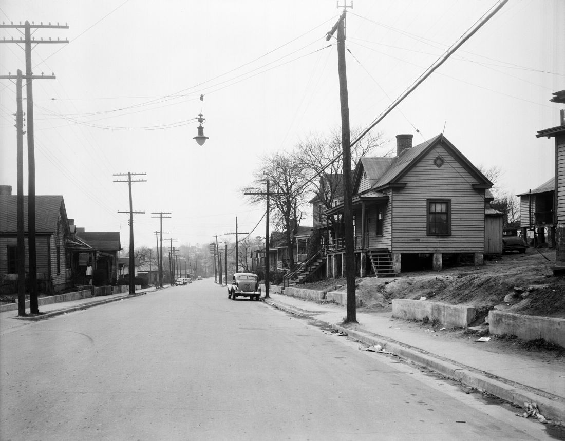
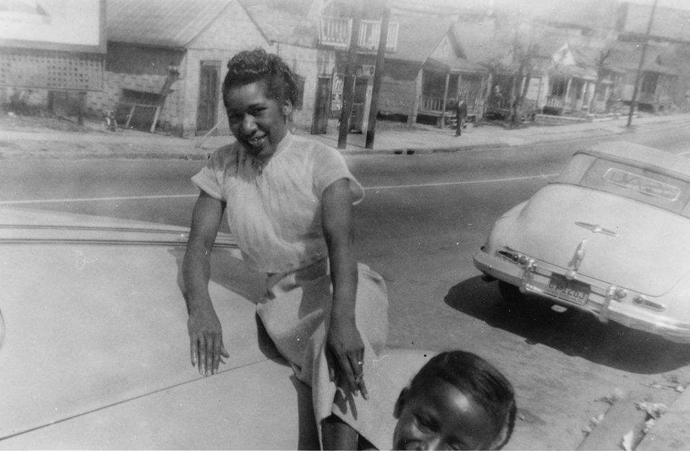
looking north towards Memorial Auditorium
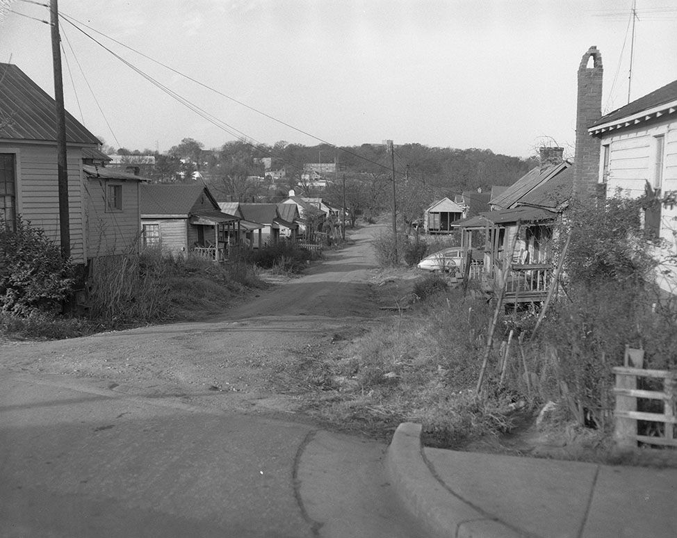
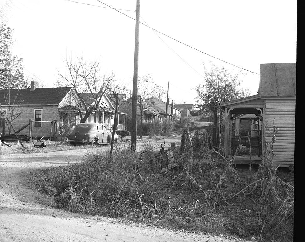
Looking west towards Dix
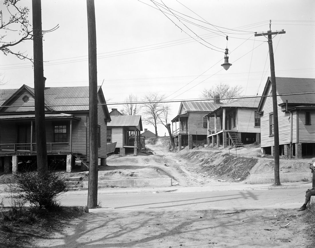
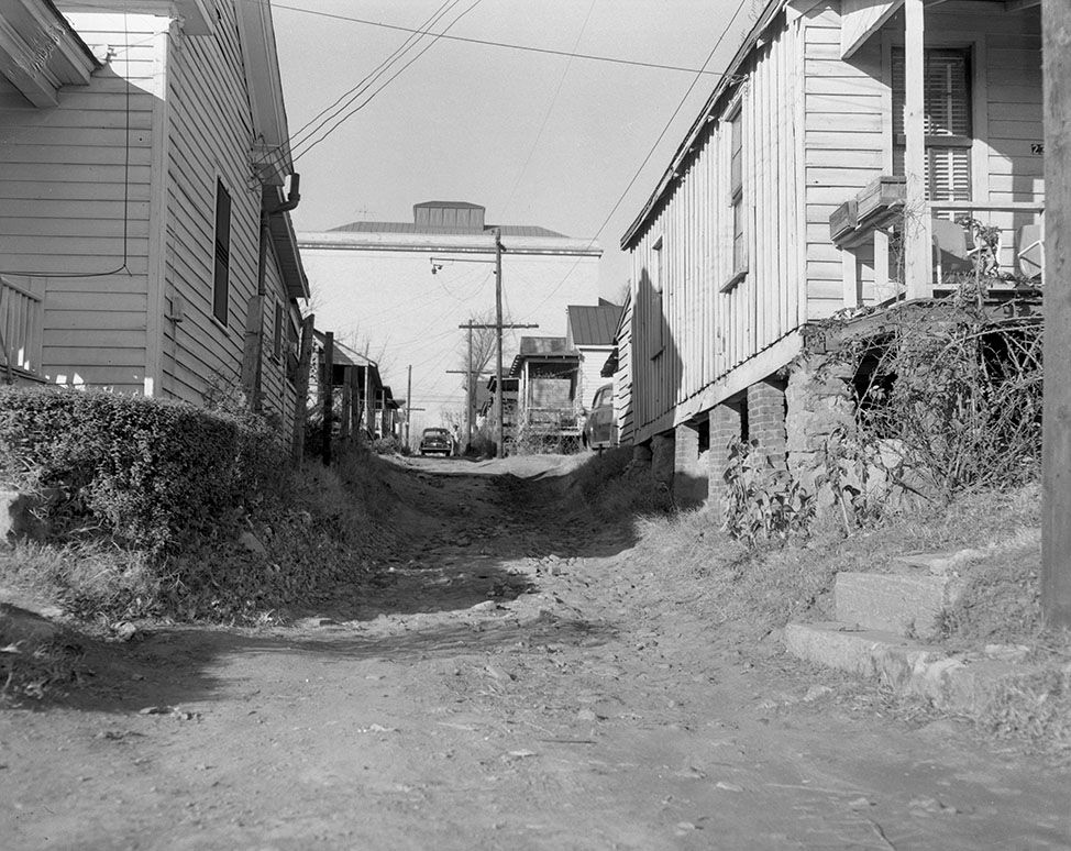
Corner of Pugh and Cannister
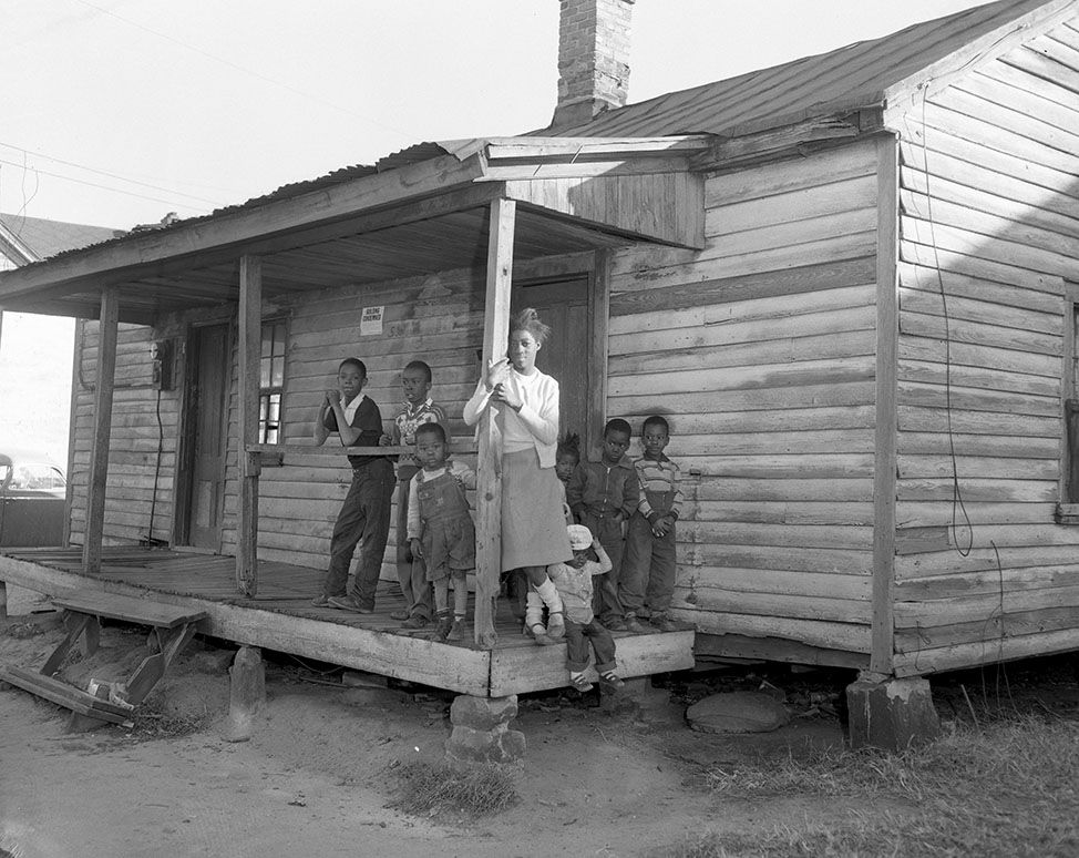
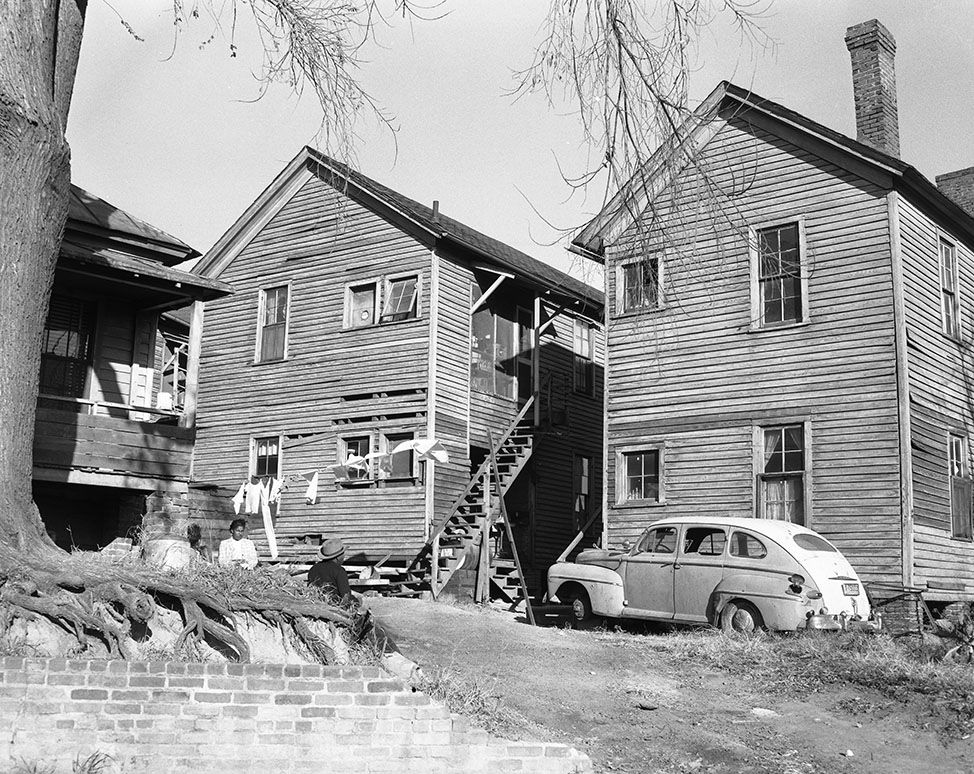
Ms. Johnson owned a house on South st near the railroad bridge
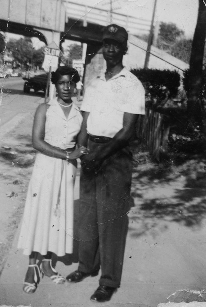
South st looking north, train in upper right corner (what color do you think her dress and car was?)
26 Likes
Those pictures are amazing!
3 Likes
Thank you, this is exactly the kind of info I was looking for. I actually am pretty ignorant of the history of urban renewal as it relates to Raleigh and South Park… Compared to Durham’s Hayti, there seems to be little information out there about the historically Black neighborhoods in Raleigh that were demolished in the 60s and 70s; I only found this and a N&O Article (excerpt below).
By late 1979, the city’s housing authority began a series of public hearings about a proposed $3.6 million redevelopment project in the South Park neighborhood, where city leaders deemed two-thirds of the housing substandard. Supporters of redevelopment also called for sewer and water improvements and the paving of dirt roads. In all, nearly 90 buildings were demolished. The redevelopment plan came on the heels of a proposal in 1977 to extend Western Boulevard eastward by running it through South Park. Lightner said the plan might have been better described as “urban removal.” Instead of revitalizing the neighborhood and allowing the business owners to return, Lightner said, the city purchased the land and amassed “whole blocks and years later sold it to white developers, who built large apartment buildings in South Park. “The city started driving out black businesses and buying up land under the guise of urban renewal,” he said. “The city really did a hatchet job on the community.”
Perhaps this needs to be its own thread, but is there an opportunity for some kind of rememberance or recognition of the history at this site or in the general area?
A timely article in Metropolis Mag from last week highlights Durham architects Zena Howard and Phil Freelon (of Smithsonian Museum of African American Culture and History fame) who are at the forefront of a national movement to recognize the lost histories of predominantly Black neighborhoods that were decimated by urban renewal and are now being redeveloped. In Greenville, where an entire neighborhood and iconic community church was obliterated in the 1960s, they are designing a Gateway Plaza and monument to recognize this history. A masterplan they are working on for Miami’s Overtown Neighborhood (decimated by I-95) recognizes the history and aims to reference it in the new design. Same deal in Hogan’s Alley in Vancouver, where the architecture aims to emulate a fine-grain and vibrant texture of porches and passthroughs of the original neighborhood, and where incorporating affordable housing has been a core aim. I’m not saying that the Five Horizons development necessarily needs to do this, but I do feel that as these areas are redeveloped, we shouldn’t lose sight of their history, particularly in light of the continued gentrification in the surrounding areas. It seems like a lost opportunity to recognize some recent wrongs.
9 Likes
I went to the Five Horizons website to see if they had posted any updates. There’s nothing there except a notice that they are no longer residential builders. It also says they can now be found under a company called Merge Capital. The only Merge Capital I can find is a securities trader. What’s up, anyone?
http://thefivehorizons.com/
1 Like
Interesting. Well, we originally thought that this was a big jump for Five Horizons. It doesn’t seem impossible that they brought in a strategic partner (i.e. they were acquired) that does this kind of investment.
Agreed. They have to have an equity partner to pull off the kind of project they are proposing. Even John Kane has brought in outside capital. What puzzles me is the only US company named Merge Capital (that I can find) trades in securities listed on the stock exchanges. They don’t appear to invest in real estate projects.
http://mergecapital.com/home.html
1 Like
I mean, I would rip out these road configurations and put back in the grid, just as sure as they removed it in the first place. Nothing radical about it in my head. Every time a cul-de-sac laden area in north Raleigh gets blighted, I’d rip that out and replace it with grid too. In time you’ll get majority urban grid, like it should have been in the first place but for making it absolutely dependent on automobiles. Anyway, a steady U-curve of putting back in at about the rate it was taken out.
8 Likes
Of course you aren’t thinking of the real reason why there is no grid in those areas… to protect the streams and creeks, keep our water cleaner, and limit flooding. And guess why we have so many greenways in Wake County? I assume that by your statement you are more than happy to just pave over everything…
2 Likes
I am an environmental engineer by trade (and licensed) and can assure you that is 100% *not why in 1907 Boylan Heights was the first plat in Raleigh to deviate from the grid. Of course that set the course and here we are. Buffers, bridges instead of culverts and BMP’s are easily incorporated into a street grid. If anything this sprawl has massively degraded water quality. Do you work for the Locke Foundation? Because I did a stint there incognito and that is precisely what they said.
11 Likes
Yes.And a lot of bridges are pretty expensive. My point is that neighborhood streets tend to follow the contours of the land because of the buffers protecting our water resources. Did that happen everywhere like Boylan Heights?.. no of course not. I don’t see how you are going to have a grid everywhere and still protect what needs to be protected. Besides its mostly too late for that anyway. Now if you were reasonable and advocated the slow gradual addition to the grid system on the fringes of current downtown then I would more than likely agree with you.
1 Like
The effects of poor water quality are expensive too. Your point sidesteps why the contour following began and it was just to please the physche of white people with enough means to get out of the city. Boylan Heights had covenants preventing african americans from living there so be careful before you start off trying to refute my statement. Also you are confusing street alignment with impervious surface. Here’s a nice case study for you.
Calling *me the unreasonable one? I am basing my idea on the historical fact that street grids were ripped out with impunity and replaced with things like the Dawson/McDowell connector. Yes, additional grid on the fringes is easier to get to and for that reason needs to be heavily advocated for, but I think it’s worth the exercise of trying to figure out what the highest and best use layout for any city could and should be for water quality, for animal habitat, for energy consumption, for transit and transportation, for quality of life. And yes, current suburban style development has indeed incorporated some water quality rules (mostly by regulation though, not out of the goodness of anyones heart. The first Federal Water Pollution Control Act was passed in 1948 and has been steadily gaining teeth since then with massive rewrites in 1972 and 1987), but developers fight that stuff tooth and nail. There is also some subjective quality of life improvement on a cul-de-sac…your kids can safely play outside. But I say that means we need more parks…lots more parks…not cul-da sacs. Habitat, energy consumption and transit and transportation are 1/10.
8 Likes
This is what the grids you want sound like to me as this is basically what the grid system does… if this is what you want then by all means let’s get this done…
I never said anything about burying streams. I am talking about grid street systems while maintaining natural water quality protections and adding mitigating structures. Where you develop (not in wetlands or along stream buffers) is just as important as how you develop (density, street orientation etc.) of course, and certainly they are both part of the big picture but I only am discussing the *how. I would never advocate developing in a manner than trashes water quality or fragile eco systems…though really…any growth is bad for that stuff. Growth is unsustainable in the long run and we should all be advocating for net zero population globally. But I won’t be getting into that here or anywhere else for the time being.
1 Like
Clearly, the worst part of the existing configuration of this overpass/intersection is the de facto barrier it creates between downtown proper and “something else”. Secondly, the design of both roads and the intersection where the meet exacerbates the situation by mimicking a crossroads of a freeway in the burbs.
This “boundary” is further re-enforced by two more recent developments near it: Gateway Park and Walnut Terrace. Both are typical examples of suburban development with a car oriented site plan. It also doesn’t help that there’s a giant cemetery & large elementary school grounds to the east of McDowell.
For me, the very first thing that needs to be done here is to redesign the actual intersection itself and change the nature of MLK Blvd. Both need to be made less suburban and more intimate to meet the scale of the city and slow the speed of drivers.
In a perfect world, I’d then integrate the lands where the two aforementioned residential projects are, to be more engaged in an urban model way. Whether that’s a grid or not, I don’t know. I just know that I don’t want a car oriented site plan for either property.
I think that that the stretch of McDowell from MLK southward to its joining of S. Saunders is a bit tricky though, because of the cemetery and the grade changes. This might not be able to significantly change on the northbound lanes.
3 Likes
Apparently Merge Capital does exist. Here’s there minimalist website:
They’re helping foot the bill for public art in the Rocky Branch Greenway Tunnel: https://www.raleighnc.gov/parks/news/content/CorNews/Articles/PRecRaleighArtsGreenwayTunnel.html
I take this as a sign they’re still pursuing the S. Saunders planned development.
5 Likes
Very interesting. I love this project and I hope they follow through
Yeah, same here.
Have to wonder if the Merge Cap people are talking with the Kane/Malik people since S. Saunders and Penmarc are so close to one another.
1 Like
I don’t think it’s a stretch to expect they’ve exchanged some texts about the subject. 
1 Like
And I’m curious about what these developments mean for the Southern Gateway Corridor plan. Haven’t heard much about it since 2017.