I looked the place I think you’re talking about on Cary’s OpenGIS portal. This may be doable (if you make most of the property go along Cedar St. rather than Durham Rd.), since most of the parcels you’re talking about seems to be owned by one person rather than a hodgepodge of different companies.
(I won’t list their personal information, but … a disturbing amount of it was easily accessible. Home address, tax IDs,… it’s actually kinda terrifying. I understand recording deeds, ownership etc., but this is a bit much.)
Rounding up to the higher $1k, those plots of land are valued at:
Owner 1 (blue): $1.7M land + $3k buildings
Owner 2 (red): $96k land + no buildings
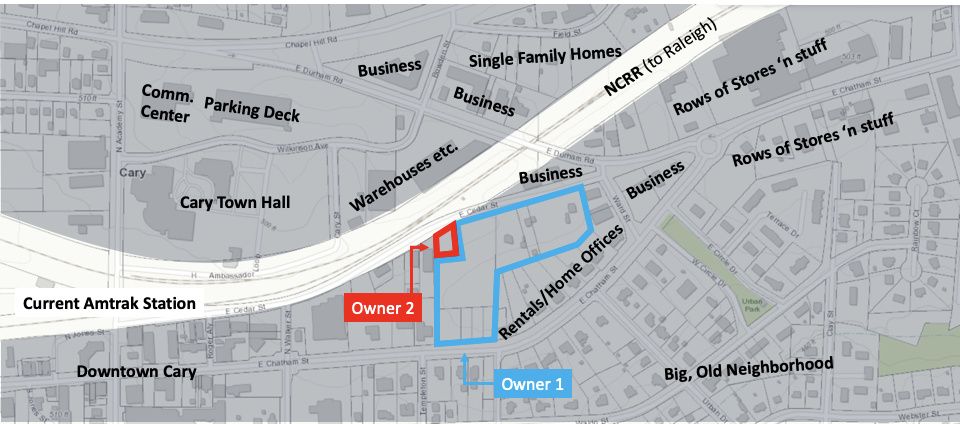
The total area of all these parcels are something along the lines of 20,800 sq meters (239,000 sq ft), via Google Maps.
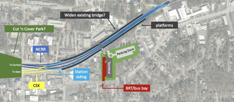
It would be cool if we could do something like this? (The way to squeeze in bus/BRT bays while keeping it from being a distraction in the nearby neighborhood’s difficult to describe with words, so here’s a crude map instead)
Now that TIGER grants are replaced with BUILD grants (which is designed to heavily favor road-centric developments over something like shuffling around Cary’s downtown traffic), though, I’m not sure how viable such a grant application would be now ![]()
Does anyone know what’s up with the study @roguejam mentioned? Doesn’t seem like that website has been updated in ages.