That’s great! My wife hates having to cross Lassiter when we go cycling there.
2 Likes
The greenway connection to Hertford Street looks like a nice improvement, replacing the stairs with a paved path. But where the greenway intersects Lassiter Mill Road, I’m not sure how much this helps since the sidewalks are still narrow so bicycles still have to ride in the busy street, they just don’t have to cross it going westbound on the greenway.
5 Likes
They are also upgrading the sidewalk across the bridge to make it wider. Here is some more info.
4 Likes
Oh that’s good to hear!
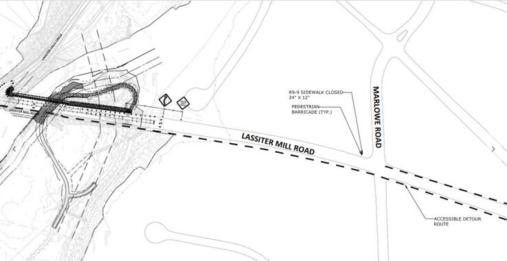
I’m a little confused on this. So it appears that this fixes the crossing across Lassiter and then makes the sidewalk wider up to Lassiter Falls Circle. What’s the plan for south of that?
When I ride, I ride in the road north on Lassiter and then get onto the greenway that way. With this, I would need to either stay on the narrow crosswalk from Lassiter Falls Circle up to Grasteel Creek greenway or cross again to get to the west side of Lassiter (assuming the entrance to the greenway changes). Is that correct?
I’m also curious if there’s considerations about the flooding potential under Lassiter.
It sounds like they are widening sidewalk on the west side of Lassiter to make it a multi-use path. I take that to mean folks will use that side to go in both directions.

5 Likes
About time! I HATE this section of Crabtree Creek with passion.
1 Like
That project has been in the works for years, probably more than a decade.
This will be a big improvement.
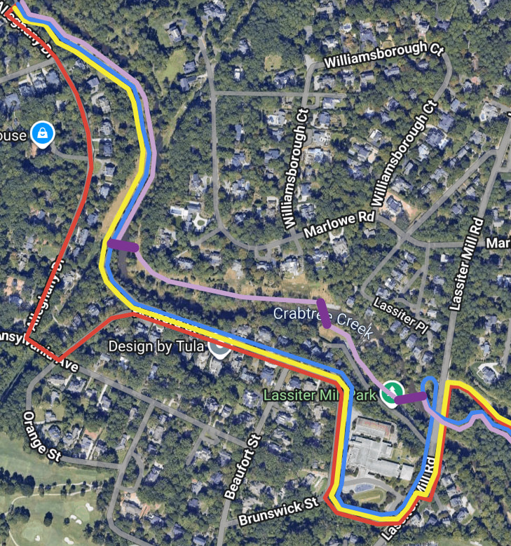
I’m a bit disappointed that they decided not to plan a route that stays next to the creek for the entire distance - although I can understand why.
A water level route would cross the creek, follow the sewer easement on the north side of the creek, cross back over to the south side above the dam along Old Lassiter Mill Rd, and then cross again just before Lassiter Mill.
The above route would cross through the backyards of seven of the most expensive homes in the entire city, and the owners would certainly fight to maintain their views and private access to the creek.
This is one of the most scenic spots in the entire city, and unfortunately the planned greenway will bypass it almost entirely. Although you could argue that having these extra bridges over the creek could harm the scenic nature of the spot, I personally believe that it could be done tastefully. There are other places (such as literally a quarter mile east of here) where the greenway zig-zags similarly across the creek on bridges several time in a short distance, and it’s perfectly fine.
Anyway, what they’re planning to build is the blue route, what this would have been is the purple.
12 Likes
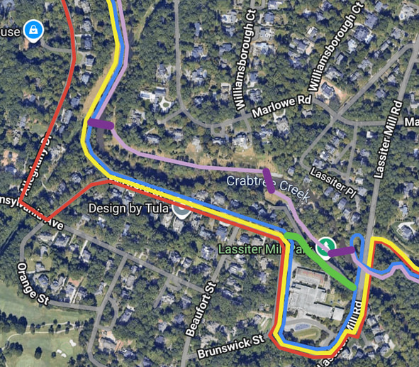
I don’t cycle, but for walking/running that’s absolutely one of the best and most scenic sections of the greenway. I think the blue route above makes sense considering the trail already exists on the other side of the creek.
2 Likes
Yeah, I wonder about this too. The elevation difference between these two points is pretty severe, so it may be an issue of accessibility? I imagine it’d be comparable to this stretch by Capital, so it’s not without precedent.
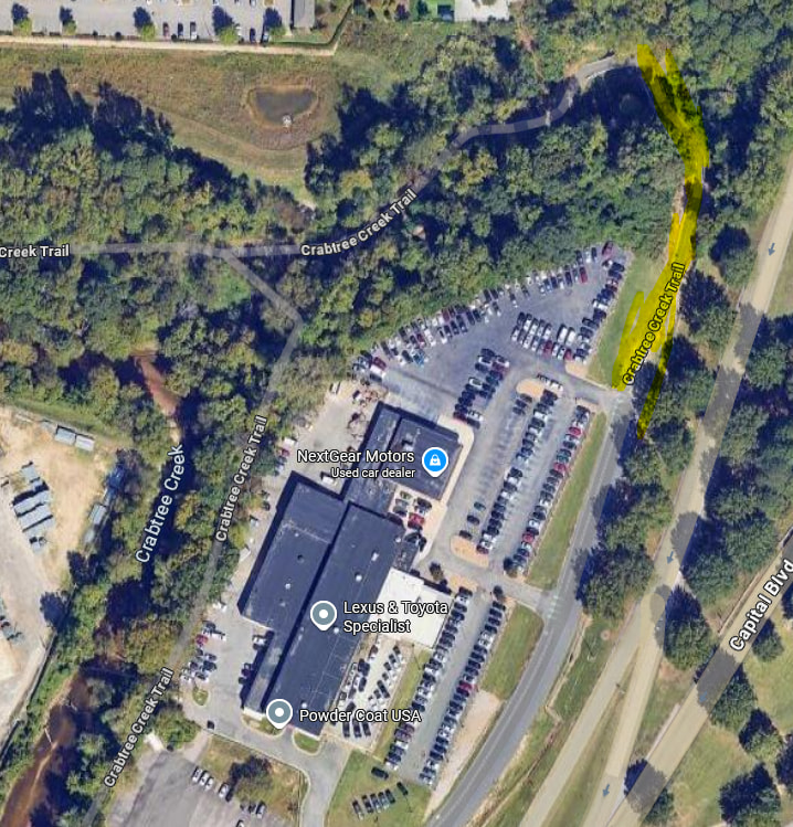
Maybe the school doesn’t want to play ball? I remember the first time I ran this route west to east and I noticed a staircase near the school that I thought would go down to Lassiter Mill Park. It would be nice if that connected, even if it wasn’t formally part of the greenway.
4 Likes
I don’t know for sure, but, yeah, I wouldn’t be surprised if the issue was the elementary school. And, yes, that climb up Northampton St. is steep, so the elevation change could have been an issue too. Notwithstanding what could be done if there were no obstacles, I’m excited about this project. It’ll be a significant improvement over what exists now.
6 Likes
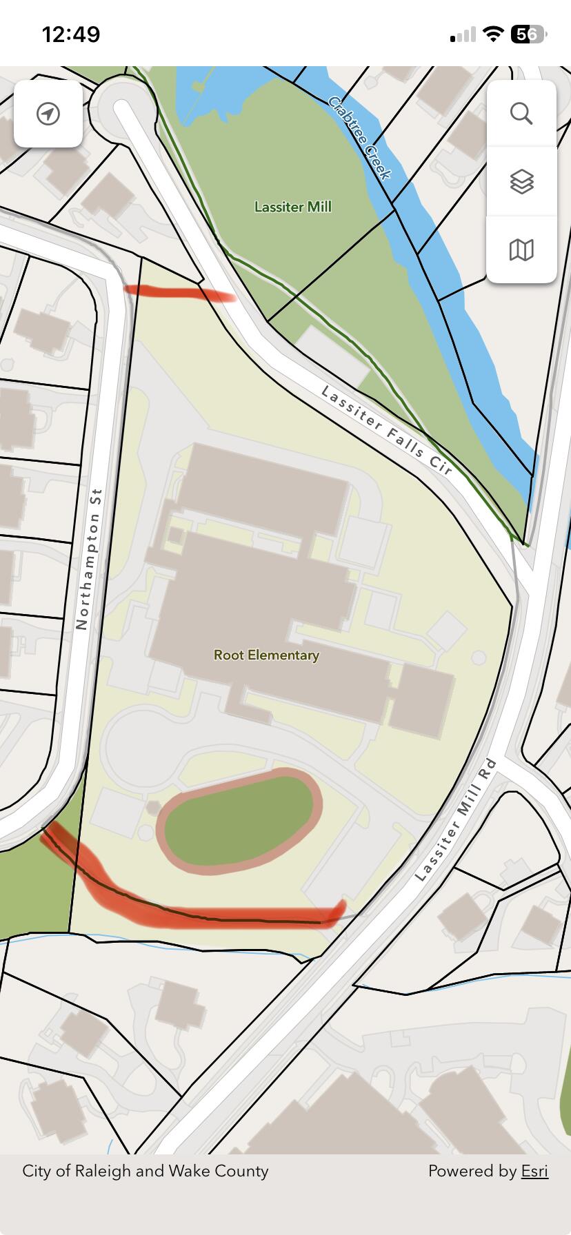
It looks like it would cross their property in that corner. But interestingly enough, the current trail cuts across as school property well on the other end.
3 Likes
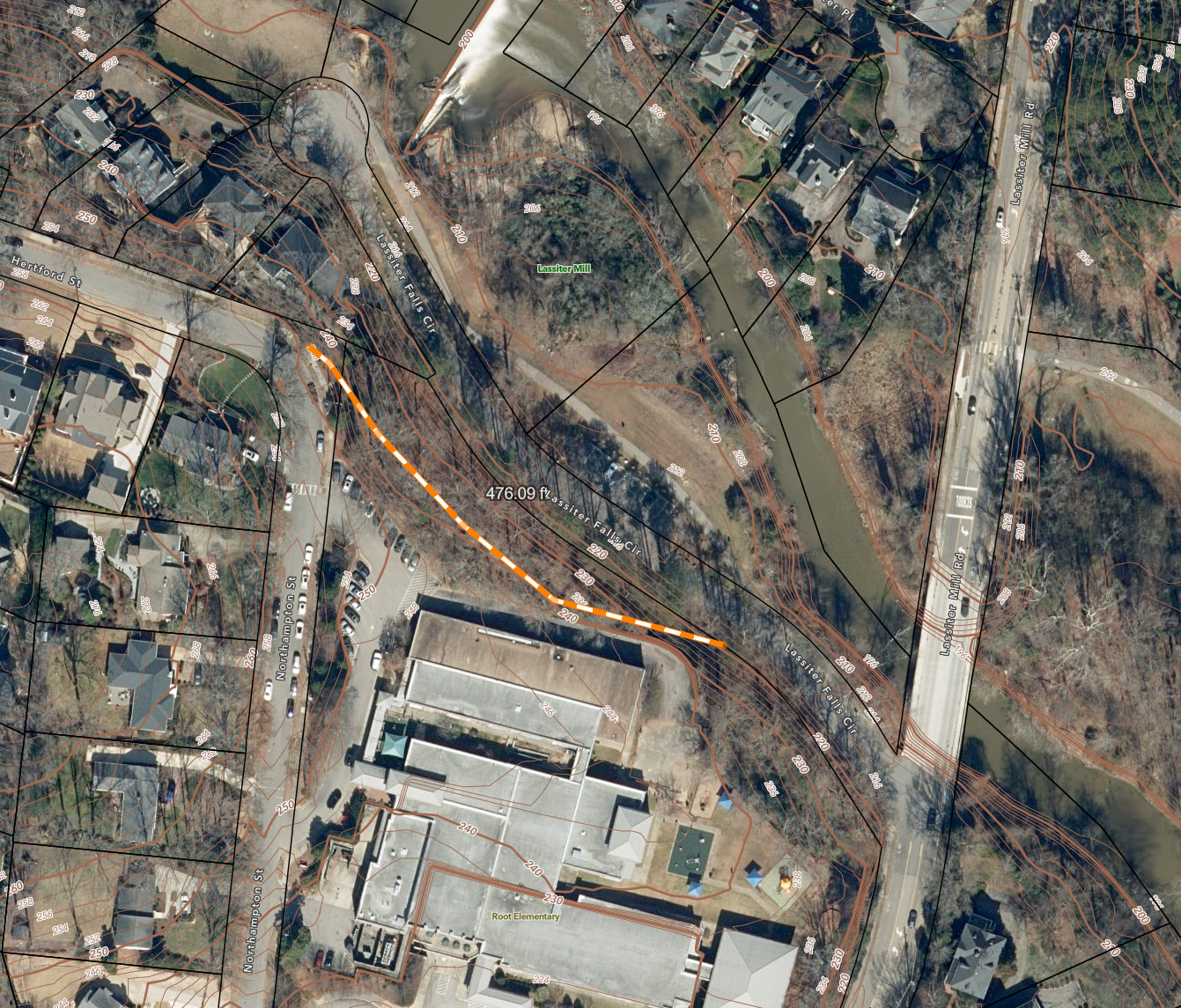
30 ft elevation rise in 120 ft there. what’s the requirement for greenways?
Since the facility serves pedestrians, PROWAG says 5% if not parallel to a road and it doesn’t look like there is a lot of space for switchbacks here. Maybe stairs could be installed here since there’s the alt route that @Kanatenah pointed out.
1 Like
If the grade is so steep that the majority of folks will struggle, a bicycle stairway would be terrific. However, how does the ADA affect that decision? Would they have to find an alternate route to extend the length of path while reducing the grade? And, if they did that, then a stairway wouldn’t be needed at all.
There are current Greenway sections way steeper then 5%. The spur trail heading up to N. Hills Park comes to mind. But these older sections are probably grandfathered in.
1 Like
Yeah, I think the hairpin turn on Crabtree Creek Greenway just past/before Milburnie Rd. is just a smidge steeper than 5%.
2 Likes
Maybe the stairs don’t need to signed as the greenway but could be provided to extend the street grid and provide a more direct route for a majority of people, while giving people who need it an accessible path via the connection from Lassiter Mill to Northampton.
Yeah, I’ll bet this is the case. This is from the current City of Raleigh standard for greenways:

2 Likes