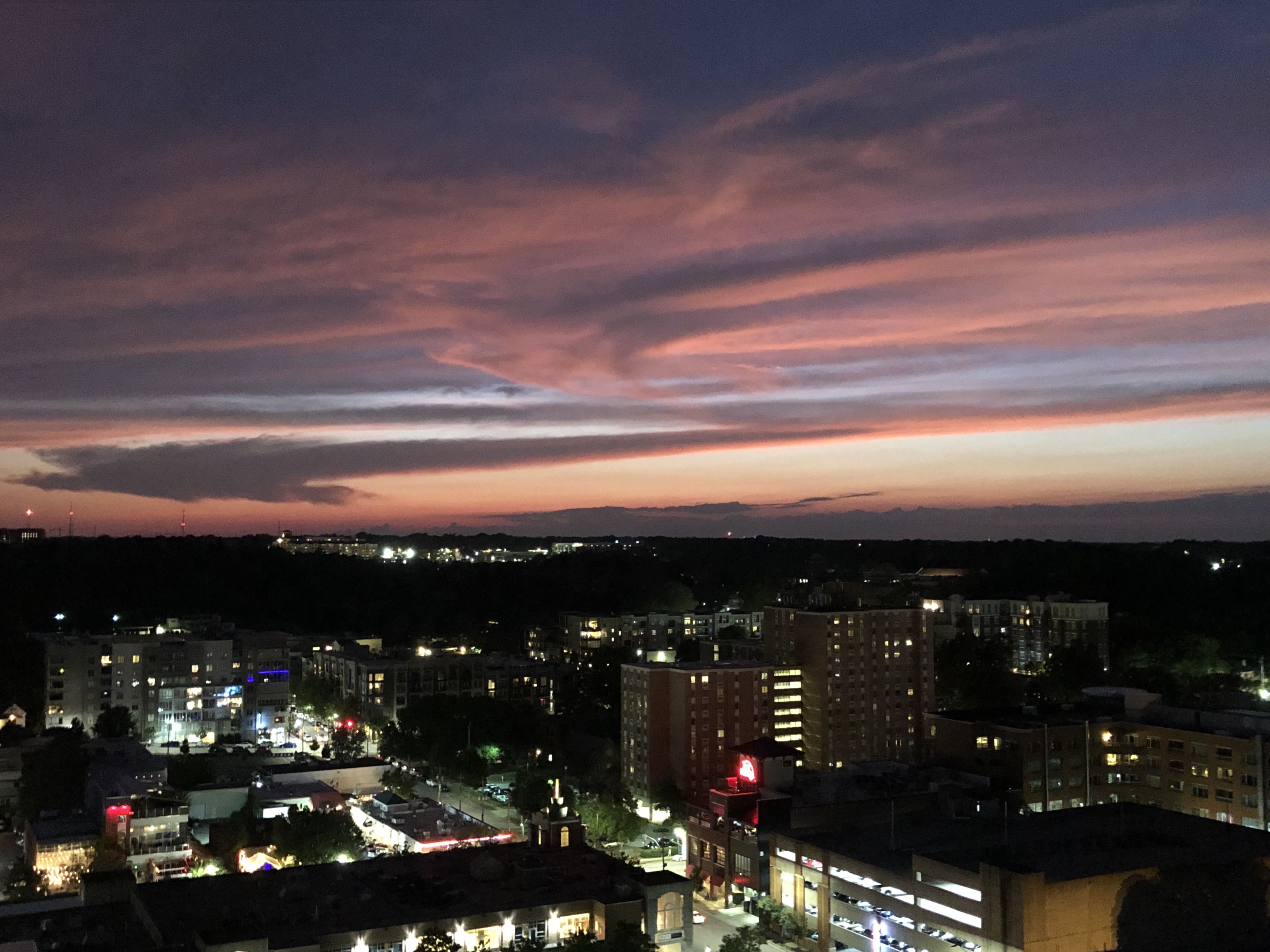
Nice sunset over Glenwood South.
19 Likes
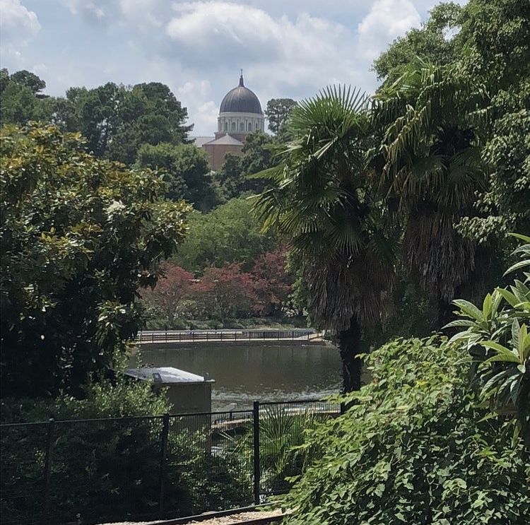
That is an awesome photo of the park with the Cathedral in the background.
2 Likes
What mediterranean city was that taken in?
12 Likes
Does have that Mediterranean vibe to it, but I think Pullen Park is a lot greener than most Mediterranean cities.
5 Likes
That’s just what I thought! lol
1 Like
The palm fronds really serve to remind that Raleigh is classified a “humid subtropical” climate, (at least according to Köppen).
As if I could ever forget that fact in the summer, when all my pants must technically be classified as sweatpants (according to anyone who has to be within 10 feet of me between May and September).
5 Likes
Kudos for apparently jumping the fence and risking collision with the toy train to get this photo. 
3 Likes
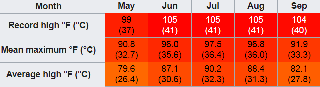
the summer double 100’s (heat and Humidity) are why I left and moved to mountains.
5 Likes
I see some palm trees that need to be added to the map
Also, the palm tree on Cabarrus in BoHi (Boylan Heights) was cut down about a year ago
4 Likes
Hahaha I actually took the pic from Shelter 6 on the other side of the park. There are great views on that side of the park from above.
1 Like
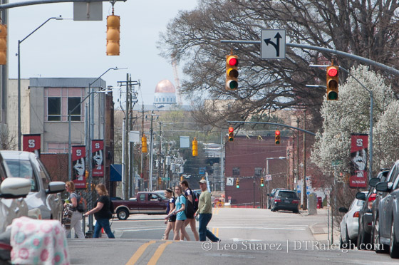
I like that you can see the Cathedral from Davie Street next to Nash Square. Once those projects pop up near Union Station that view will probably be gone.
3 Likes
Reminds me of this post from 2016.
15 Likes

Raleigh is the new Vatican.
7 Likes
Perhaps this should be in the tourist attraction thread 

2 Likes
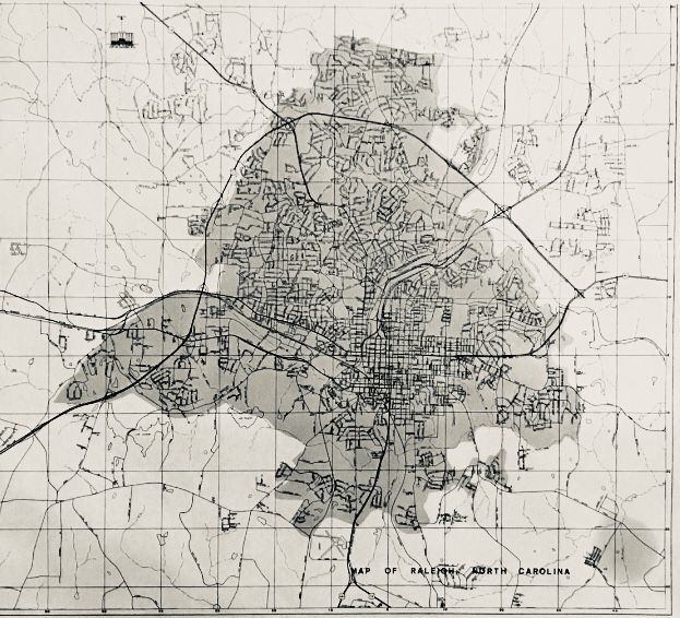
I didn’t know where to put this, so I am taking liberties by putting it here. It’s a photo, but it’s a photo of a historic map that I’ve had for quite some time that dates to the early 1960s. The map doesn’t have a date on it but the section of the Beltline that arcs across the NW opened in 59-60, so it has to be in the early 60s.
Look how tiny Raleigh was less than 60 years ago!
20 Likes
The Municipal Airport can be seen at bottom of photo, ( used by small planes at the time of this photo + no Crabtree Valley Mall ). Downtown + a visit to Cameron Village, then Pullen Park - what a day in 1960!
6 Likes
Interesting N. Raleigh would be what is currently the between the beltline and millbrook. This was right around the time my current neighborhood was built.
I’d consider that a good day still! Though not in this heat.
This weather is why we have indoor malls! lol
1 Like
You can see the speedway track just north of the beltline, in between Wake Forest rd and Capital blvd
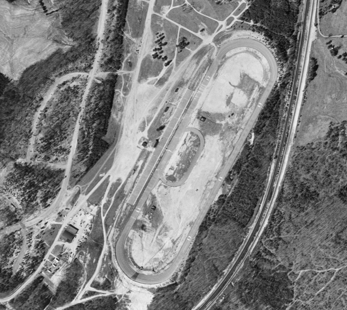
https://en.wikipedia.org/wiki/Raleigh_Speedway
8 Likes