You’re right that a grid doesn’t necessarily = urban, but it is still one of the best indications of the potential for urban development. If you look at most cities, single family homes are often bought out and redeveloped into larger buildings as downtowns expands, and this is in large part driven by a continuous rectilinear grid. I was just in Toronto, so to use it as an example: if you look at the city’s graining, commercial areas line the E-W thoroughfares, and single-family neighborhoods fill the blocks in between them. The density trickles into the residential neighborhoods via urban infill, which makes for a walkable city that extends far beyond downtown. From my (limited) understanding, this is urban planning 101 – a robust urban grid is the framework for a pedestrian-oriented city (including walkability and efficient public transit), while meandering, sparser streets are built for the car and usually lead to suburban sprawl.
Which cities are you thinking of? The only thing that comes to mind for me are the historical inner cities that can be found all over the world, but that kind of density isn’t realistic for Raleigh. I’m wondering if there are any good examples of turning around this kind of suburban sprawl in cities that are built similarly to Raleigh?
Question…
I know that DTR has the zones that help define the CBD, however how does Raleigh see the Eastern side of DTR? I know that we have a lot of opportunities in that area but at the same time you have a lot of older established neighborhoods? Does DTR keep marching East as the western edge has those horrible railroad tracks?
The Public Land Survey System (PLSS) was created by the Land Ordinance of 1785 to survey land ceded to the United States by the Treaty of Paris in 1783 after the end of the American Revolution. Land surveyed by the PLSS was divided into a rectangular grid system composed of townships and sections.
The original colonies were NOT part of the PLSS. For this reason states like Florida have a vast grid system on the ground whereas land boundaries in states like North Carolina tend to meander because they follow natural topography. Over time roads were built and they tended to follow land ownership boundaries.
In my view the legacy of the old British metes and bounds system is a big reason our state is so much more interesting. It is why today our roads twist and turn and why it can be so difficult for new-comers to learn their way around Raleigh. The grid system in PLSS states such as Florida is horribly mundane by comparison! Think about this the next time you fly between states. Once aware you can see the effect of PLSS on the ground.
As a resident of eastern downtown, I think it’s time to officially stop thinking of the areas as older established neighborhoods…the older part is almost completely gone, for better or for worse (note I am NOT supporting massive gentrification, simply noting it is mostly a done deal here). It is being re-established as a huge number of houses over $300,000 and infill condos and townhouses. This will be the reason the business district and stuff over 3 stories never goes beyond about Person St in our lifetimes. Anyway, zoning has it that way now, and no variance will ever be granted with the new, big money in control now. You might see some other urban characteristics though, like neighborhood businesses cropping back up…many of those corner stores were demolished as most became just heavy drinking street corners…but if the zoning still allows it, some North Person st like stuff might take root eventually. Lots like the old Big Johns on Edenton, this place on Lenoir or this brick laundromat building on Hargett all will end up with businesses that serve $500,000 houses filling in around them.
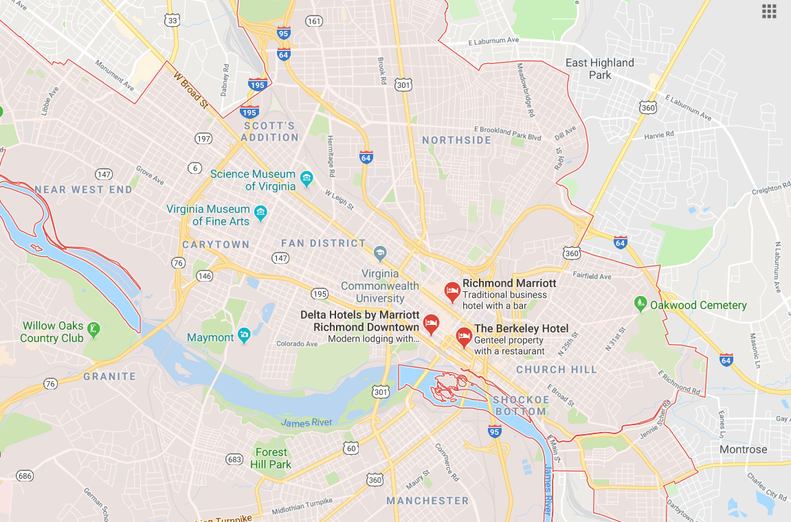
Moreover, Florida is notorious for suburban sprawl in meandering forms, while almost any urban area even within the thirteen colonies has a rectilinear street grid. I think the bigger issue at play here is the time period of major growth in these cities. Like most postwar suburbs, Raleigh’s major expansions happened after the advent of the car, and we never really established a walkable grid beyond a very small area. Compare Raleigh’s urban fabric to Richmond, which experienced most of its growth before the early 20th century, is a smaller city by population, and has a much more expansive, dense, and pedestrian-oriented grid. I still think the structure of our city beyond downtown proper is our biggest challenge.
@elevatoroperator. You are correct in that the PLSS isn’t the only factor encouraging a grid system. Master planning efforts in the original colony states certainly led to grids being established and the Christmas plan for Raleigh’s downtown is a good example. Richmond also has a grid system but it is not aligned N-S-E-W as grid systems in other PLSS states would be inclined to be.
My point was to mention the profound effect the PLSS had on growth patterns on a grand scale.
FWIW Stew, Florida has very little topographical variety onto which a meandering network of roads could be created. Topography is almost never a consideration for most of the state.
I’m good with Raleigh’s core size. I’d rather see more energy go into filling up the core we have instead of focusing on how to expand it. There is still tons of opportunity in our existing core. When the core fills up and expansion is compelled, it will happen.
My #1 focus for DT proper is to prevent suburban type development, regardless of density or grid. I don’t want to see parking lot encircled fast food joints, strip centers, etc.
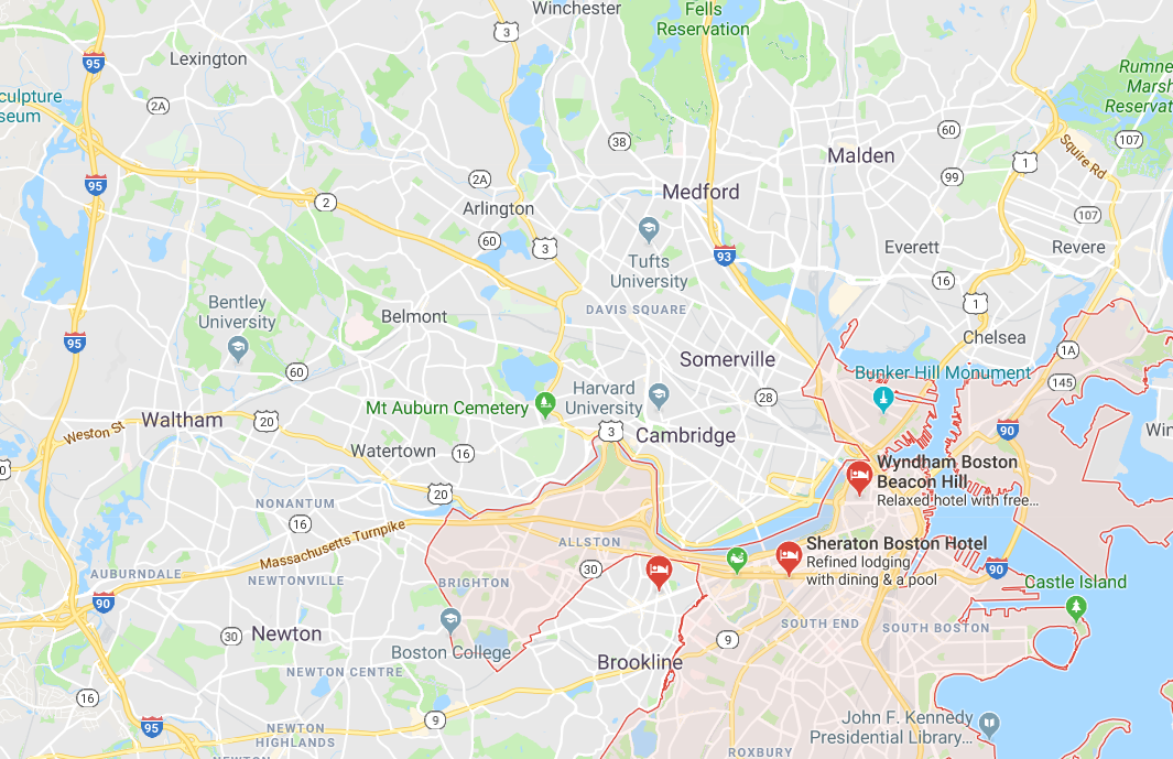
I just got back from a week in Boston. I stayed in the very center of the city while I attended a conference at the convention center adjacent to the Back Bay. Boston is a very good example of a small, compact downtown that Raleigh should use to guide its core’s growth. You don’t have to have a huge footprint to make a big impact.
But really, looking into these two cities to try to compare them has just re-iterated how hard it can be to compare cities with what information is readily available online.
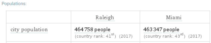
“The City of Raleigh” and “The City of Miami” have nearly identical populations according to 2017 census estimates. However, the city of Miami in total is ~56mi², compared to Raleigh’s ~143mi², leaving the City of Miami much more dense overall. Fairly straightforward!
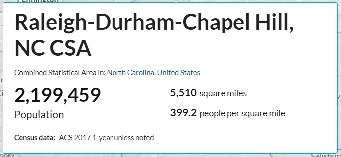
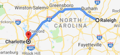
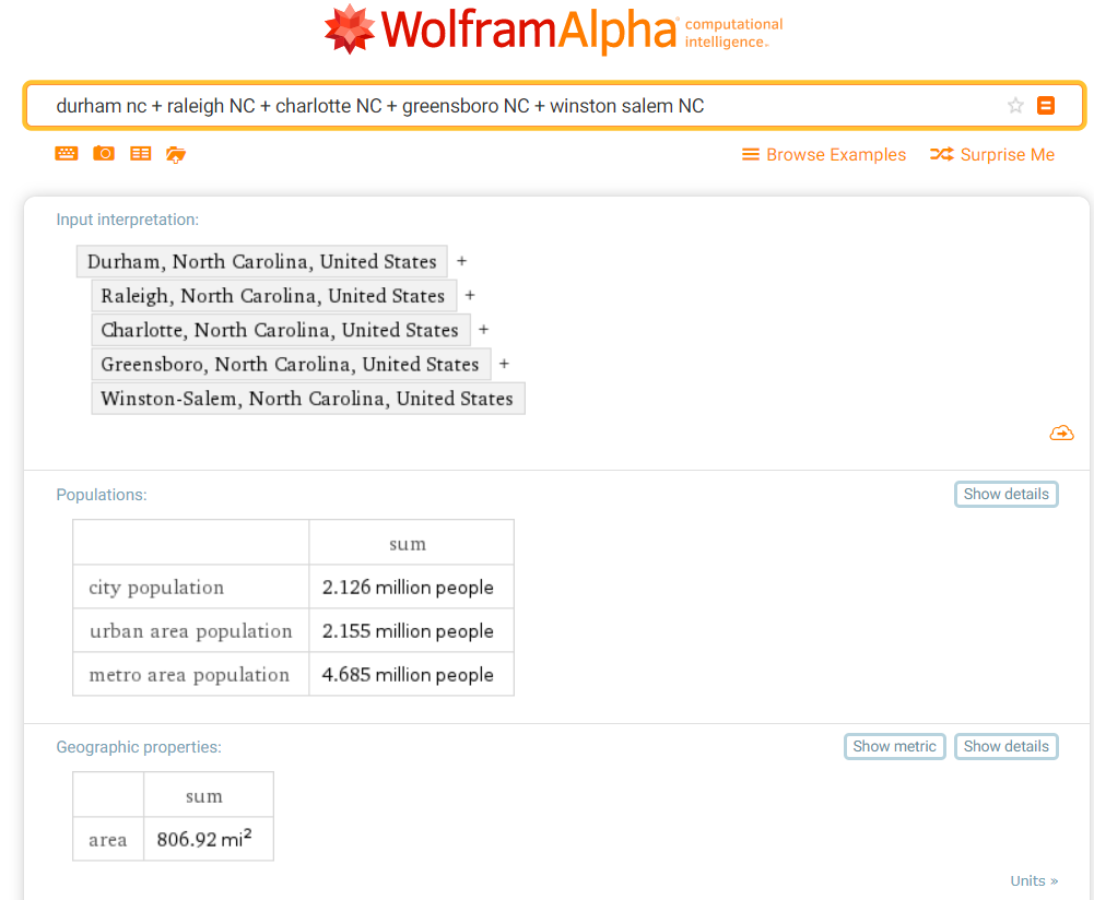
That would be the equivalent of measuring our MSA as being Raleigh + Charlotte + every person within 20 miles of the drive between the two on I-40 and I-85, which would include Durham + Greensboro and maybe even Winston-Salem.
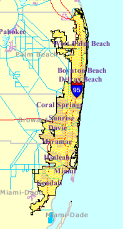
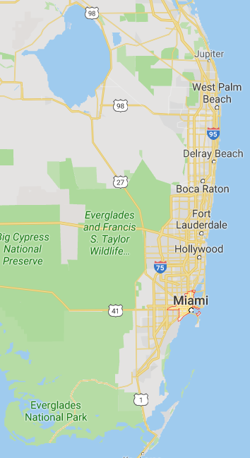
All that said, I do think the greater Miami metro area will have to continue densifying due to a constraint that we don’t have. Geography. They are naturally restricted from sprawling out too much further to their west because of the Everglades.
Having lived in the tri county area of Miami-Dade, Broward, and the Palm beaches, I can assure you, it is basically all one dense mega city that should be under water soon.
Oh yeah, I used to live down there too. The urban area all runs together there in one big corridor, just like it does in Phoenix-Tempe-Mesa-Scottsdale or whatever they’re calling it.
@Mitch, Miami’s actual land area is even smaller at less than 36 square miles.
My point at the outset of this thread is that Raleigh has no excuse to not continue growing. As of the 2018 Census estimates, Miami passed Raleigh in population. Yep, Miami is outgrowing Raleigh in less land area than ITB alone. They are doing it through rapid densification of their urban core, and by expanding that urban core to the north and west and along existing transit corridors.
I want to agree, but this assumes that the economy around us is growing instead of being stable (i.e. staying constant). …and I wonder if that’s something we can safely assume on any level.
Discussions about macroeconomics (both in the US and globally) aside, Miami has a built-in tourism economy as well as a famous Cuban expat community and an … err… entertainment industry. All of these things culturally fuel and enhance the more practical reasons to make their metro area survive and thrive.
The Triangle, though? Sure, we have the universities and RTP, but those don’t guarantee urbanization. We’re definitely growing and covering more area on a map -I’m sure we’ll beat Miami in that regard before long- but I wonder if that’s just false equivalency.
If you only look at the area of a metro area but not its density, you’re basically saying someone’s single farm contributes to what makes a city a city the same way a whole block of apartments do. That doesn’t really square with me…
Miami’s official city limits are comically small. They have almost nothing to do with the effective city limits, which would include Coconut Grove and Coral Gables and Wynwood, among other neighborhoods.
Yeah, I grew up in Kendall and lived several years as an adult in an unincorporated patch between South Miami, Pinecrest, and Coral Gables (because there were quad apartments there that weren’t bougie enough for those places ). Both places had Miami addresses and there were no real distinctions between any of those municipalities besides them carrying certain levels of status.
Miami also has a ton of foreign “investment” that Raleigh will never have. Some of that is because of its geography and link to the import/export industry of various legal and illegal goods.
I haven’t been back there since 2013, but at that time it was hardly a place to aspire to. The areas that weren’t part of the city core (i.e., where most people live) were pretty hellish to get around due to very poor transit, horrible traffic, and tolls. The grid doesn’t work very well when almost everything west of US1 is residential and all those people have to commute east.
Coconut Grove and Wynwood are in the Miami city limits. Coral Gables is a separate city. I don’t know what you mean by effective city limits. In the last couple of decades, MiamiDade county has pushed for incorporation of formerly unincorporated county communities. For example, Doral has only been a city since 2003.
What Miami is doing that Kane and Malik are attempting to do with downtown south in Raleigh is push the urban development beyond its borders. Foreign investors do in fact fuel a lot of development, but if they don’t live in Miami, they aren’t counted as residents. There’s been a huge population push of actual residents in and near the city center, partially as a result of demand, but also a result of supply. Massive developments like Midtown Miami created entirely new districts that didn’t exist before (like Kane’s and Malik’s plan) and people came. It was a “build it and they will come” sort of scenario.
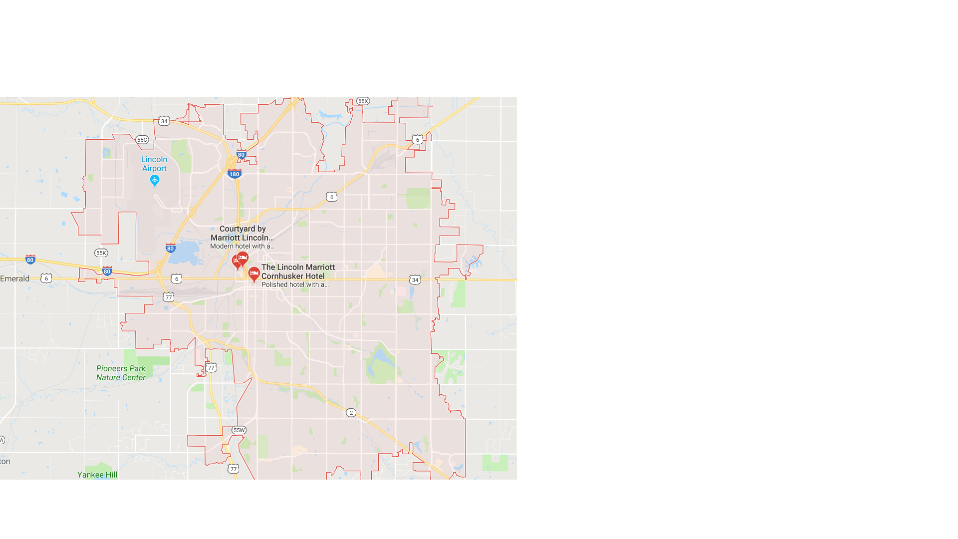
This seems like as good a place as any to put this comment.
^ This is what Google Maps calls downtown Raleigh. I have no clue how they made this determination, but it’s clearly not how the city defines its downtown. Does anyone know the process one can take to get this corrected? Also, has anyone already contacted Google for a similar correction to their maps?
 ). Both places had Miami addresses and there were no real distinctions between any of those municipalities besides them carrying certain levels of status.