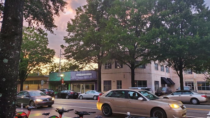
I hope they don’t build this project. Too many beautiful historic buildings with active street level experiences for pedestrians.
In all seriousness, I do love that corner (2-story) building and think it could make a sweet little retail hub with space for a restaurant with an outdoor patio where the corner lot is now, and even a rooftop bar. I wish they would activate it with pop-ups at least until demolition starts (if ever).
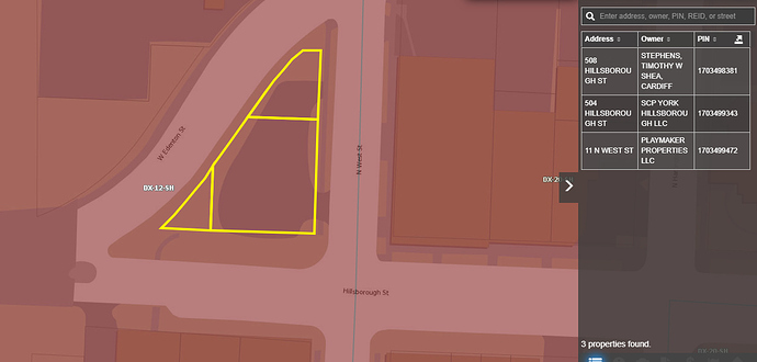
I’m also curious as to how anybody is going to do anything with those three little parcels wrapped by Edenton, West, and Hillsborough once 400H gets rolling. All three are zoned DX-12, but parking structure is the only thing which comes to mind.
I vote NO MORE exclusively-parking-deck-structures in Raleigh haha. If you’re talking about that triangular lot in the middle, there, I hope that just stays green space.
I’ve always hoped a small dog park would go there.
aka Dog-Poop park, with how small this space is that’s about all it’d be used for by the pups 
The total land value is listed at $527,596. I wonder if the odd property shape contributes to no development due to the fact that you would have to pay a lot for a triangular building. The economics of usable floor space might make it not worthwhile. Just a guess.
Larger than most dog parks here in NYC. Seems like a nice idea.
someone will complain about the odor (ref Moloks)
Park with Statue of President Obama.
Ah yes, prominent Raleigh/NC politician Barack Obama.
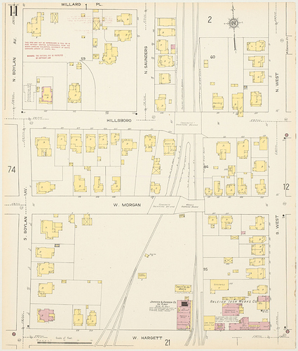
That’s a wonky property to be sure. It runs low on the north side of Hillsborough, then there’s the cut from Edenton. Looking at the 1914 Sanborn map, Block 60 had Edenton terminating at West. And, what occupied it was fairly low-grade housing stock being that close to the tracks.
One could maybe make a square-shaped structure from the York property, but the points aren’t going to be financially viable for the price of the land.
When I went to Exploris, we would use this block for recess. I’ll bet this little area would do well with the smallest bit of landscaping, serving as a green, shady resting spot for workers in the WeWork and 400H buildings and the other surrounding small businesses. Sod the gravel area and throw in a couple of picnic tables and it would be just lovely.
Don’t forget the fountain! ![]()
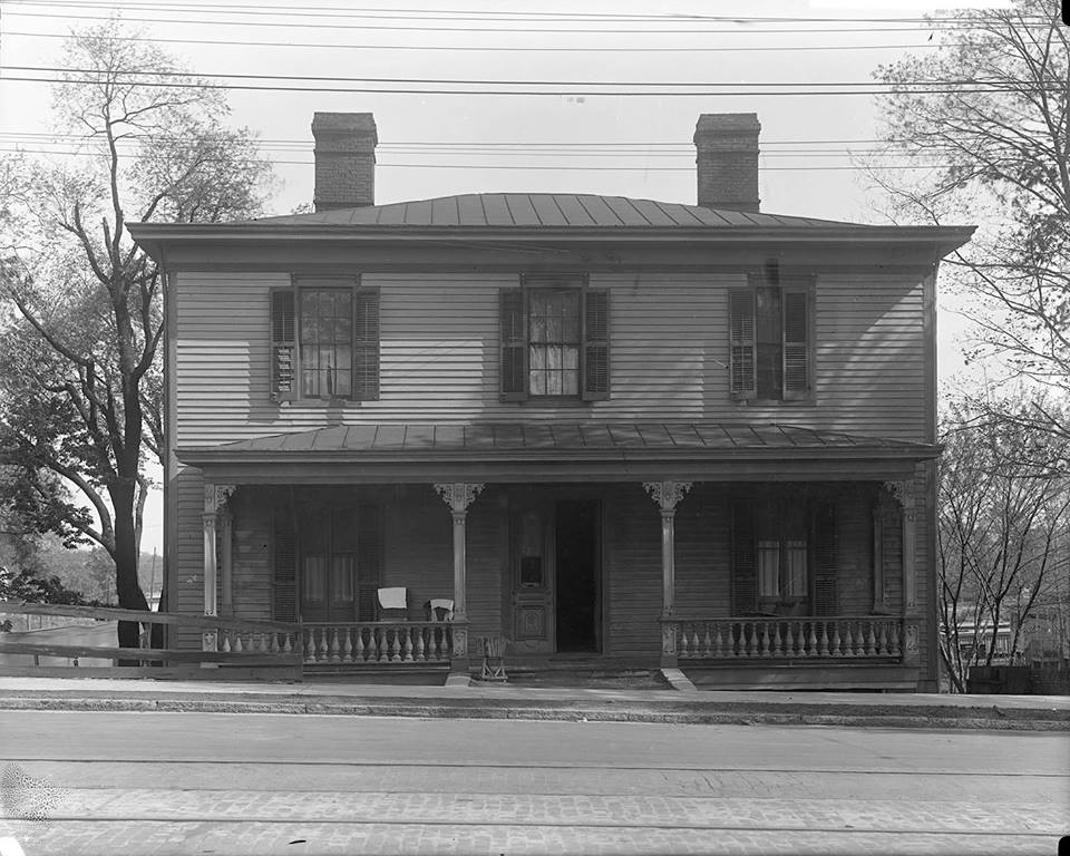
To get deeper look at a block its always helpful to look at Drie’s map too. From the look of the outlines, the 4 houses facing West St were probably post civil war upper middle class Italianate homes. The center parcel (north to south) was a grocery or produce stand. Olde Raleigh has posted a pic of it before. The western most parcel labeled ‘boarding’ in 1914 is probably seen on the Drie map as the middle class Federal style structure. If it is Federal style (can’t be 100% certain from this…just like 95%) it would have been built outside the original city boundaries (some people did this to avoid City taxes) and also would have existed before the railroad was put in. Similar to the original wing of Mordecai house, pretty nice place for central NC in its day. My guess is it became a boarding place partly because it was old by 1871 and also, like you said, it was right next to the rail road, even if above it. Now cut in half, the best use is probably the dog park mentioned earlier.
This is a bigger lot than y’all think. Skyhouse would fit on this lot, for example. (Albeit without its parking deck)
Correct. 514 Hillsborough Street. Olde Raleigh had it as an image challenge that I was able to solve in 12/2017.
Being a western gateway to downtown, the city might consider an eminent domain purchase for green space preservation.
That or, the 400H owners do somewhat the same thing by purchasing the neighboring air space rights to preserve the views for their upper level residents/tenants (and charge premium for the vista).
Ah I missed that one. I was referring to the little market stand just to right at 508/510 though. I can’t seem to find a pic now…maybe you have one handy?


