Looks like the Triangle Bikeway’s preferred alternative is starting to be put together! The Durham-Chapel Hill-Carrboro MPO’s meeting this Wednesday will have a presentation with updates on this project.
(Note: CAMPO is also a stakeholder agency for this project, but it looks like they just stick to verbal updates about this project.)
Click here if you forgot what this is about or you want to see the receipts for this study.
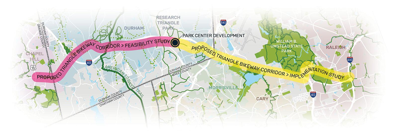
To refresh your memories, this is a study to find out if a bikeway can be built that roughly parallels I-40 between Chapel Hill and Raleigh, and what’s the best way to do that. Think of it like a highway for non-car vehicles.
The corridor is split into two parts: from the 440/Wade Av. interchange to Hub RTP (which was called the Park Center in planning stages), and from the Hub to the Glen Lennox neighborhood in Chapel Hill outside of UNC. The latter is just doing a feasibility study, but the former already went through that and is going through engineering design.
McAdams, the planning consultancy behind this study, looked into what people want from this bikeway (e.g. where they want to go, what features they want), as well as who they were. Overall, lots of responders wanted to go to destinations along the general footprint of I-40, with particular emphasis on UNC, Southpoint Mall, 40-adjacent businesses around RTP, Morrisville, Umstead Park, and Lake Crabtree.


Respondents clearly preferred separated greenways and protected bike lanes over other solutions. This means some project alternatives like mixed-use lanes got axed as engineers came up with potential designs.

The study team seem to be converging this preferred route:
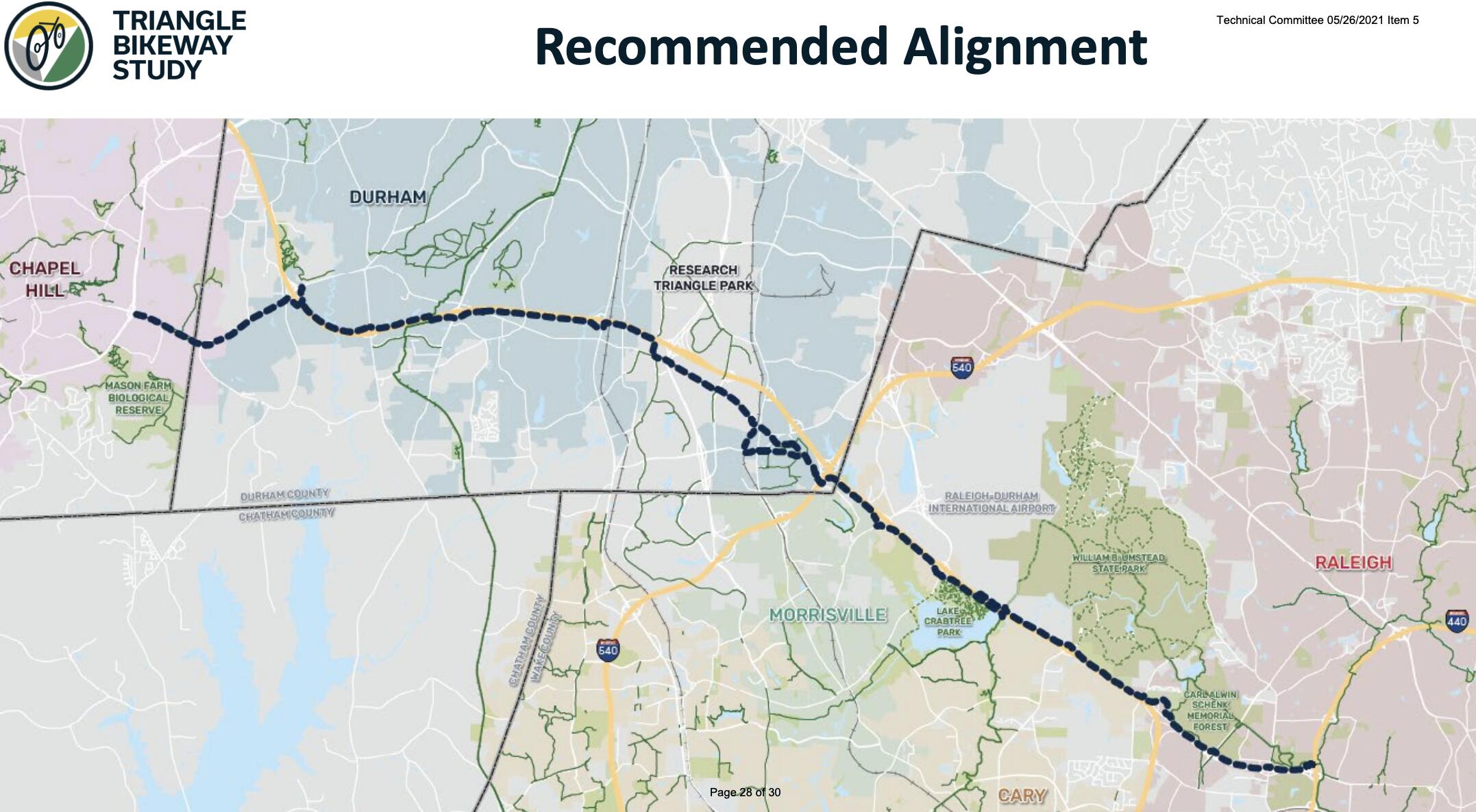
If you're curious about other alternatives, click here.
The design team looked at lots of other alternatives for specific areas (gold), though they didn’t keep them around for several reasons like environmental impact, poor connectivity, and conflicts with other existing/future road projects like the widening of NC54.

It looks like the route east of RTP’s largely a greenway entirely separated from I-40; it will not just be stuffed into the side of NC54 or another local road. Here’s a preview of plan sheets around I-40’s exit at Aviation Pkwy. You can see raised mounds on the edge of the highway’s right-of-way; this is where the greenway could run.

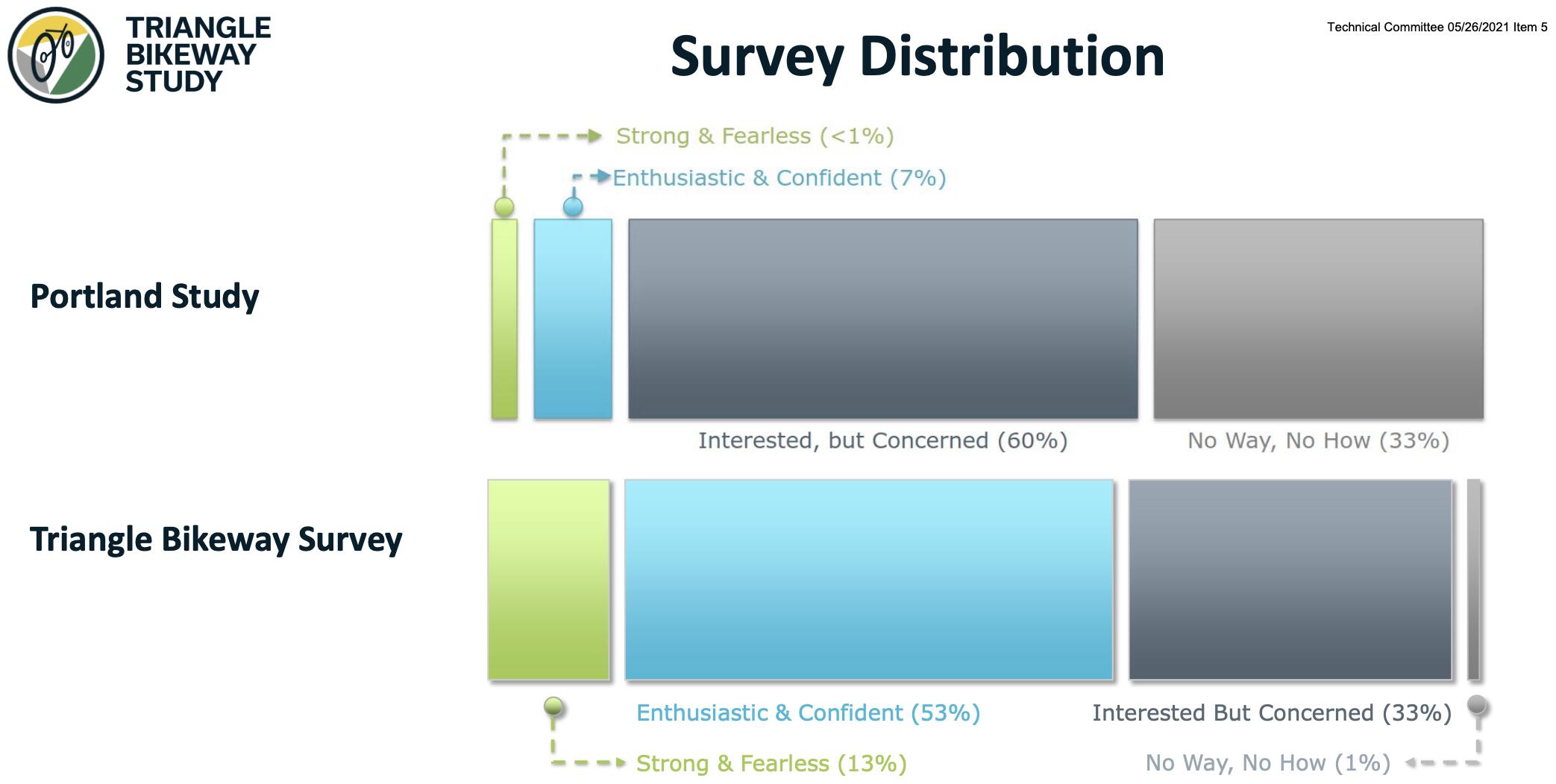
I’d take this study’s conclusions with a grain of salt, though: the study grouped together responders to four categories of cyclists and used the Portland Bike Study as a baseline to see how skewed their survey sample was. If you assume Triangle residents as a whole have the same distributions of attitudes toward cycling as Portland’s, regular cyclists who know what they’re doing are very over-represented in this study while non-cyclists are underrepresented.
Click here for the data.
The distributions of the four categories out of survey respondents looked like this. Notice how half of the Triangle’s survey responders are in the “Strong and Fearless” and “Enthusiastic and Confident” groups (read: people who enjoy and are comfortable with biking regularly) when the Portland study only thinks less than 10% of their populations fit that group.
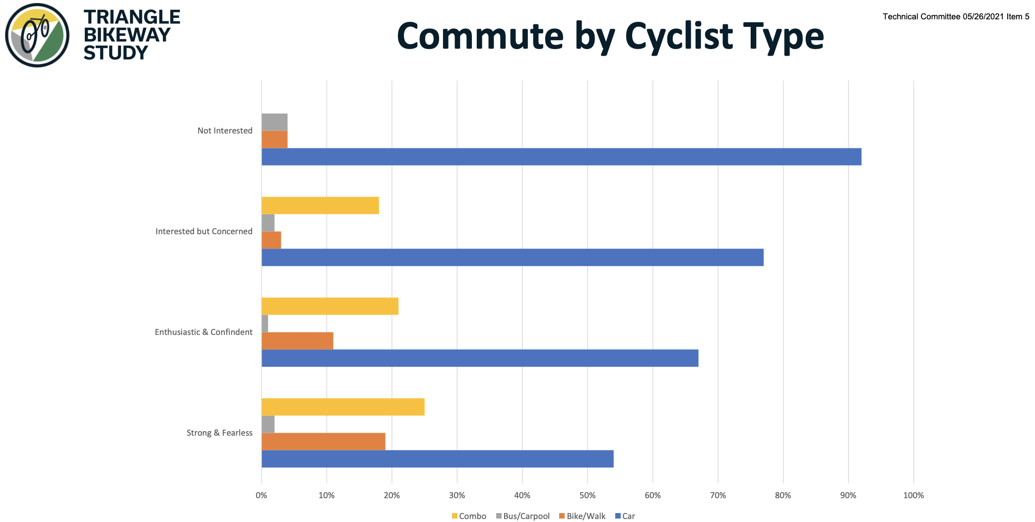
This is how people of each category commute to and from work.
Here’s how often people in each category bike, normalized by category (i.e. the yellow bar on the far right is about 65% of “Not Interested” people, not 65% of all respondents).

Interestingly, respondents from all groups had similar preferences for what engineering features the bikeway should have.

We don’t have pretty renderings for this project, yet, since there’s several aspects that are not yet defined. There’s a survey coming out later this month so the project can learn from you about specific design features like:
- where you’d like to walk (not cycle) along this route
- where you’re most likely to get on/off this trail (i.e. key access points)