For a long time the city has wanted to prioritize blue ridge road. There are some great assets in the area, but it doesn’t feel like a district and certainly isn’t dense or walkable. Would be great if this project can catalyze change for the better.
Also, this will intersect/connect to the Reedy Creek Greenway Trail, so it does tie into existing bike/pedestrian infrastructure.
Agreed. If this area is ever to feel like an important district to the city, it’s going to need some serious creativity and rethinking. As it stands now, the corridor has some large landholding uses that don’t lend itself to any real sort of pedestrian intimacy. From the fairgrounds and vet school on the south to the art museum, hospital and state offices land to the north, it’s quite the conundrum.
The area around Blue Ridge south of NCMA (south of Wade) is totally non-bikeable imo. I’ve had to ride out to the stadium for meetings from time to time, from campus, and there is zip for infrastructure. Best bet is to stay on Beryl Rd as long as possible and cross Hillsborough and ride along the west side of the state fairgrounds. Blue Ridge is a death trap. This is the biggest problem with the current plan, it is definitely a step in the right direction but it doesn’t feed in to any existing bikeable network. Maybe there’s a plan to add bike lanes as part of the Hillsborough/Blue Ridge intersection reconstruction that would ultimately connect to this project at/near Trinity. At present this is just a dead zone for biking. Every step in the right direction is, well, still a step in the right direction, though. That said I consider Hillsborough the BEST road in the area for biking, though not in the Blue Ridge part. But from about Meredith to downtown it’s actually pretty good, and the traffic circles scare drivers so much that they actually look up from their phones/radios/makeup/whatever and notice the other cars and pedestrians, and it really makes me feel better when I can see a drivers eyes, or at least see that their eyes are not looking down at something inside their car. So my personal opinions may not line up with the majority…
Looks like the City has reallocated $500k from the ‘streetscape’ program towards bikeways program aimed at providing more protected bike lanes. Besides the Greenway, do we have any protected bike lanes in the city?
From : WRALJoe Fisher @JoeFisherTV
“At@Saige4Raleigh’s request, #Raleigh City Council reallocates $500,000 from ‘Streetscape’ program to Bikeways program targeted at building more protected bike lanes. This didn’t increase proposed FY20-21 budget that council unanimously approved. #wral#ralpol@RaleighMoves”
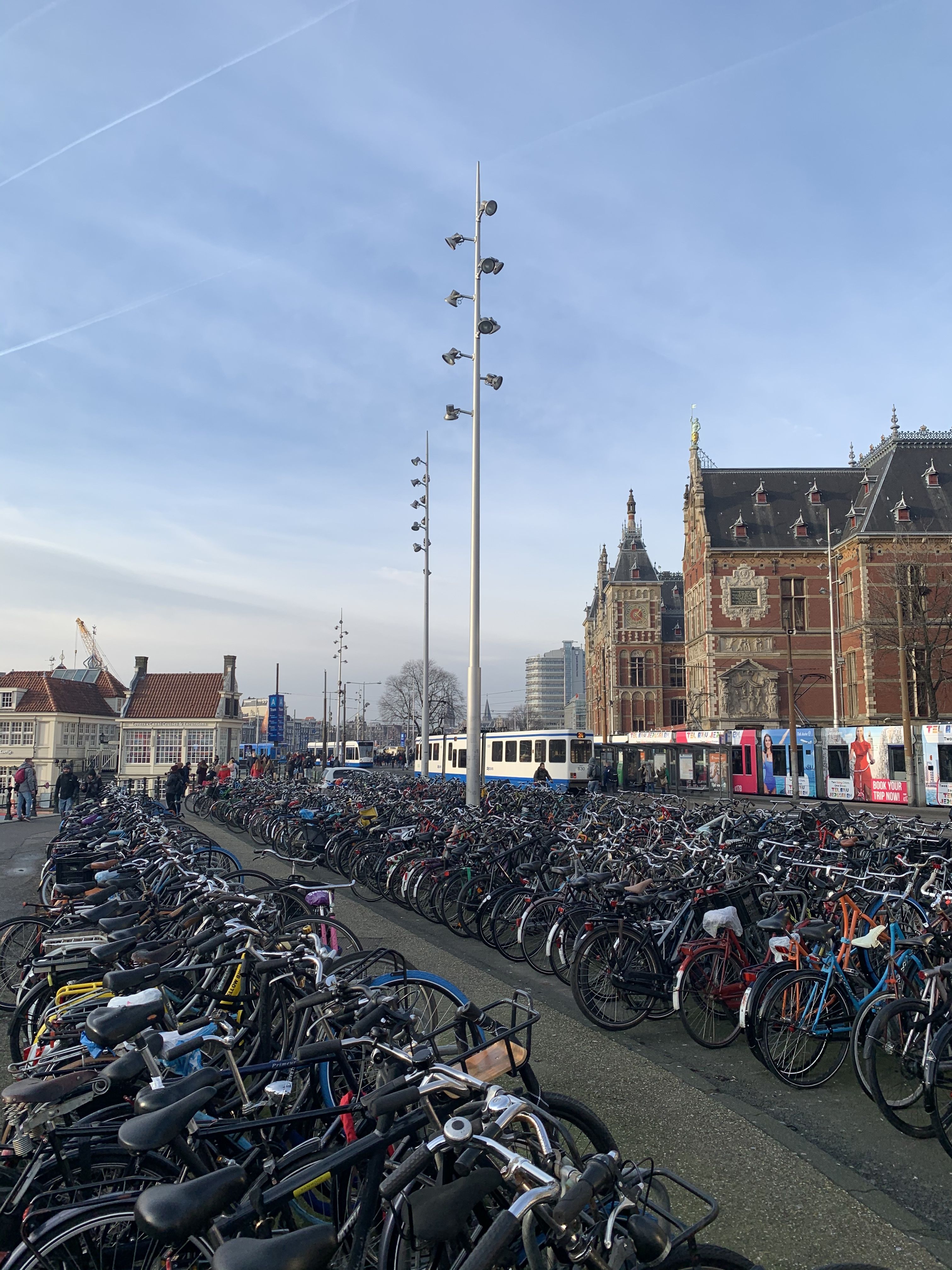
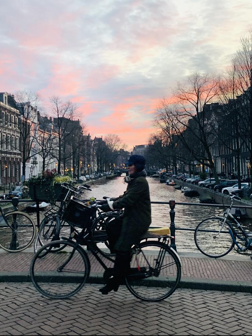
I visited Amsterdam a few months ago, and immediately became addicted to traveling only by bike, granted cars are in the extreme minority. They have taken bike infrastructure to a whole new level with physical barriers and separation from vehicle traffic. But as much as I enjoy two wheels and the freedom bike riding offers on the road, I almost refuse to ride on the street in Raleigh, and only feel safe on the scooters where I can dodge traffic. So hearing we are getting closer to actual protected bike lanes is great news.
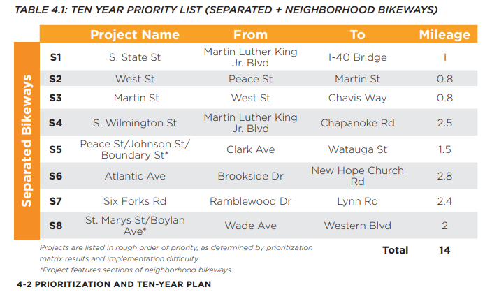
Folks can see the list of priority projects identified in the bike plan here, with the list of protected facilities (having a physical separation from traffic) below.
My ex is Danish and lives in Odense, Denmark. 3rd largest city in Denmark. There’s so many bikes that she doesn’t bother to lock up the bike up when she leaves it by the Odense Banegård Center (main train station in Odense). Imagine leaving your bike unsecure in downtown Raleigh in the morning and it still being there when you come back into the city late at night.
Very excited for the protected bike lanes! My only question is why was State St the first priority? I’m sure there are good reasons, but I would think West and Martin would have way more riders.
Surprisingly lots of cyclists use State St. to get to and from the Walnut Creek Trail, there’s also plenty of asphalt to work with. I’m sure there are financial and economic reasons I’m unaware of, but in terms of usage, there’s more riders than you’d imagine. Here’s an picture of part of the street south of MLK.
@RaleighBikeLady Do you know roughly the time frame on State st sections?
The fact that its not a priority is why they are starting with State St. They are starting there because its an easy way to say they did something. Its rather insulting and a waste of money.
Somewhat yea, Little Rock Trail winds through the woods behind the homes to the right of the picture I posted, then before Bragg it turns West towards Garner Rd. then up towards Chavis Park.
I’m not completely sure of the end game with this first proposal, but I envisioned (pie in the sky I know) riding a bike unaffected from my house to an event at Downtown South (if that ever happens).
So theyre doing a little something that’s really nothing to look like something so they can do nothing? Hmmmmmm. Look, they pulled $500k for bikes and that’s $500k more than any previous budget. Also State Street puts it in southeast raleigh whinch can use the investment and can provide an alternative transportation route for some lower income people and provides a north south route to Walnut Creek trails. I think this council wants to improve bike infrastructure profoundly so I’d expect more to come.
I don’t know. Sounds like government in action to me.
We need protected bike lanes on streets where it is otherwise dangerous to ride not a transportation route for poor people on a wide low volume street. I’m perfectly fine with bike lanes on State St but why start there? And we’ll see how profoundly they improve bike infrastructure. I’d hardly call 14 miles in 10 years ambitious.
You’ll notice the asterisk at the bottom of the graphic where it says “projects listed in rough order of priority as determined by prioritization matrix results and implementation difficulty.” I wonder which factors are most heavily weighted in there little matrix.
West / Harrington (N/S Connector) will most likely be the 1st installation. There has been a 4+ year public engagement process for that project and council took action to proceed forward with that yesterday.
State St is being worked on concurrently w/ West / Harrington St install. Staff are doing public outreach and engagement right now. This neighborhood had also asked for traffic calming and has virtually no bike facilities. The protected portion of this would go down toward the neighborhoods south of I-40 to connect folks into the greenway system.
I dunno. I’d think that providing transportation routes for poor people who have few alternative transport options is worth being prioritized. Especially while in a pandemic where riding mass transit is not advised. Many more people are riding bikes now than they were four months ago.
What qualifies a bike lane for separation from traffic? Noticed there are no plans to separate Blount / Person bike lanes, which leaves East downtown with no protected lanes going North/South.
You actually just missed the survey where the city was seeking feedback on Blount / Person for Phase II (closed yesterday). I have asked staff if we can consider additional outreach beyond the survey like an online meeting where folks can ask interactive questions, etc (they did get over 200 responses to the survey, too). Please reference this page for additional information on that project: Blount Street - Person Street Corridor Improvement Project | Raleighnc.gov
A few things. Yes, absolutely, it is vital that Phase II of this project includes protected lanes on either Blount or Person Street. I did notice this was one of the options on the survey, so I do think the city is aware there is a desire for that. Oaks and Spokes has also been advocating for that and is a good org to plug in with if you’d like to stay up to date on advocacy opportunities around biking in Raleigh. Reuben Moore is the (fantastic) lead Project Manager for this corridor and is very receptive to feedback. I encourage you to reach out to him directly to provide input if you’ve missed the survey.