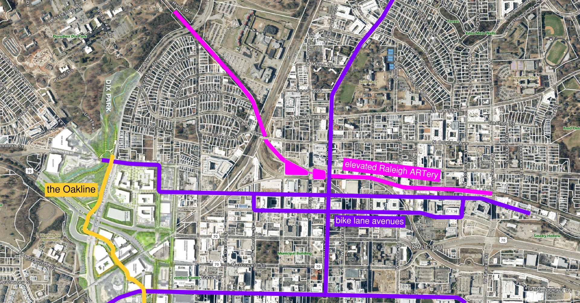
Can’t all folks from downtown make their way to that same underpass chokepoint and not build that strollyway at all?
Also, doesn’t the Rocky Branch Trail already provide access coming from the east and Southside of downtown, passing by that very same underpass?
It’s nice to connect these two destinations but ignoring where people actually live doesn’t sound like a good plan if you want it to be used.
South Boylan is a huge pedestrian collector street for west side downtowners who want to walk to Dix, and all of the folks coming down Boylan either have to make their walk substantially longer by diverting east or west to access Dix without crossing at grade. A crossing at Pullen doesn’t help either because it’s too far west.
If this gets built as designed, many folks on the west side (and there are lots of folks across the west side of downtown) will just continue to cross Western at grade at the light by Central Prison, and then make their way into Dix without a sidewalk, but at least we’ll have a pretty strollway for our marketing.
Even when I ask google maps to give me walking directions from general Glenwood South to the intersection of Umstead & Blair in the middle of Dix Park, it tells me to follow the path down Boylan to Cabarrus, to the footpath under the rail line to the corner of Hunt and Western and cross at grade to the other side. This is the general path that needs to be enabled if we want the vast majority of folks who live in the most densely populated part of the city to walk. That’s why I suggest a stub over Western to this strollyway if we want its use to be maximized.
If anyone wants to see this pedestrian migration in action, go to Dix for the fourth and watch how thousands of people get home by foot to the west side of downtown after the fireworks.
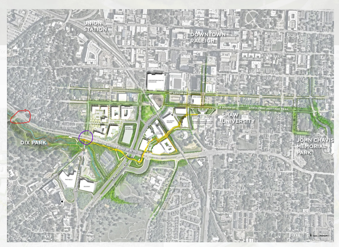
I mean it looks like the goal was to connect to the CBD and the density that was close but not connected. I misunderstood that you were looking to expand the scope to the red circle instead of just using the purple circle as sufficient. Seems like the red circle intersection could be a separate issue to address rather than trying to shoehorn this amazing idea beyond the scope.
Also, if it happens, I’d be interested to see if the S. Saunders to West St tunnel (then to the “Artery”??) actually solves the problem you raise.
I went back and edited my previously reply because I wasn’t clear. Yes. The red circle is what needs to be fixed if we want to enable crossing Western without crossing it at grade for the vast majority of folks who live in the highly populated west side of downtown. It’s the shortest walking distance between places directly connected to Boylan and Glenwood and the core of Dix Park.
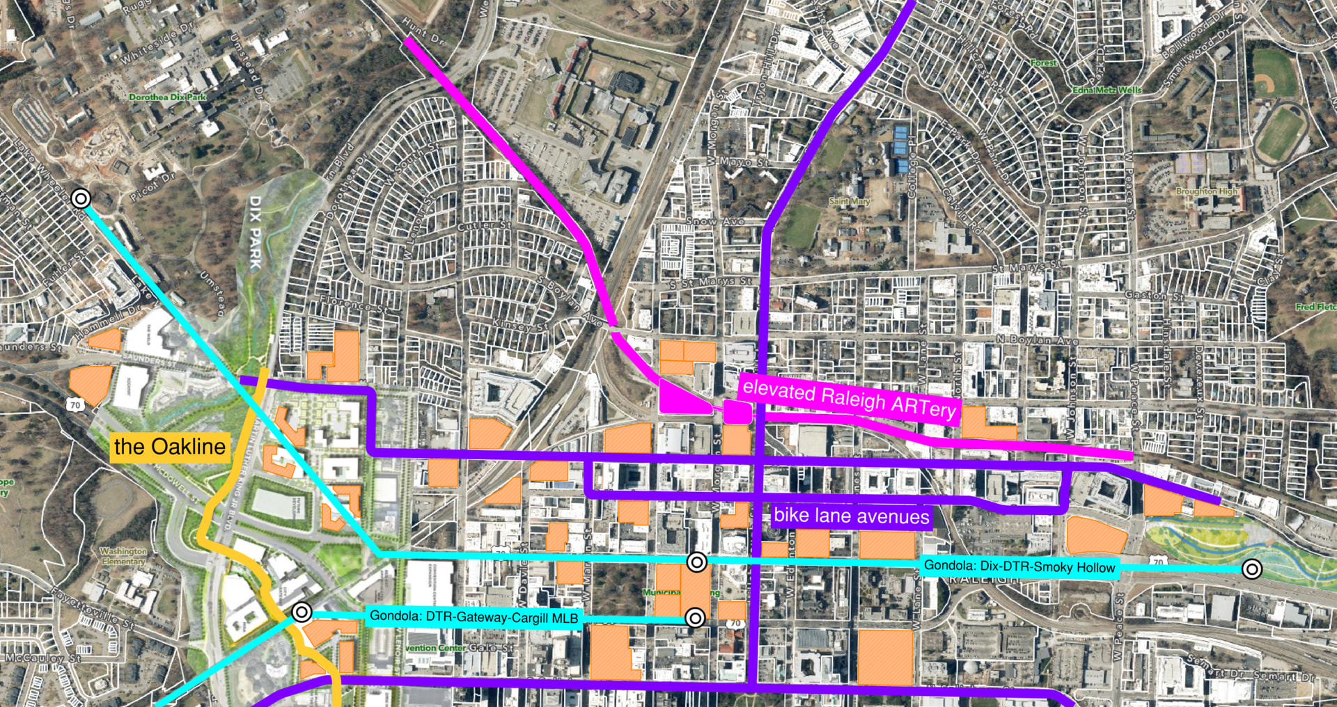
To be fair, to me anyway, it looks like there is/are several recent and proposed residential projects along this very route between Dix and Memorial Auditorium. Do you think all those folks at the two (maybe a 3rd at some point) Weld buildings and whatever they are calling the Kane development (Rockaway??) would use this to get into the south end of DTR (Memorial Auditorium, Red Hat 2.0, Convention Center, City Plaza, etc.)? Also, what about the (kinda sorta dead for now, but maybe revived in the future) Salisbury Square residential and hotel buildings and Mira (etc) folks to get over to Dix? Plus two (soon to be three with the Omni) large hotels at the south end of DTR to get visitors over to Dix Park… I think the demand is plenty there already. I wish we could just build something rather than study and value engineer and cover every proposal with red tape. AND, I bet this connection would only be a catalyst to even more development along that corridor (just look at the Beltline in Atlanta).
Raleigh has SOOO much potential, but at some point the bottleneck between funding and “planning” has to break lose and let the City continue to mature into a more dense and interesting place to live.
Maybe it’s not definitely shelved but I only meant that it’s the most expensive alternative and it may get downgraded to a bridge. I’ll take that apology whenever you’re ready
This is why I said that there better be a lot of development along this strollyway to activate it (at least), but if we are going to do it, why not think about it some more to make it more robust and solve even more pedestrian issues with some simple modifications?
@mike Yes, if the West St connector under the tracks was completed, it would definitely help in so many ways, as I am sure @SVP could confirm. Right now there’s no N/S corridor between Boylan and Dawson that fully connects the north and south sides of the west side.
As is stands, there’d be a lot left on the table by not thinking about the highly populated west side if we want to get more folks on their feet or on their bikes.
The land bridge has been postponed due to the pending Western BRT project. The original design would not be compatible with the proposed center running BRT lanes on Western Blvd. It may or may not be built before the BRT project. My best guess is that it will be built afterward at this point.
I hope that if it is built, the street frontage along Ashe Ave at Pullen Park is renovated. I feel like it’d be a waste for people crossing this beautiful land bridge to be dumped into a suburban-style parking lot just to get to the park.
Technically one can get from the two parks without grade crossing Western, and that’s at the Pullen overpass. I know because I’ve done it many times. IMO as both a big walker and a west side downtown resident, an overpass path is needed closer to downtown first and to the east of Central Prison.
Makes sense, but it pushes any hope of a land bridge out by decades unfortunately.
In the meantime the Pullen Bridge Overpass needs to be prioritized as part of the BRT project as well, which is also some years out from completion. The traffic situation on that bridge is becoming an absolute nightmare and it’s an awful crossing for pedestrians. It’s actually much easier and safer cross the light at Boylan than to use the Pullen Overpass. The entire Western Blvd crossing between Pullen and Central Prison is essentially a game of frogger for pedestrians.