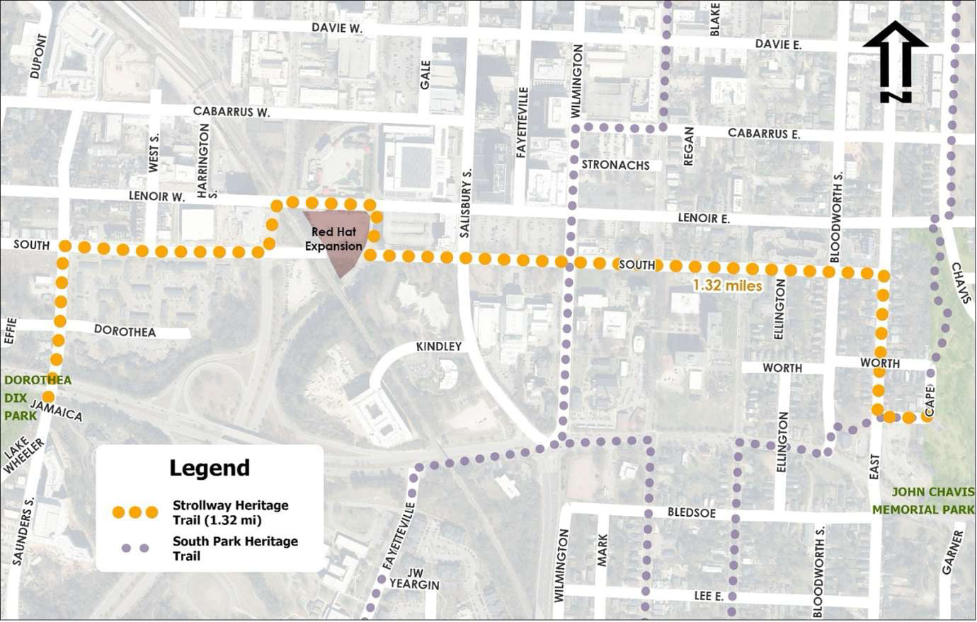
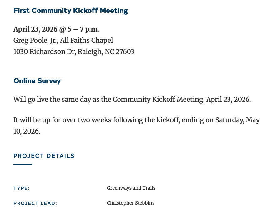
First community kickoff meeting scheduled for tomorrow for the Chavis-Dix Strollway.
13 Likes
When did they move it from Lenoir St. to South St.?
Edit: At first I thought it was to take advantage of the portion of South Street that will now be closed to vehicular traffic due to the new Red Hat Amphitheater, but I see it actually has to route around that, so I’m not really sure. Maybe b/c it goes by the Performing Arts Center and its new plaza.
3 Likes
I’m gonna attend to ask they make sure it is car friendly. Much easier for me to drive on it than walk.
7 Likes
I think there could have been a great opportunity for a pedestrian bridge near Redhat to navigate over/through this area. Would have been a nice feature for the city and added in a fun design element. Unlikely to happen as @GucciLittlePig wouldn’t be able to drive across.
2 Likes
more pedestrian bridges everywhere, IMO
8 Likes
Too bad that they are both logistically challenging and expensive. In today’s world, there’s too much resistance to spending money to have nice things.
1 Like
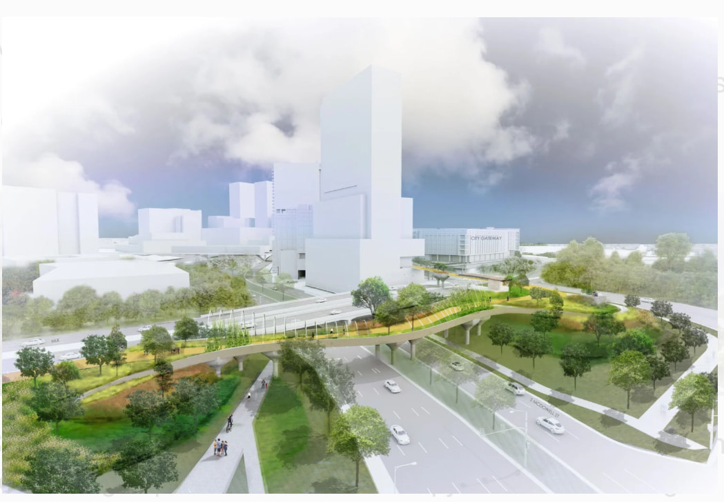
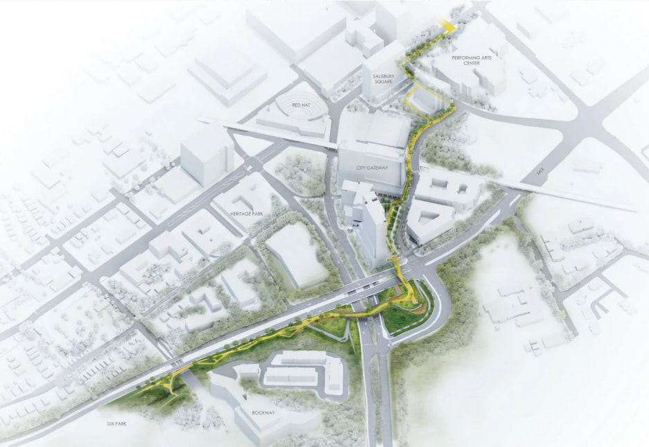
I came across this proposal recently and wanted to share it because I thought it was exceptionally well done.
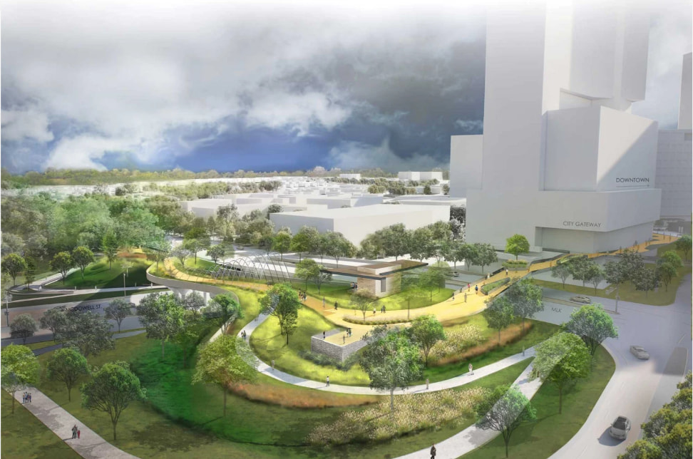
A team consisting of Surface 678, SfL+a, and Preston Montague recently earned 1st place in the Wake County Community Design Challenge with a concept called The Oakline.
The proposal envisions a tree-lined pedestrian and bicycle promenade connecting Dorothea Dix Park to Downtown Raleigh, stretching from The Grove at Dix Park to Lichtin Plaza at the Martin Marietta Center for the Performing Arts.
What stood out to me is that this isn’t just another greenway concept. It’s designed to create a safe, accessible, and inviting connection between two of Raleigh’s biggest destinations while strengthening neighborhoods, supporting local businesses, and creating a signature public space for the city.
The project won the juried competition and will be presented at the 2026 Greater Raleigh Chamber Growth & Development Summit.
Whether or not this exact proposal is ever built, I think it’s a compelling vision for how Raleigh can become a more connected and walkable city.
29 Likes
I love it! Let’s make it happen!
2 Likes
20 Likes
If the city ever built this strollway, they better treat it as infrastructure and stack its path with more housing, hotel rooms, etc. so that it gets highly used. It would be a shame for it to be built and not maximized.
13 Likes
That is a cool looking project. It appears to be heavily inspired by New York’s High Line, which was a great idea and has inspired a lot of neat projects around the country and world.
I wonder if this Oakline would be more or less expensive to actually build than the gondolas? Either way, Raleigh really needs to build some kind of good connection between Dix and Downtown Raleigh b/c right now they are pretty separated despite being relatively close together. I really like the idea of the connection being an attraction itself, not just a connection.
I have often thought Raleigh needs better connections. IMO the city has a pretty solid collection of attractions in and around Downtown (see list below), but in general everything feels divided and it isn’t a great place to walk/explore.
- Parks: Pullen, Dix, Nash Square, Moore Square, and Chavis.
- Museums: NC Museum of Natural Sciences, NC Museum of History (which I think is going to be awesome when it reopens), and Marbles Kids Museum. Hopefully CAM will reopen at some point.
- History/government attractions: the Capitol Building, Freedom Park, the Executive Mansion, and the Legislative Building.
- Nightlife and cool neighborhoods: Glenwood South and the Warehouse District
- City Market should be a major attraction, but it is so underutilized.
19 Likes
One more suggestion for this strollyway: it needs to have a connection/branch to the highly populated west side of downtown so that folks don’t have to cross Western at grade. As it’s designed, it does nothing for anyone who is west of Salisbury.
3 Likes
What about the shadows from the gondola?

4 Likes
Don’t they currently cross under Western at S. Saunders? Seems like that satisfies the concern? And the West St tunnel would add to the walkshed for this path.
Tbf isn’t Dix already in planning for the bridge crossing western to Pullen? Assuming that it’s just the pedestrian bridge and the land bridge has been shelved
1 Like
First identified in 2015 Downtown master plan
Strollway idea crystalized in 2020 Dix Park master plan
3M in Federal funding received in 2022.
“Concept of plan” to be done by 2026
Non-committal ‘Design, bidding and construction to follow’
Doesn’t seem like there is even funding for this project at this stage which is really disappointing as I think it’s very cool and important. Even if it gets built you are talking about 15-20 years from when it was first proposed, and ~10 years from when funding was first received to complete what is essentially a nice sidewalk for 1.3 miles. It is a disease how long it takes and how much it costs to build things in America.
6 Likes
For reference - China has built more high speed rail than exists in the entirety of the EU since Raleigh received their funding for this project.
4 Likes
Why would you assume the land bridge has been shelved? Everything from the Dix 10 year implementation plan is on schedule and has been executed with high quality. The land bridge to Pullen is a carbon copy of land bridges at Gathering Place in Oklahoma. They can do it, so can we, and the Conservancy has given us no reason to think they’d fumble this. Lazy pessimism.
7 Likes