Plus, with @nicholas’s suggestion, BRT vehicles in the Western Blvd. line would need a ton of space to snake through rectangular city blocks. That’s dangerous for everyone involved, too, and it also makes signal timing a nightmare. I’m almost 100% sure this is what the second slide in @NoRaAintAllBad’s post meant by “works better for future BRT station”.
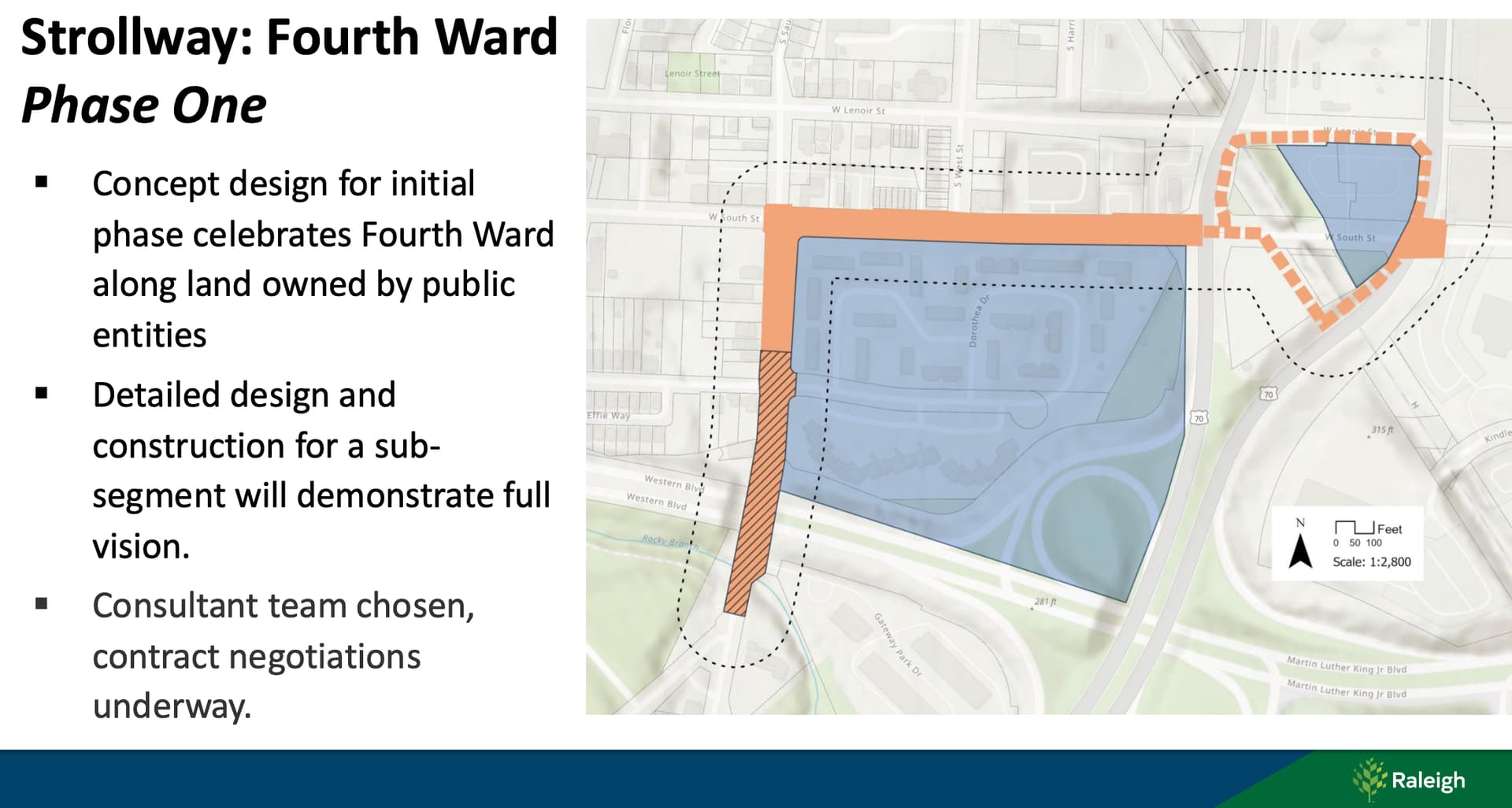
EDIT: the original post comes from this slide deck that gave general updates on major downtown public works projects. It also included this update on the Chavis-Dix strollway:
My memory is slightly fuzzy but I think that was the plan all along. Every time they’ve closed one affordable housing place for renovation or replacement, the people are bumped to top of lists for new ones.
Looking at the plans posted above, there is some sort of curb cut/entrance (two of them actually) planned right about where I extended Kindley St to. On the Dawson St side there is an intersection planned about halfway around the curve which makes me believe the grade can be mitigated to a somewhat reasonable extent at least on that side.
I’m of the opinion that bridges are generally terrible for urban environments, aside from separating tracks from roads/sidewalks. However, I think it will be extremely difficult to make that stretch of Dawson/McDowell bike/ped friendly given the existing design. I guess I don’t really understand the sentiment that what is planned will be an improvement over what’s currently there…if the goal is to better connect that interchange and generally extend the urban fabric down Dawson/McDowell, then the MLK bridges should just be removed so that it can be turned into a regular intersection, and additional connecting streets need to be built between South St and MLK. Bike and pedestrian traffic should ideally be encouraged to follow South St to S Saunders St unless Dawson/McDowell sees an unprecedented road diet with separated sidewalks and bike lanes.
Dawson is maybe possible but there’s likely issues like BRT alluded to above or utility relocations as mentioned in the slide. Read: we could do it but it would be 2x more expensive and then it wouldn’t get done.
On McDowell those curb cuts are for the development planned on that side that would literally terrace parking garages into the western side of the block with vehicular ingress/egress to McDowell because the grade is so difficult. Which is another reason it can’t connect straight across to Kindley.
I don’t want to be dismissive but you’re doing this right now:
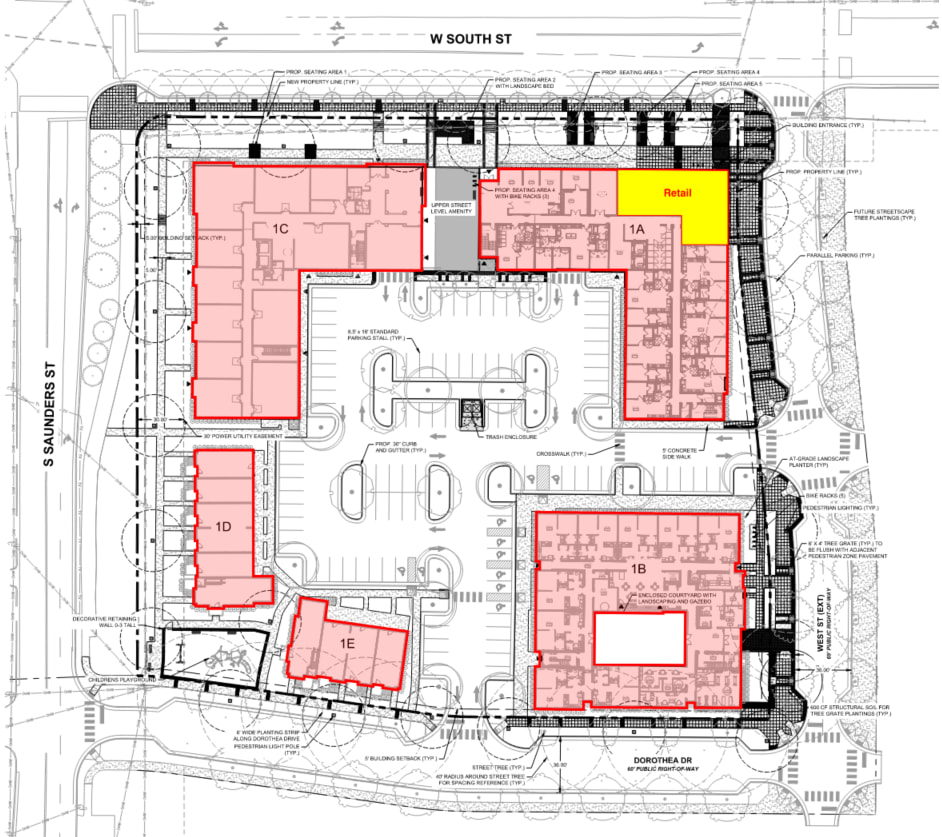
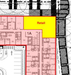
It never ceases to amaze me how the city keeps providing suburban style development in our core while approving higher density for market rate housing. This site plan could be anywhere in the city without anyone blinking an eye. Four floors? Surface lot parking? Are they kidding? Is that square building in the bottom right at least a taller tower?
One would think that the city would be looking to get the most value out of the land by building more units. It’s not like more units aren’t needed. Don’t we have a housing affordability crisis? If they didn’t want to go big, why didn’t they sell the property and make “bank” to buy more land elsewhere and build more of these suburban-dense units?
The presumption that the surface lot is more accessible is bunch of hooey. Why would that matter here and not everywhere?
They should’ve just done a building around a parking deck in this whole block then similar to the Moore Square East Phase 1 affordable housing. Why is that one more dense than here?
The city has a history of developing public housing less densely and/or more car oriented than that of nearby private development downtown. It happened at Capitol Park. It happened at Chavis Heights & Walnut Terrace, and it’s happening again here at Heritage Park. Am I wrong about this?