That would have been impressive to fly from Salt Lake City to Raleigh. 
1 Like
Everything is possible with magic underwear.
3 Likes
@OakCityDylan, are you still taking requests? An update to this view would be awesome with all the Smoky Hollow, Capital Blvd, Bloc 83 progress, plus other cranes and such.
1 Like
Apple Maps updated their satellite imagery to around last fall with smoky hollow progress and clearing for 301H.
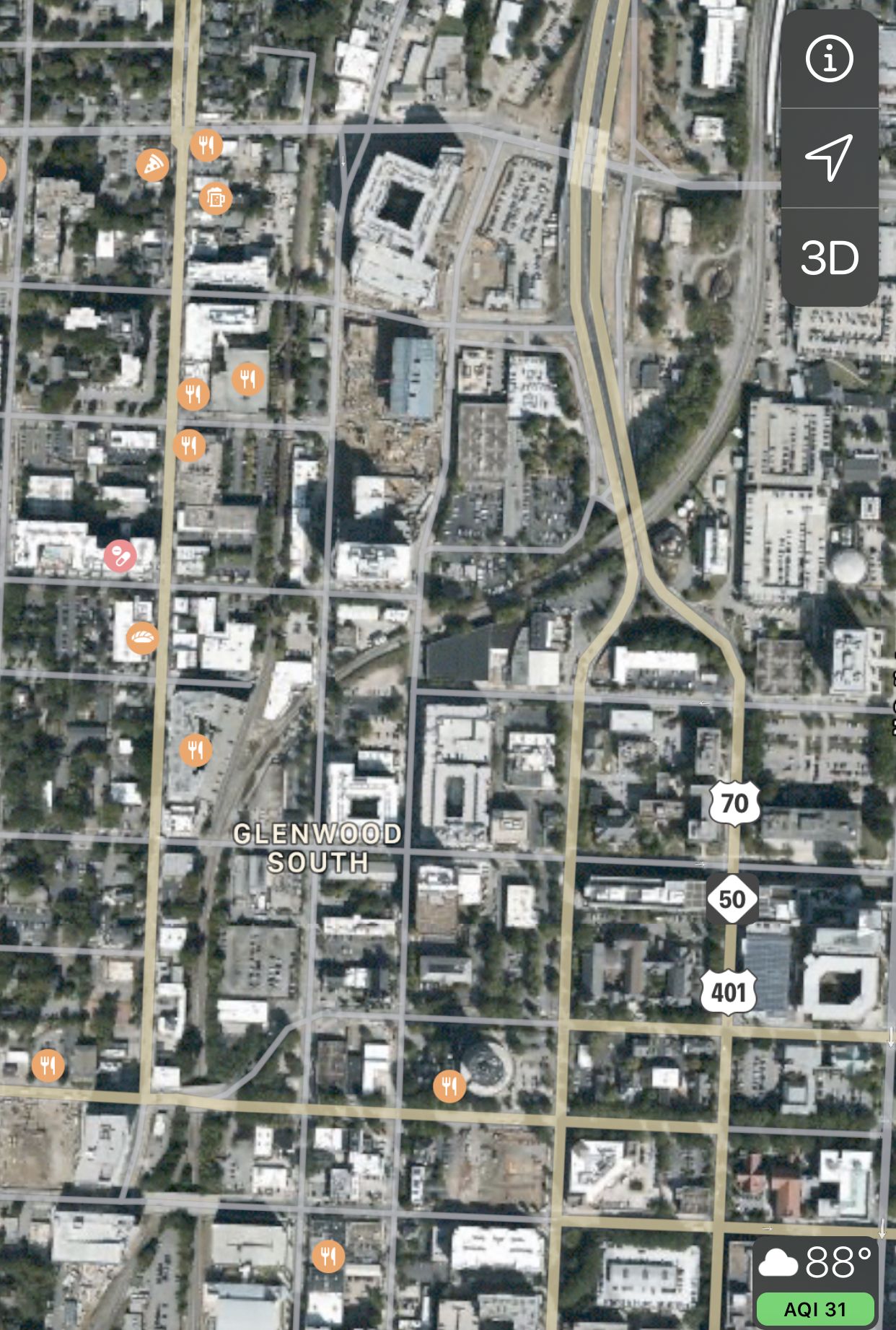
7 Likes
I bookmarked your request and hopefully I can get to it before we leave town later this month. I agree it should look great with the new construction!
3 Likes
Would be cool to see some occasional aerial shots of construction progress on 540 as they’re clearing land now and building bridges. Not as sexy as a high rise, but a very important development for Raleigh.
Cary town center transformation starts very soon, that’d be neat to see progress drone pics too.
Thx
9 Likes
I’d have to like get in the car and drive places. LOL!
Great idea though! I’ll see what I can do. Sounds like I need to set up a schedule and maybe a few points. Can you help with a few points of interest along the 540 construction? I’m guessing intersections like Bells Lake Rd, etc.
7 Likes
You’re like me; you only want to drive long distances to places afar, but don’t want to drive when you’re staying put!
1 Like
Thanks for considering 540… I’m a road nerd sometimes, So I’m kind of interested in how they’re building some of the interchanges like at 40/70, 401, and the starting point in Holly Springs…the maps are all online, and they have a Google Earth overlay You can install, The intersection at 40 and 70 is massive, wouldn’t be surprised if it’s the largest interstate interchange in the state once it’s built.
For that matter it would be kind of cool to see the 440 reconstruction at the major intersections from 40 to blue ridge to wade avenue… I mean if you’re going to be in your car anyway lol.
Thx!
4 Likes
Cooler yet, would be to see DTR from one of the massive flyovers that will be 540, 70, & 40 near the 42 intersection of Cleveland School rd! 
3 Likes
It is insane. Like Texas interchange big. When I drive by there I wonder all the cash that is spent on it. maybe one day we can get the commuter rail built instead of more highway lanes.
7 Likes
When the final alignment was released I recall an article stating that it would take up ~650 acres.
I’m still so confused as to what exactly the whole Wade Ave and 440 thing is supposed to look like once finished. I drive through that mess 3 or 4 times a week. I just hope it’s done soon, but right now it’s a conundrum.
1 Like
3 Likes
NC540 at I40 at 70 Interchange is at 4:33
")
8 Likes
4 Likes
I wonder if that greater interchange will feel as a big as it looks in that animated aerial? It might just feel like a series of overpasses, unless one or more of them are particularly tall.
What’s interesting to me about 540’s crossing of 40 at both ends is that that they are basically both at the county line.
3 Likes
Watching the flyover that was my impression @John. NCDOT always gone for using a ton of land to make major interchanges large and flat as opposed to stacked. I can’t think of anything in NC comparable to stay the I85-Perimeter interchange in Atlanta.
2 Likes
I 540 at I 40 just past RDU is right at the county line also (Just barely in Durham County).
1 Like
I know that. That’s why I made the comment.
Watching that video makes it really easy to see where Wake is going to put hundreds of thousands of new residents. It’s getting really easy to imagine Fuquay and Holly Springs nearing 100,000 each.
3 Likes