I was secretly laughing when Kate asked Dix community meeting first-timers to raise their hands. It was almost like she was asking the people who wanted complain at the end of the process to publicly identify themselves to those who have been actively involved.
@OakCityDylan Everything that I’ve heard from the city to Kane reps is that the “under” option is the plan for West St.
They are also showing Cabarrus street still open which supposedly isn’t happening with the tunnel. That would be steep a## bridge if you were going to have it tie into Cabarrus…it’d be like a ride at the fair.
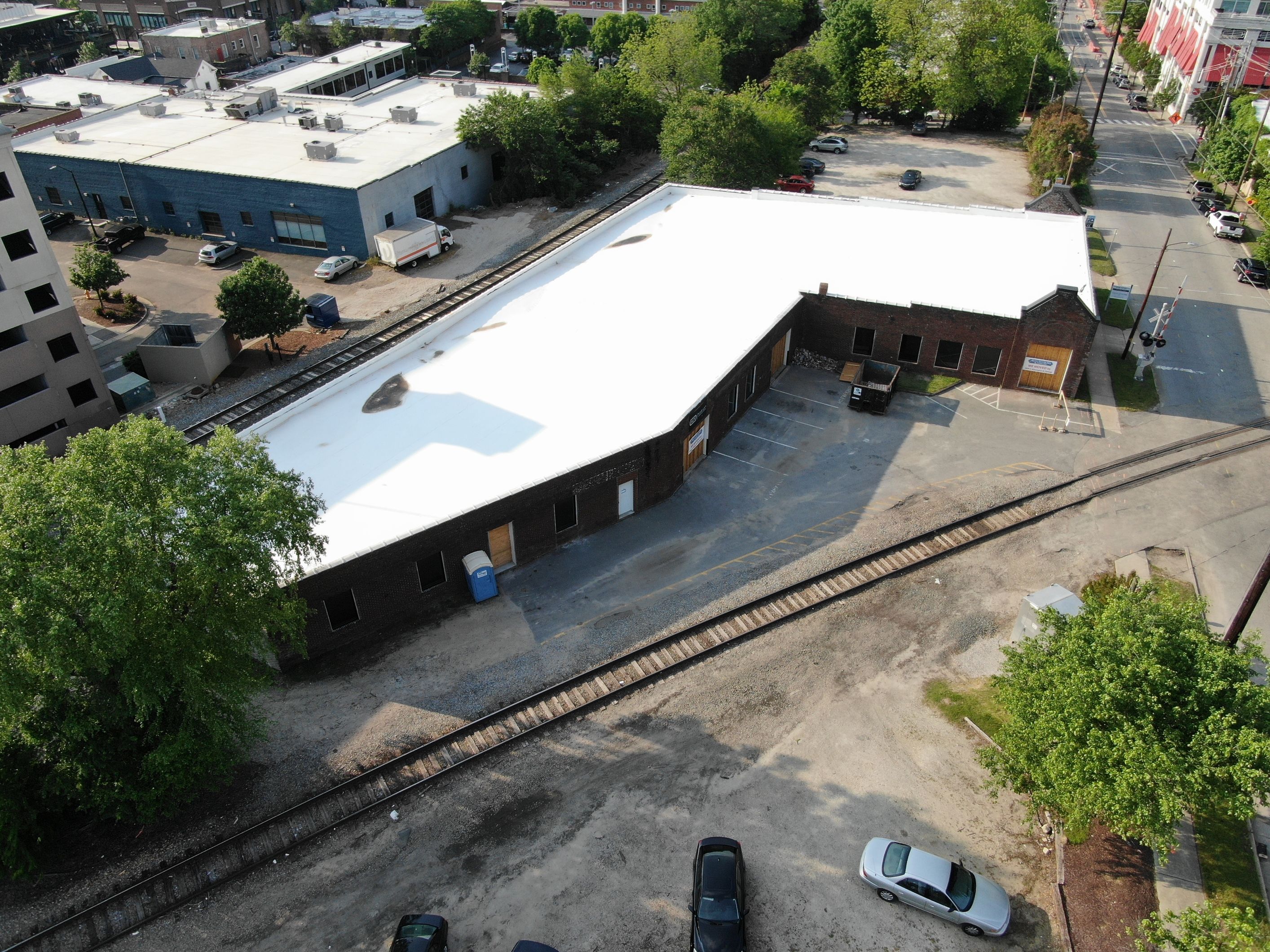
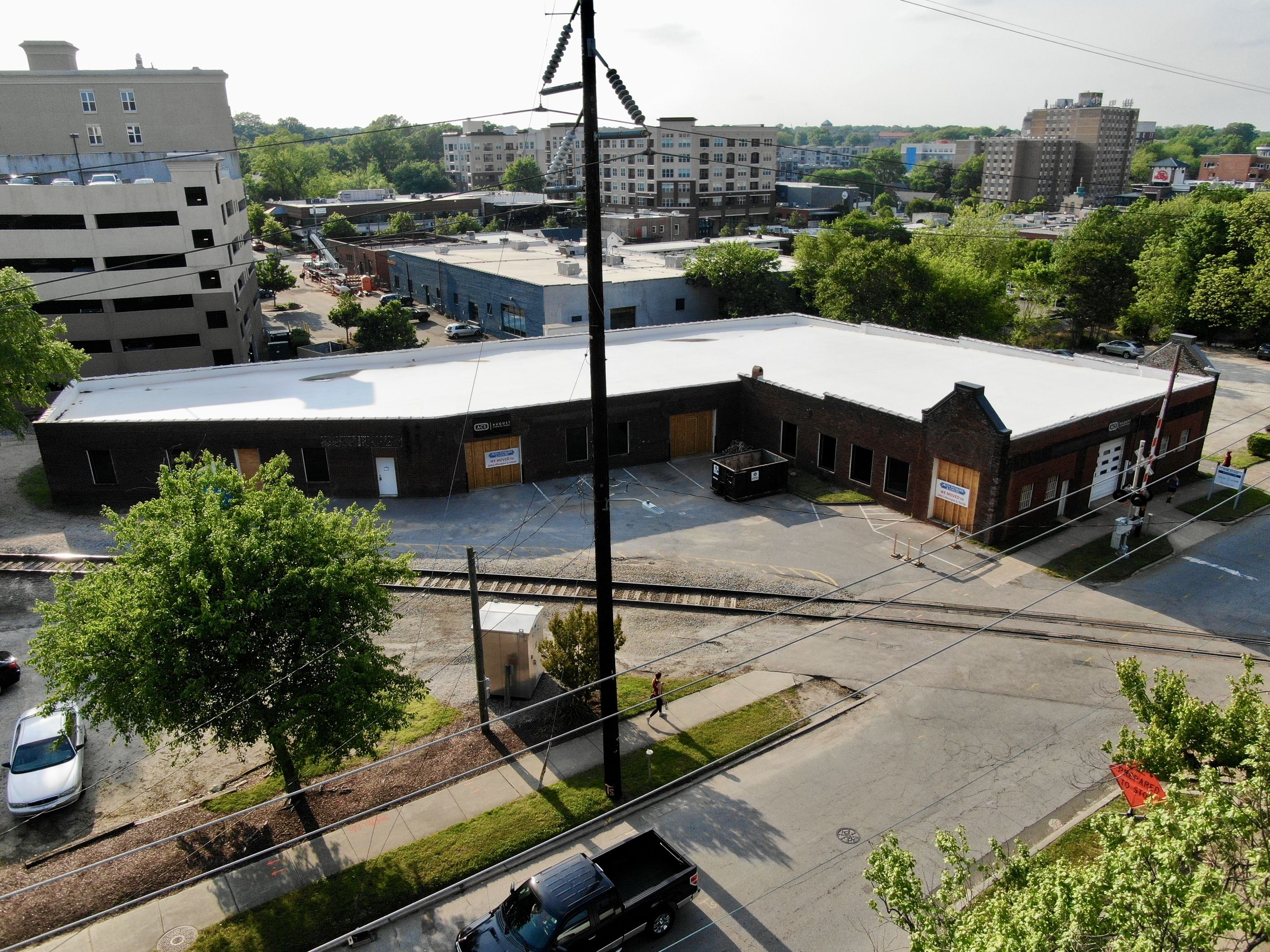
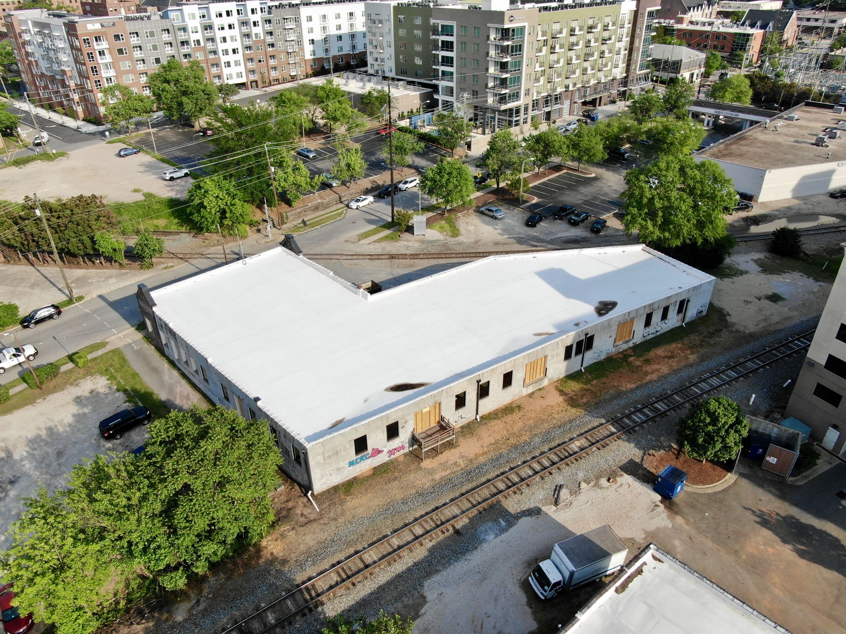
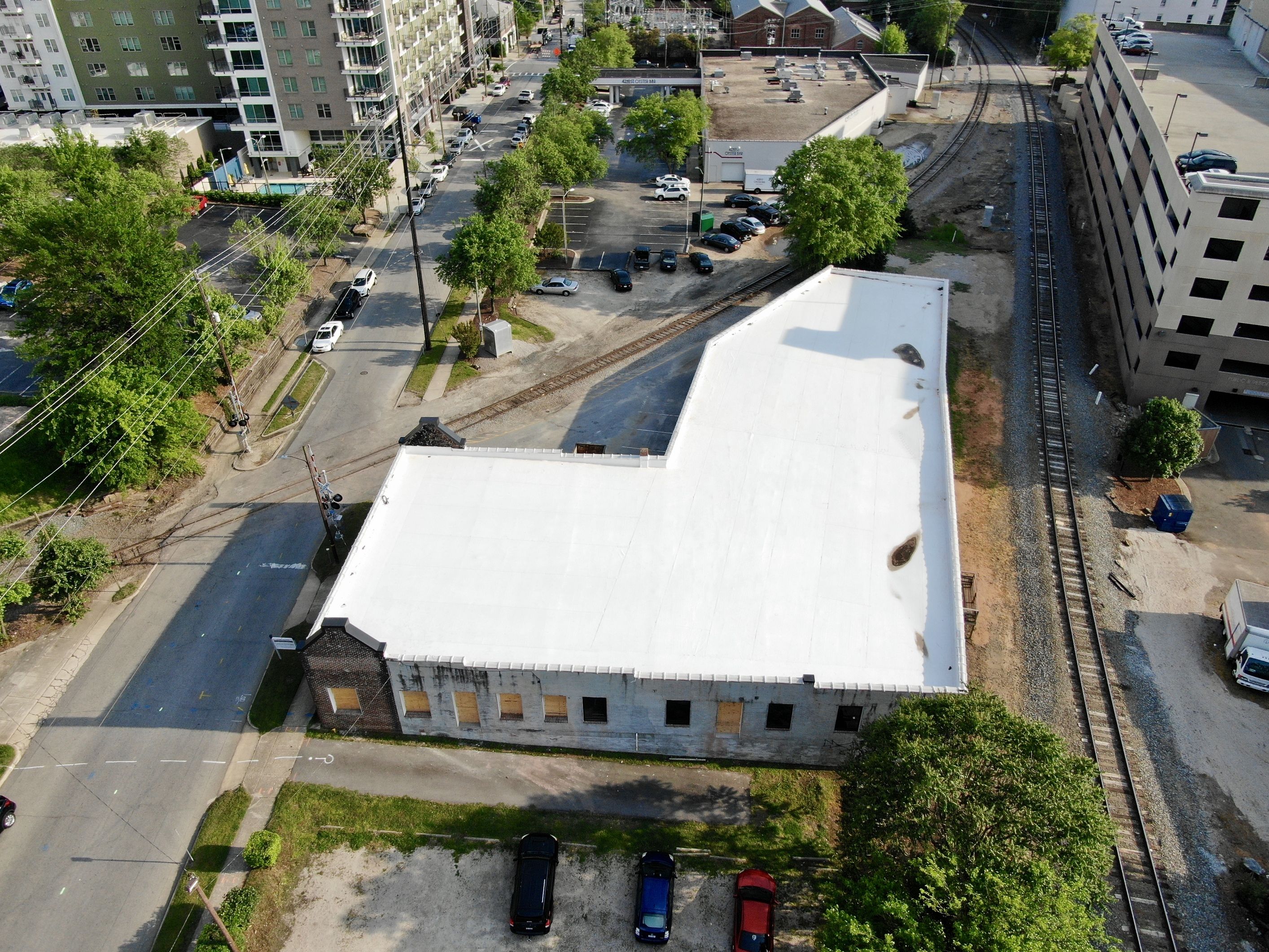
I’ve always dreamed of being able to do something with this space. It’s such an odd and interesting place with so much character and challenge. I hope that its next incarnation is worthy of its oddity and potential.
I just drove by the “Auto Interiors and Tops building” yesterday and it appears that the majority of it is painted in “Atlas Stark” white signature brick paint
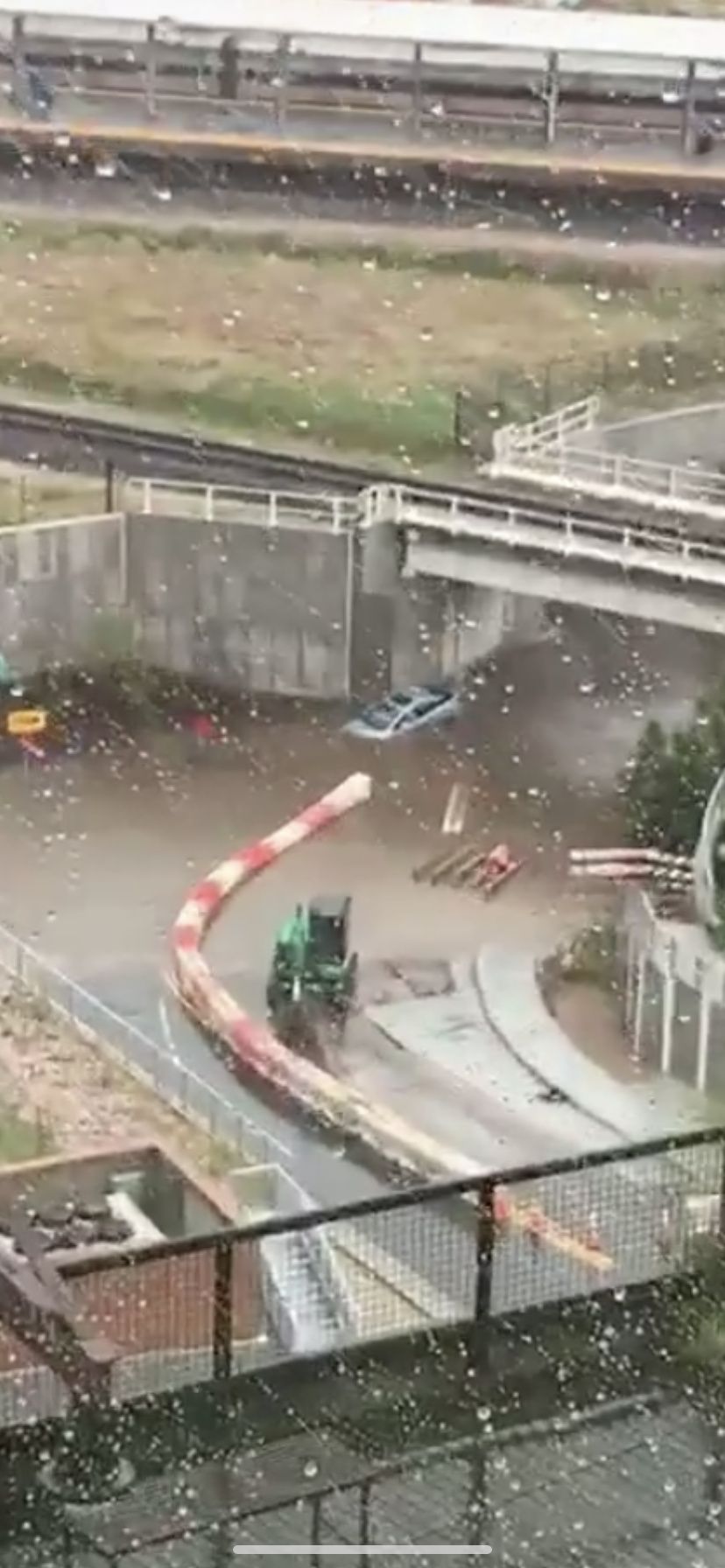
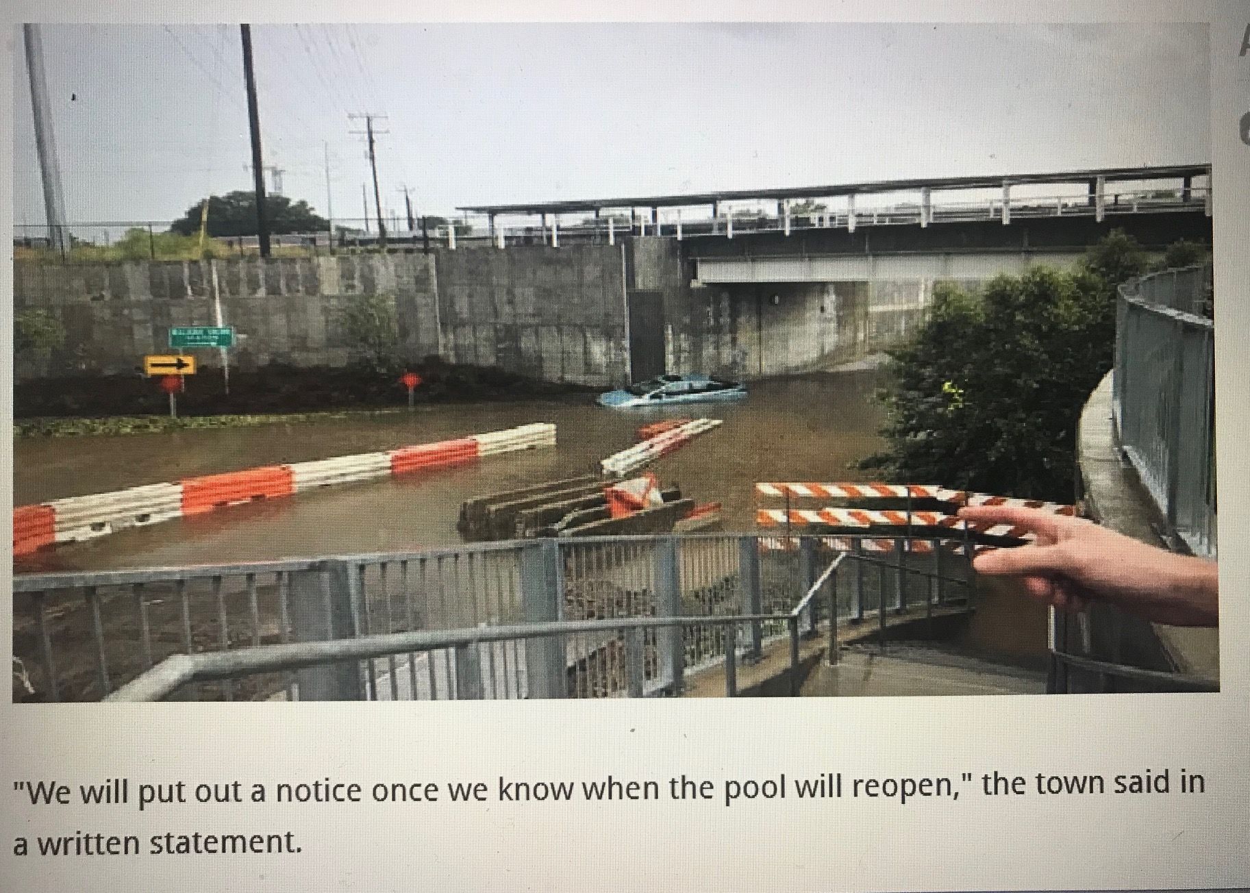
From what I saw, they actually tied additional modern culverts into it coming from RUS. Given that they didn’t appear to be taking peak flow measurements, and there likely aren’t maps of this stone culvert, it doesn’t seem like they could have known if this thing ever ran at capacity or not. They could have also neglected to TV the line to Rosengarten to see if it needed cleaned out or rebuilt anywhere immediately downstream. Its very possible the problem is under the tracks, which if it is, will make for a very expensive fix. This was like a one year event, so not fixing it is not an option…it shuts down the tunnel entirely.
On Thursday the daylighted section along Rosengarten was running as high as I’ve seen it in the last seven years, including during the make rain-making hurricanes we’ve had. From my understanding, a lot of west downtown drains into that.
A few years ago the Lenoir Street park completely flooded due to a blockage downstream, maybe near the busted culvert at Dorothea that the city blocked the road to fix a few months ago but hasn’t moved on. I’m sure “the pit” on South St isn’t helping, either. I also thought the city wanted to daylight that section, too, as part of the Rosengarten Greenway. But that whole thing has turned into a huge cluster and daylighting isn’t happening.
Kane reps have mentioned that the project at Cabarrus will include storm water improvements, but not sure what those will be. I thought the north side of RUS was supposed to have a water garden similar to the one at Fred Fletcher to help with runoff.
I could see the storm water infrastructure improvement required to fix this mess becoming a much desired physical connection between Dix and RUS.
Perhaps a “corporate sponsored“ greenway, one with deep enough pockets for the “eminent domain” necessary to clear a path for a day-lighted stream with an adjacent bike/Ped path.
Of course the railroad tracks are the elephant in the stream…
Hillsborough, Fayetteville and the RR tracks on the western edge of Boylan Heights are your ridge lines that define this drainage. Some of it comes together south of the RR choke point of course. Its a huge amount of impervious surface. I wrote some city folks and suggested those bulb out stormwater gardens at intersections and use transportation money to build them…or vice versa, use stormwater money to build those and get the added aesthetic and traffic calming to boot. No response of course. Anyway those would help peak shave from the impervious areas (was just in Seattle and they have tons of them and my guess is the Puget estuary program helped pay for them…Raleigh is in the Albemarle-Pamlico estuary area so that makes various Federal and State monies available to do similar things). The little BMP at RUS only looks like it catches runoff from the plaza…nothing from the street.


