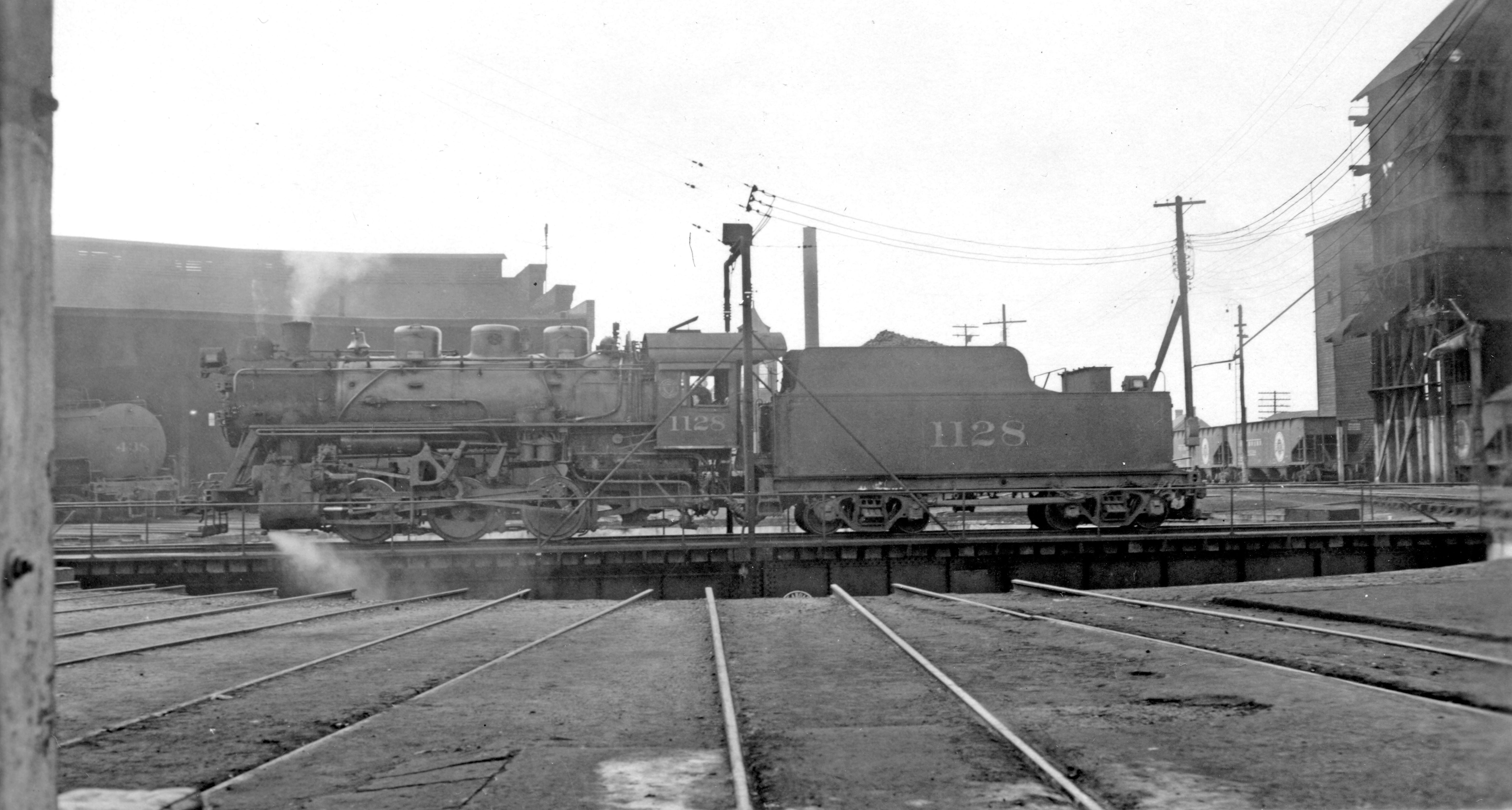
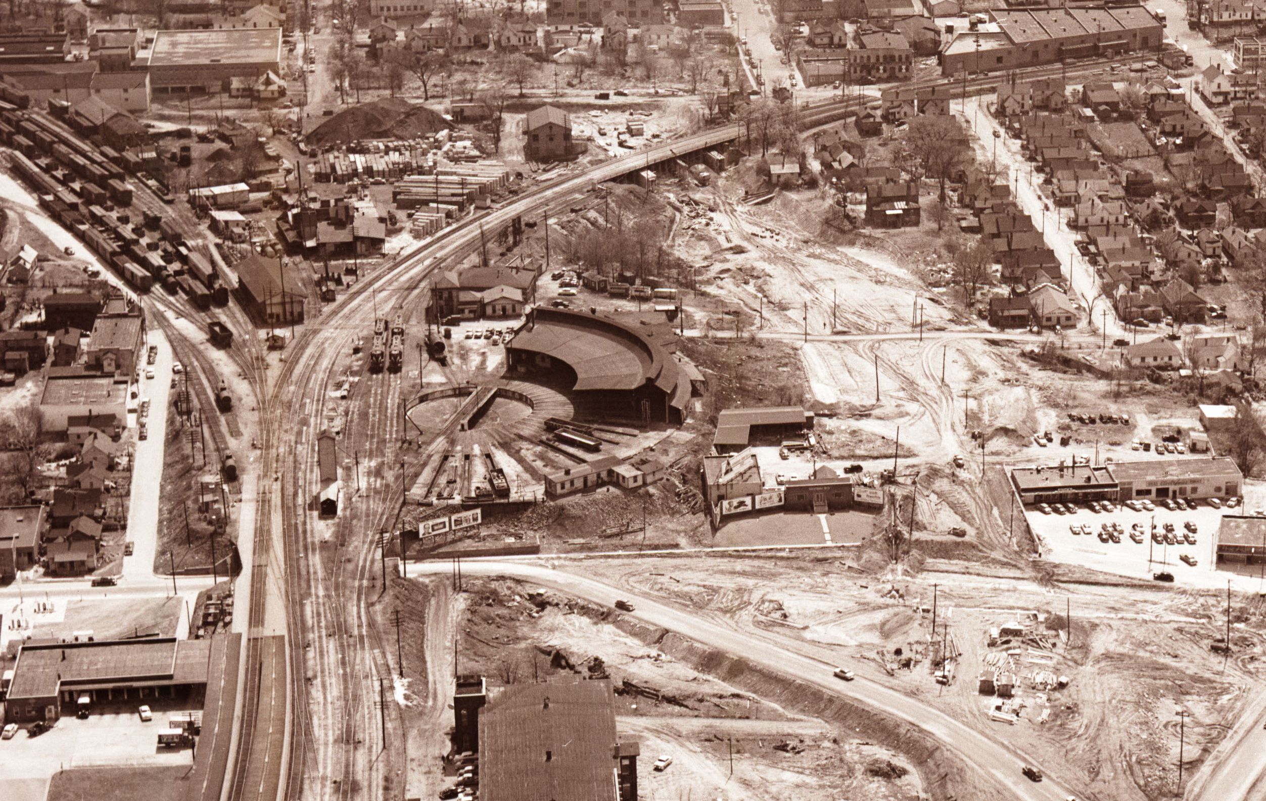
That’s just a turntable. The Round House was demolished a long time ago and was south of Johnson. It’s neat, and I love quirky older stuff, but even I would say let that go for development.
1 Like
They could donate or sell that turntable to some tourist line who runs steam trains. While diesel-electrics don’t care which direction they go, steam engines aren’t designed to travel long distances in reverse. The Great Smoky Mountains RR out in the mountains recently installed one in Bryson City and I think they want one in Dillsboro and perhaps another on the Andrews end, too. Those things are too useful to just keep around as post-industrial eye candy.
As for redeveloping the land, go for it! CSX doesn’t need it.
3 Likes
And they can probably get a pretty penny for selling it. That said, it would be nice if the city required the developer to set aside a piece of this property for a future transit rail stop since the land abuts the tracks and a stop is presumed in that location in the future, though I don’t know which side of the tracks makes sense for that stop.
2 Likes

This is a rather inaccessible corner of downtown, wedged between Capital and the railroad. Here is my thought on how to open it up:
As I’ve said, there is no reason for there to be a railroad on both sides of Capital Blvd north of downtown other than that that’s where they are now and it would cost money to move one of them over to the other side.
If the SE HSR or Wake Forest commuter rail ever happens, I’d like to see the entire CSX line abandoned from Jones Street to Wade Avenue. The CSX bridge over Peace could be demolished (opening up a rather dark and dingy section) and the bridge over Capital could be repurposed as an extension of North Street, which could curve north along the old RR path and intersect with Peace Street where the RR bridge is today.
5 Likes
You realize the NCDOT/CSX just added another lead track from the south and reconfigured a part of the south end of the yard for more efficient access?
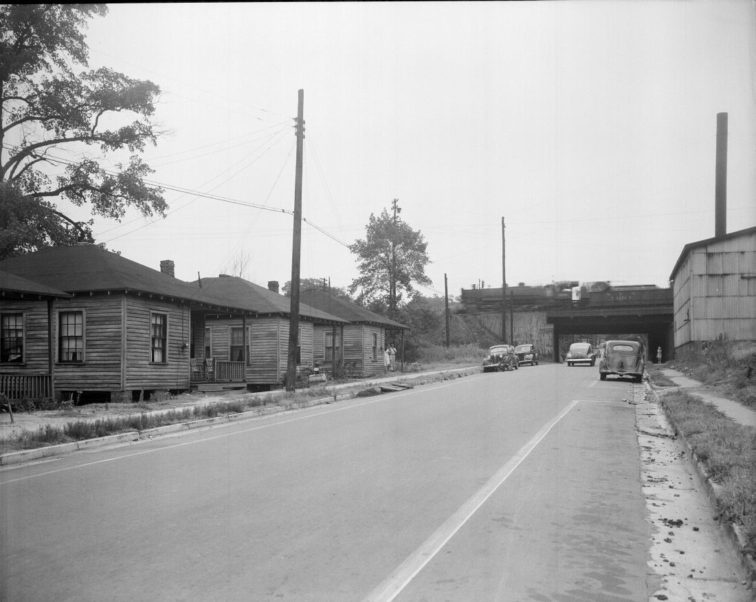
Peace St looking east:

Corner of Dawson and Peace, looking southeast:
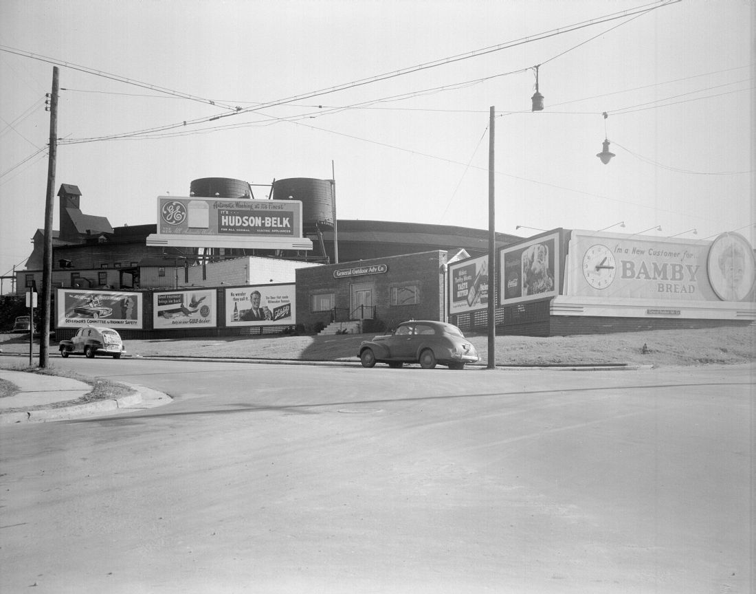
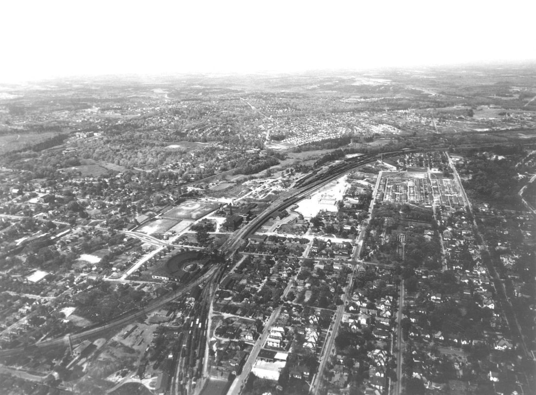
Aerial Looking Northwest:
Peace st looking east:
15 Likes
@bamaspam Great photos! Thanks for sharing.
So, was this before a Capital Blvd and Dawson intersected Peace?
1 Like
Do you have any pretty drawings of this one? I’m having a little trouble visualizing it.
It looks like the roundhouse was dismantled around the same time that they cleared the path for Downtown blvd. (Capital)
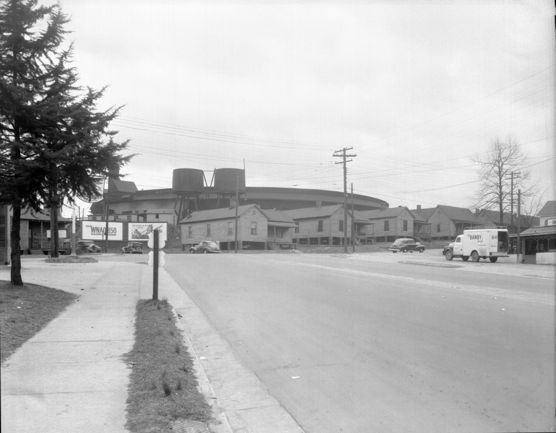
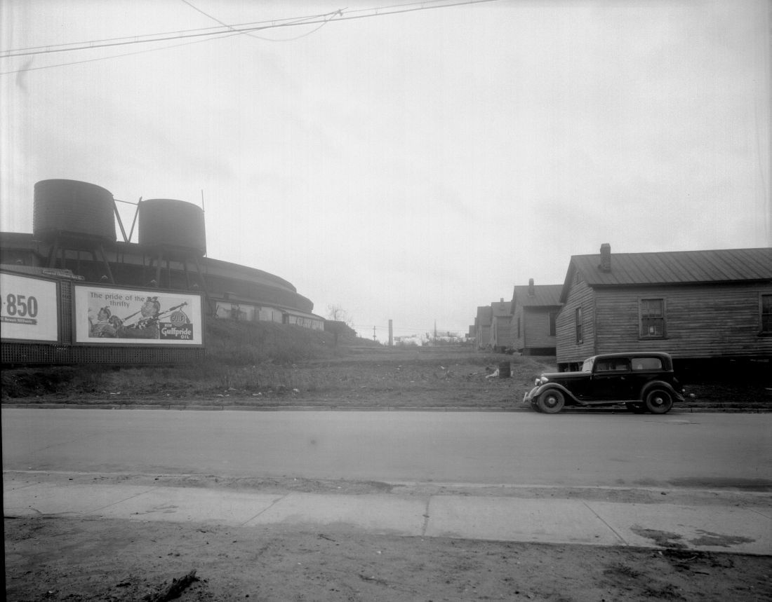
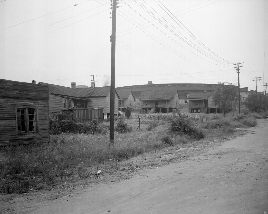
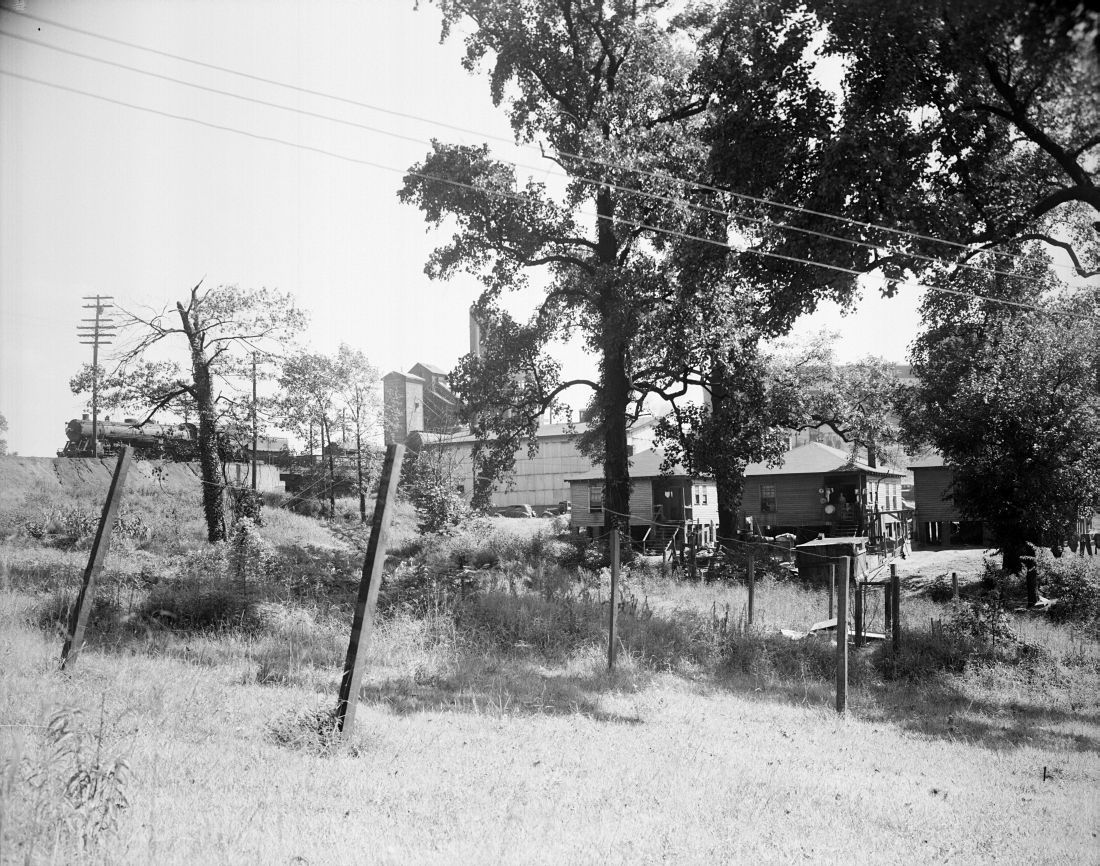
Looking south, ‘slums’ cleared / roundhouse being demolished:
Peace st looking south, future path of Downtown blvd (Capital):
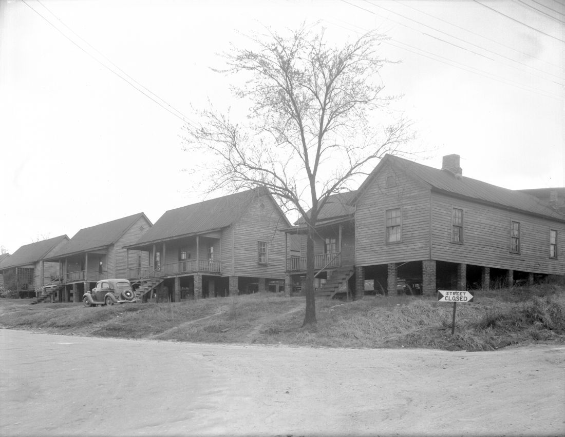
old North Dawson st
Peace st looking east (location of present day Capital blvd bridge):
old North Dawson st looking south (location of present day Jersey Mikes):
old North Dawson st
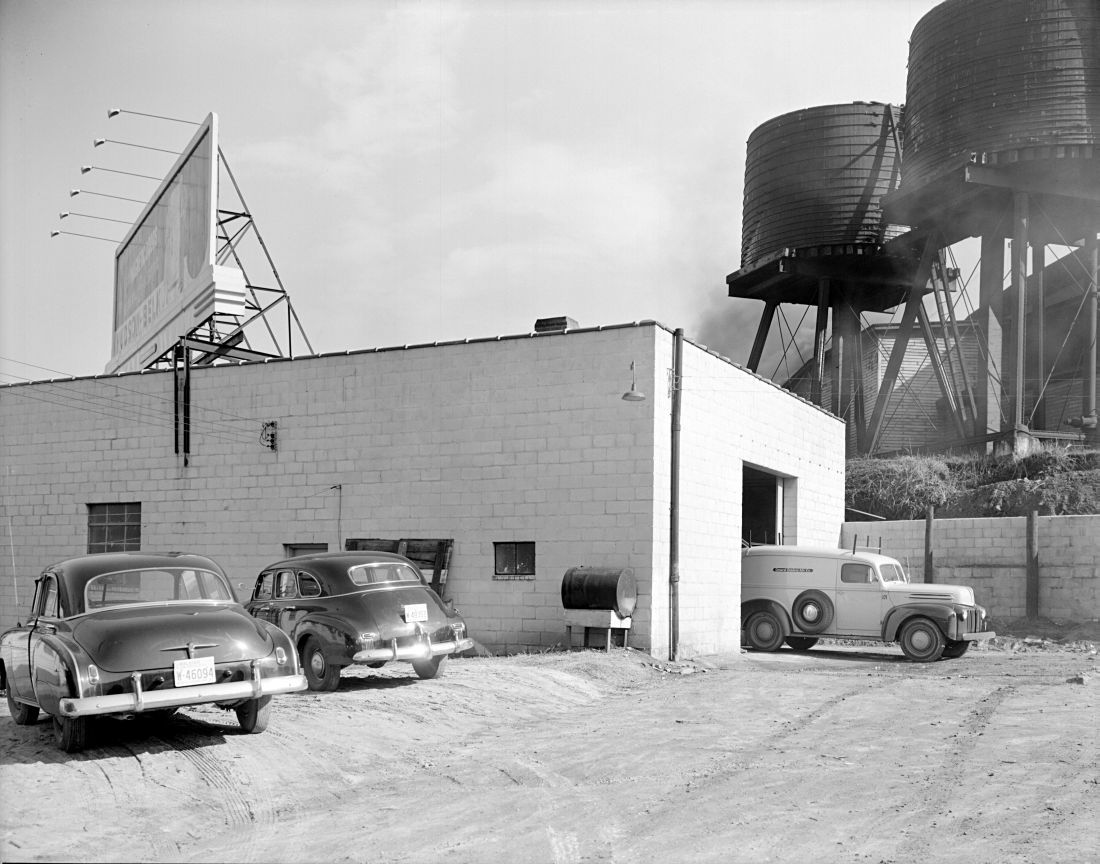
General Outdoor Advertising Company (Fairway Advertising)
13 Likes
Of course this is contingent on CSX relocating along with HSR, which I think should be a no brainer if they go to all the trouble of building the planned alignment for HSR.
4 Likes
Looking at that view. You could even run North street north past seaboard station and tie into the backside Mordecai somewhere.
4 Likes
Wasn’t/Isn’t the stop supposed to be adjacent to Melrose Mill? The ‘State Government’ stop. I believe GoTriangle still owns everything between Lane/McDowell/Harrington except the Mill. If they do own it, seems like your idea is better and they could unload this land for a pretty penny.
What I keep referring to as the round house was really the repair shops, which were also a round house of sorts. They were quite massive. Both structures can be seen on the 1914 Sunburn of the area. Raleigh 1914, Sheet 53.pdf (150.9 KB)
1 Like
I don’t know @Mark
I thought that there was supposed to be stop along Peace; maybe I’m completely remembering incorrectly?
I was remembering two, that were criticized for being very close together. One straddled Hargett between West and Harrington and the other was the block I mentioned. Ok, here you go…look at the parcel description. Top center of page.
I think Logan’s is awesome and is a perfect reuse of the old Seaboard Station and its platforms and canopies, so I wouldn’t want to do anything to affect that. The Cotton Mill is also obviously historic. I don’t think there’s enough room to thread a street between the platforms and the Cotton Mill, and I can’t really think of anywhere else for North to go past Peace, so maybe I’d just stop there. I’d say make it a rail trail, but that would be pretty much redundant with the Pigeon House Branch Greenway. Maybe just let the CSX right of way north of Peace Street become a NCDOT storage yard.
1 Like
I think you’re right that a two-way road would be awfully tough there, but just eyeballing it, you could maybe fit a one-way alleyway running south in between Logan’s and Cotton Mill?
I just feel like there’s a lot of land back there that could be put to a much better use, especially since you already have multiple points of access built into northbound Capital Blvd.
Also, not that it’s of huge consequence or anything, but extending North St. in this way would be a great time to rename the western portion of North St. The two North Streets don’t connect, it’s no longer the northern boundary of the street grid, and you would alleviate the issue of there being both a N. West and a W. North St. that have some of the same address numbers on both. If it ran east-west from St. Mary’s to Harrington before doglegging north toward Peace and then became a one-way alley north of Peace, a rename would make a ton of sense. (Although we could definitely just do it now, too.)
There’s no way that that’s going to happen. Not only does the back of the Cotton Mill jut out toward the property/fence line but the right of way for the tracks continues to widen as it moves north from there. There’s just no room to put anything between the two properties.
1 Like